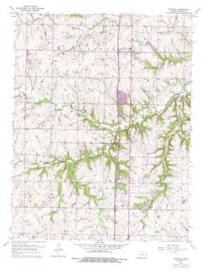
Stilwell Topo Map Kansas
To zoom in, hover over the map of Stilwell
USGS Topo Quad 38094g6 - 1:24,000 scale
| Topo Map Name: | Stilwell |
| USGS Topo Quad ID: | 38094g6 |
| Print Size: | ca. 21 1/4" wide x 27" high |
| Southeast Coordinates: | 38.75° N latitude / 94.625° W longitude |
| Map Center Coordinates: | 38.8125° N latitude / 94.6875° W longitude |
| U.S. State: | KS |
| Filename: | o38094g6.jpg |
| Download Map JPG Image: | Stilwell topo map 1:24,000 scale |
| Map Type: | Topographic |
| Topo Series: | 7.5´ |
| Map Scale: | 1:24,000 |
| Source of Map Images: | United States Geological Survey (USGS) |
| Alternate Map Versions: |
Stilwell KS 1956, updated 1957 Download PDF Buy paper map Stilwell KS 1956, updated 1971 Download PDF Buy paper map Stilwell KS 1956, updated 1976 Download PDF Buy paper map Stilwell KS 1991, updated 1995 Download PDF Buy paper map Stilwell KS 2009 Download PDF Buy paper map Stilwell KS 2012 Download PDF Buy paper map Stilwell KS 2015 Download PDF Buy paper map |
1:24,000 Topo Quads surrounding Stilwell
> Back to 38094e1 at 1:100,000 scale
> Back to 38094a1 at 1:250,000 scale
> Back to U.S. Topo Maps home
Stilwell topo map: Gazetteer
Stilwell: Airports
Johnson County Executive Airport elevation 324m 1062′Mission Road Landing Strip elevation 317m 1040′
Stilwell: Lakes
Amesbury Lake elevation 302m 990′Heritage Lake elevation 303m 994′
Kingston Lake elevation 304m 997′
Regency Park Lake elevation 297m 974′
Wilderness Lake elevation 283m 928′
Stilwell: Parks
Amesbury Lake Park elevation 302m 990′Amesbury Park elevation 298m 977′
Arboretum Park elevation 294m 964′
Brittany Park elevation 298m 977′
Creekside Park elevation 281m 921′
Girls Softball Complex elevation 333m 1092′
Green Meadows Park elevation 286m 938′
Heritage Park elevation 304m 997′
Highland View Park elevation 326m 1069′
Ironwoods Park elevation 275m 902′
Kingston Lake Park elevation 305m 1000′
Nottingham Forest Park elevation 286m 938′
Overland Park Arboretum elevation 294m 964′
Regency Lake Park elevation 297m 974′
Stanley Nature Park elevation 304m 997′
Wellington Park elevation 292m 958′
Wilderness Lake Park elevation 286m 938′
Stilwell: Populated Places
Aubry elevation 333m 1092′Morse elevation 325m 1066′
Redel elevation 271m 889′
Stanley elevation 301m 987′
Stilwell elevation 325m 1066′
Stilwell: Post Offices
Stanley Branch Post Office elevation 308m 1010′Stillwell Post Office elevation 335m 1099′
Stilwell: Streams
Camp Branch elevation 267m 875′Coffee Creek elevation 276m 905′
Wolf Creek elevation 276m 905′
Stilwell digital topo map on disk
Buy this Stilwell topo map showing relief, roads, GPS coordinates and other geographical features, as a high-resolution digital map file on DVD:


