Westphalia Topo Map Kansas
To zoom in, hover over the map of Westphalia
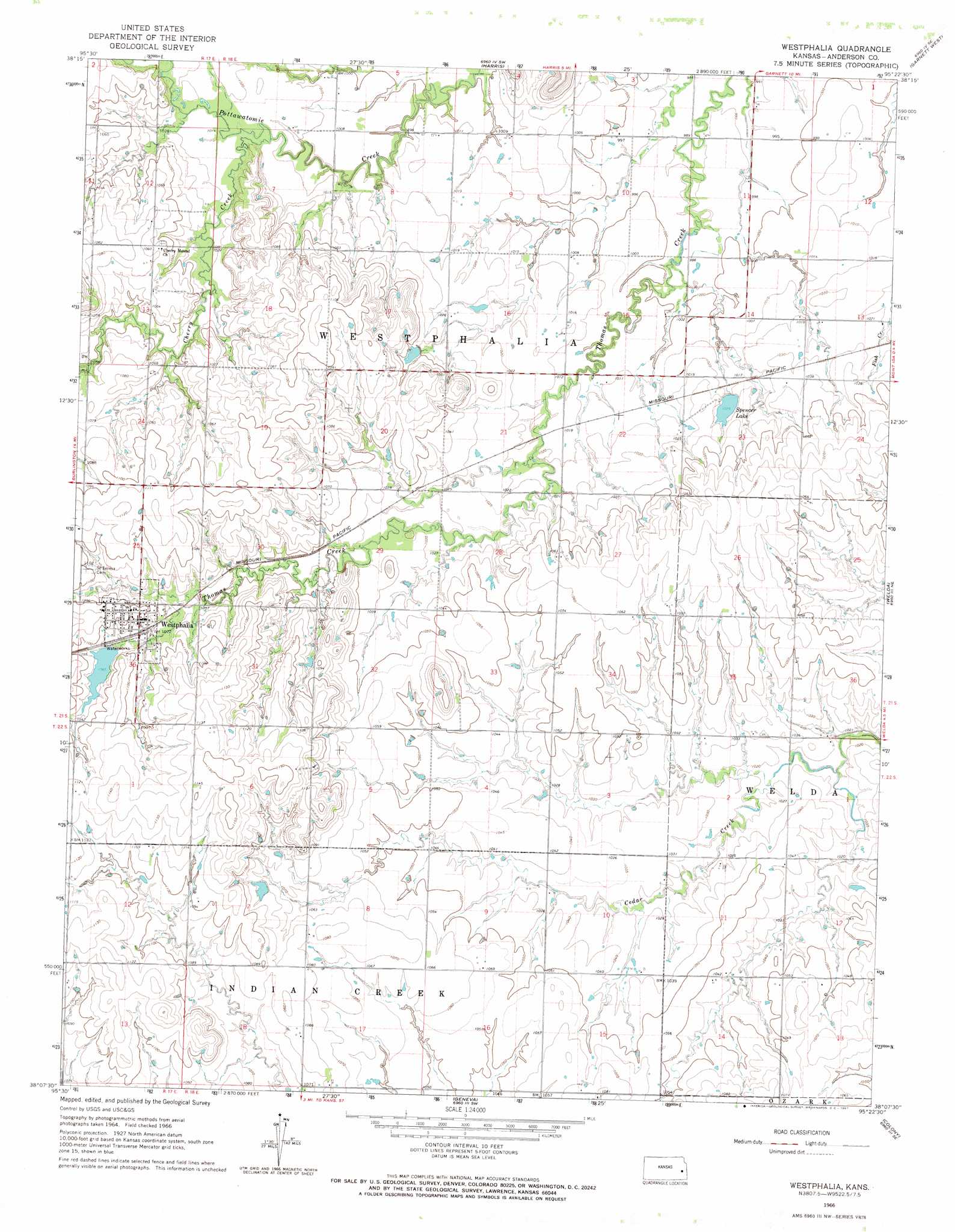
USGS Topo Quad 38095b4 - 1:24,000 scale
| Topo Map Name: | Westphalia |
| USGS Topo Quad ID: | 38095b4 |
| Print Size: | ca. 21 1/4" wide x 27" high |
| Southeast Coordinates: | 38.125° N latitude / 95.375° W longitude |
| Map Center Coordinates: | 38.1875° N latitude / 95.4375° W longitude |
| U.S. State: | KS |
| Filename: | o38095b4.jpg |
| Download Map JPG Image: | Westphalia topo map 1:24,000 scale |
| Map Type: | Topographic |
| Topo Series: | 7.5´ |
| Map Scale: | 1:24,000 |
| Source of Map Images: | United States Geological Survey (USGS) |
| Alternate Map Versions: |
Westphalia KS 1966, updated 1967 Download PDF Buy paper map Westphalia KS 2009 Download PDF Buy paper map Westphalia KS 2012 Download PDF Buy paper map Westphalia KS 2015 Download PDF Buy paper map |
1:24,000 Topo Quads surrounding Westphalia
Waverly Nw |
Waverly |
Williamsburg |
Richmond |
Garnett Nw |
New Strawn |
Waverly Se |
Harris |
Garnett West |
Garnett East |
Burlington |
Aliceville |
Westphalia |
Welda |
Bush City |
Le Roy |
Neosho Falls |
Geneva |
Colony |
Kincaid |
Yates Center |
Piqua |
Iola |
La Harpe |
Moran |
> Back to 38095a1 at 1:100,000 scale
> Back to 38094a1 at 1:250,000 scale
> Back to U.S. Topo Maps home
Westphalia topo map: Gazetteer
Westphalia: Populated Places
Westphalia elevation 336m 1102′Westphalia: Reservoirs
Spencer Lake elevation 311m 1020′Westphalia: Streams
Cherry Creek elevation 306m 1003′Westphalia digital topo map on disk
Buy this Westphalia topo map showing relief, roads, GPS coordinates and other geographical features, as a high-resolution digital map file on DVD: