Florence Topo Map Kansas
To zoom in, hover over the map of Florence
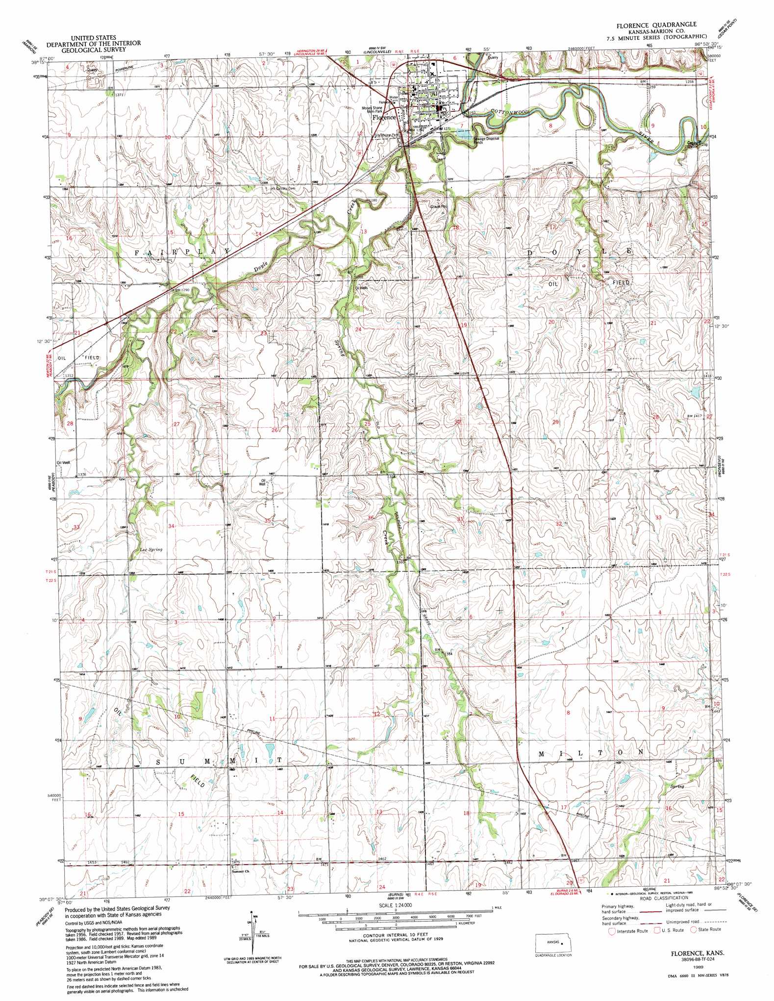
USGS Topo Quad 38096b8 - 1:24,000 scale
| Topo Map Name: | Florence |
| USGS Topo Quad ID: | 38096b8 |
| Print Size: | ca. 21 1/4" wide x 27" high |
| Southeast Coordinates: | 38.125° N latitude / 96.875° W longitude |
| Map Center Coordinates: | 38.1875° N latitude / 96.9375° W longitude |
| U.S. State: | KS |
| Filename: | o38096b8.jpg |
| Download Map JPG Image: | Florence topo map 1:24,000 scale |
| Map Type: | Topographic |
| Topo Series: | 7.5´ |
| Map Scale: | 1:24,000 |
| Source of Map Images: | United States Geological Survey (USGS) |
| Alternate Map Versions: |
Florence KS 1957, updated 1958 Download PDF Buy paper map Florence KS 1989, updated 1990 Download PDF Buy paper map Florence KS 2010 Download PDF Buy paper map Florence KS 2012 Download PDF Buy paper map Florence KS 2015 Download PDF Buy paper map |
1:24,000 Topo Quads surrounding Florence
Durham |
Pilsen |
Lincolnville |
Lincolnville Ne |
Hymer |
Hillsboro |
Marion |
Lincolnville Sw |
Cedar Point |
Elmdale |
Peabody Nw |
Peabody |
Florence |
Wonsevu |
Homestead |
Elbing |
Peabody Se |
Burns |
Florence Se |
Cassoday |
Whitewater |
Potwin |
El Dorado Nw |
De Graff |
Rosalia Nw |
> Back to 38096a1 at 1:100,000 scale
> Back to 38096a1 at 1:250,000 scale
> Back to U.S. Topo Maps home
Florence topo map: Gazetteer
Florence: Parks
Grandview Park elevation 396m 1299′Moses Shane Memorial Park elevation 403m 1322′
Florence: Populated Places
Florence elevation 387m 1269′Florence: Springs
Coyne Spring elevation 387m 1269′Lee Spring elevation 412m 1351′
Florence: Streams
Doyle Creek elevation 377m 1236′Spring Creek elevation 380m 1246′
Florence digital topo map on disk
Buy this Florence topo map showing relief, roads, GPS coordinates and other geographical features, as a high-resolution digital map file on DVD: