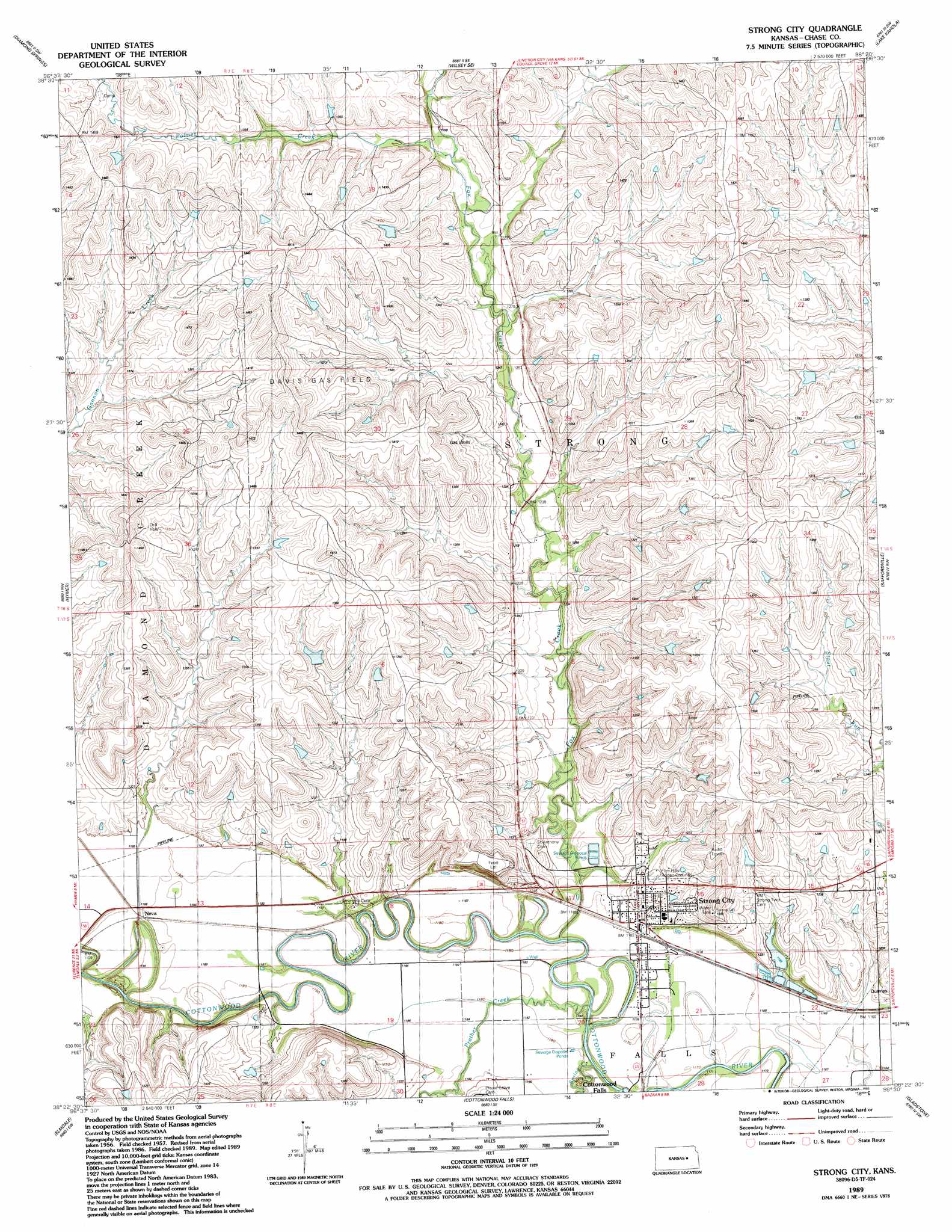
Strong City Topo Map Kansas
To zoom in, hover over the map of Strong City
USGS Topo Quad 38096d5 - 1:24,000 scale
| Topo Map Name: | Strong City |
| USGS Topo Quad ID: | 38096d5 |
| Print Size: | ca. 21 1/4" wide x 27" high |
| Southeast Coordinates: | 38.375° N latitude / 96.5° W longitude |
| Map Center Coordinates: | 38.4375° N latitude / 96.5625° W longitude |
| U.S. State: | KS |
| Filename: | o38096d5.jpg |
| Download Map JPG Image: | Strong City topo map 1:24,000 scale |
| Map Type: | Topographic |
| Topo Series: | 7.5´ |
| Map Scale: | 1:24,000 |
| Source of Map Images: | United States Geological Survey (USGS) |
| Alternate Map Versions: |
Strong City KS 1957, updated 1958 Download PDF Buy paper map Strong City KS 1957, updated 1979 Download PDF Buy paper map Strong City KS 1989, updated 1990 Download PDF Buy paper map Strong City KS 2010 Download PDF Buy paper map Strong City KS 2012 Download PDF Buy paper map Strong City KS 2015 Download PDF Buy paper map |
1:24,000 Topo Quads surrounding Strong City
Delavan |
Wilsey |
Council Grove Lake |
Council Grove |
Bushong |
Burdick |
Diamond Springs |
Wilsey Se |
Lake Kahola |
Americus |
Lincolnville Ne |
Hymer |
Strong City |
Saffordville |
Plymouth |
Cedar Point |
Elmdale |
Cottonwood Falls |
Gladstone |
Phenis Creek |
Wonsevu |
Homestead |
Matfield Green |
Thrall Nw |
Shaw Creek |
> Back to 38096a1 at 1:100,000 scale
> Back to 38096a1 at 1:250,000 scale
> Back to U.S. Topo Maps home
Strong City topo map: Gazetteer
Strong City: Oilfields
Davis Gas Field elevation 435m 1427′Strong City: Parks
Flint Hills Rodeo Grounds elevation 383m 1256′Tallgrass Prairie National Preserve elevation 389m 1276′
Strong City: Populated Places
Neva elevation 360m 1181′Strong City elevation 365m 1197′
Strong City: Streams
Fox Creek elevation 354m 1161′Palmer Creek elevation 390m 1279′
Prather Creek elevation 354m 1161′
Spring Creek elevation 354m 1161′
Strong City digital topo map on disk
Buy this Strong City topo map showing relief, roads, GPS coordinates and other geographical features, as a high-resolution digital map file on DVD: