White City Ne Topo Map Kansas
To zoom in, hover over the map of White City Ne
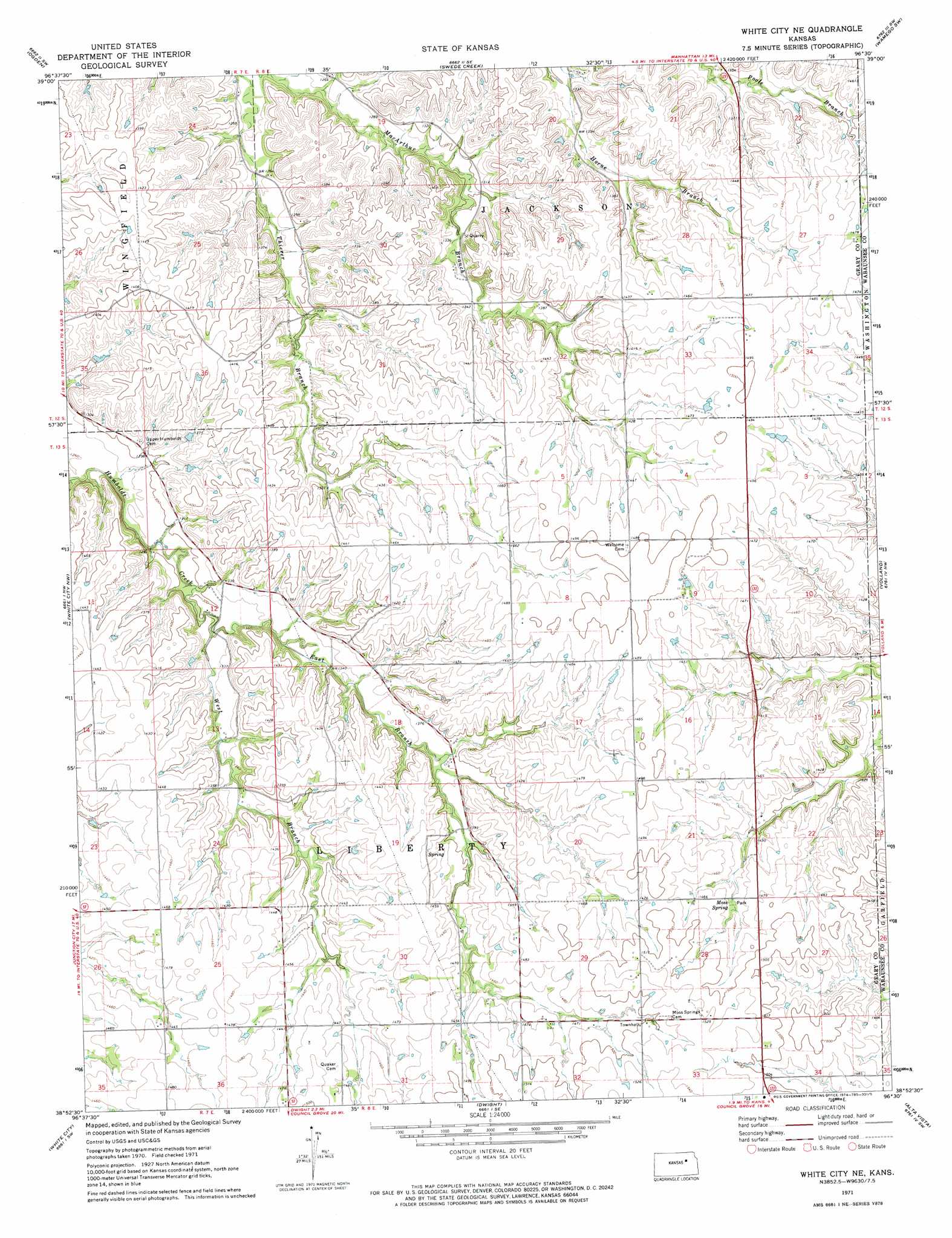
USGS Topo Quad 38096h5 - 1:24,000 scale
| Topo Map Name: | White City Ne |
| USGS Topo Quad ID: | 38096h5 |
| Print Size: | ca. 21 1/4" wide x 27" high |
| Southeast Coordinates: | 38.875° N latitude / 96.5° W longitude |
| Map Center Coordinates: | 38.9375° N latitude / 96.5625° W longitude |
| U.S. State: | KS |
| Filename: | o38096h5.jpg |
| Download Map JPG Image: | White City Ne topo map 1:24,000 scale |
| Map Type: | Topographic |
| Topo Series: | 7.5´ |
| Map Scale: | 1:24,000 |
| Source of Map Images: | United States Geological Survey (USGS) |
| Alternate Map Versions: |
White City NE KS 1971, updated 1974 Download PDF Buy paper map White City NE KS 2009 Download PDF Buy paper map White City NE KS 2012 Download PDF Buy paper map White City NE KS 2015 Download PDF Buy paper map |
1:24,000 Topo Quads surrounding White City Ne
Fort Riley Ne |
Keats |
Manhattan |
Saint George |
Wamego |
Junction City |
Ogden |
Swede Creek |
Wamego Sw |
Alma |
Wreford |
White City Nw |
White City Ne |
Volland |
Allendorph |
Skiddy |
White City |
Dwight |
Alta Vista |
Alta Vista Se |
Delavan |
Wilsey |
Council Grove Lake |
Council Grove |
Bushong |
> Back to 38096e1 at 1:100,000 scale
> Back to 38096a1 at 1:250,000 scale
> Back to U.S. Topo Maps home
White City Ne topo map: Gazetteer
White City Ne: Springs
Moss Spring elevation 439m 1440′White City Ne: Streams
East Branch Humboldt Creek elevation 396m 1299′West Branch Humboldt Creek elevation 396m 1299′
White City Ne digital topo map on disk
Buy this White City Ne topo map showing relief, roads, GPS coordinates and other geographical features, as a high-resolution digital map file on DVD: