Elbing Topo Map Kansas
To zoom in, hover over the map of Elbing
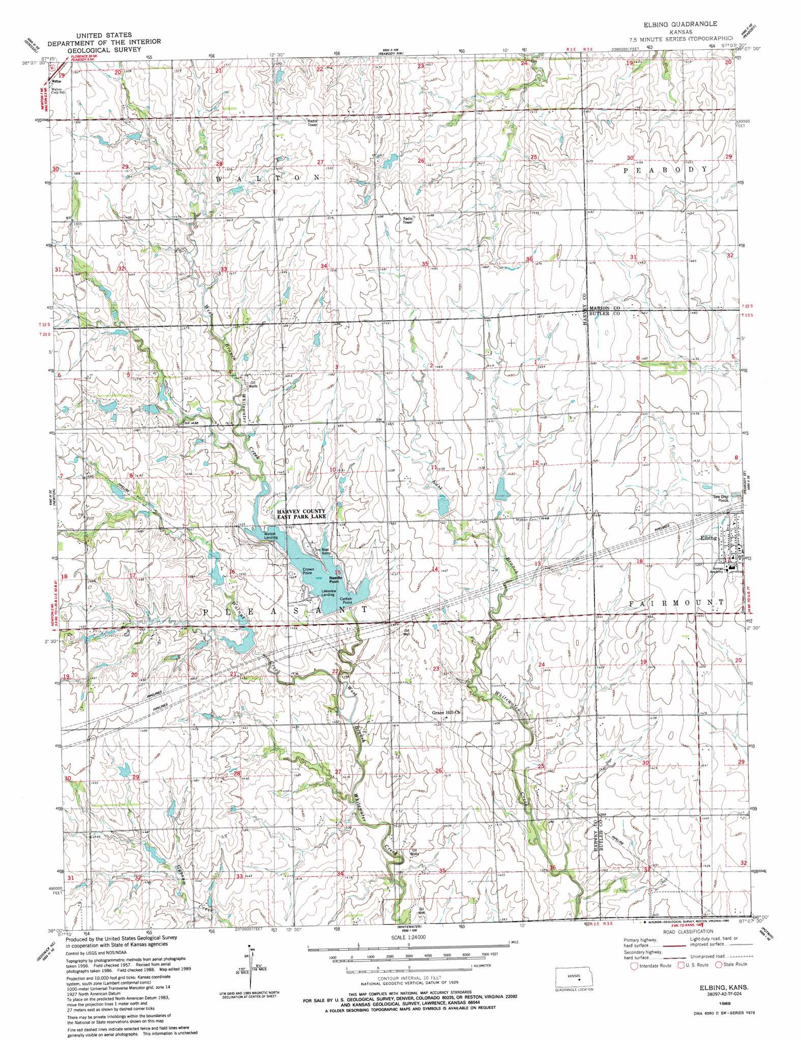
USGS Topo Quad 38097a2 - 1:24,000 scale
| Topo Map Name: | Elbing |
| USGS Topo Quad ID: | 38097a2 |
| Print Size: | ca. 21 1/4" wide x 27" high |
| Southeast Coordinates: | 38° N latitude / 97.125° W longitude |
| Map Center Coordinates: | 38.0625° N latitude / 97.1875° W longitude |
| U.S. State: | KS |
| Filename: | o38097a2.jpg |
| Download Map JPG Image: | Elbing topo map 1:24,000 scale |
| Map Type: | Topographic |
| Topo Series: | 7.5´ |
| Map Scale: | 1:24,000 |
| Source of Map Images: | United States Geological Survey (USGS) |
| Alternate Map Versions: |
Elbing KS 1957, updated 1958 Download PDF Buy paper map Elbing KS 1957, updated 1978 Download PDF Buy paper map Elbing KS 1989, updated 1990 Download PDF Buy paper map Elbing KS 2009 Download PDF Buy paper map Elbing KS 2012 Download PDF Buy paper map Elbing KS 2015 Download PDF Buy paper map |
1:24,000 Topo Quads surrounding Elbing
Canton Sw |
Lehigh |
Hillsboro |
Marion |
Lincolnville Sw |
Hesston |
Goessel |
Peabody Nw |
Peabody |
Florence |
Zimmerdale |
Newton |
Elbing |
Peabody Se |
Burns |
Sedgwick |
Sedgwick Ne |
Whitewater |
Potwin |
El Dorado Nw |
Maize |
Valley Center |
Greenwich |
Benton |
El Dorado Sw |
> Back to 38097a1 at 1:100,000 scale
> Back to 38096a1 at 1:250,000 scale
> Back to U.S. Topo Maps home
Elbing topo map: Gazetteer
Elbing: Capes
Catfish Point elevation 432m 1417′Crown Point elevation 433m 1420′
Needle Point elevation 434m 1423′
Elbing: Parks
Harvey County East Park elevation 434m 1423′Elbing: Populated Places
Elbing elevation 439m 1440′Elbing: Reservoirs
Harvey County East Park Lake elevation 432m 1417′Elbing: Streams
Walnut Creek elevation 423m 1387′Elbing digital topo map on disk
Buy this Elbing topo map showing relief, roads, GPS coordinates and other geographical features, as a high-resolution digital map file on DVD: