Mcpherson Se Topo Map Kansas
To zoom in, hover over the map of Mcpherson Se
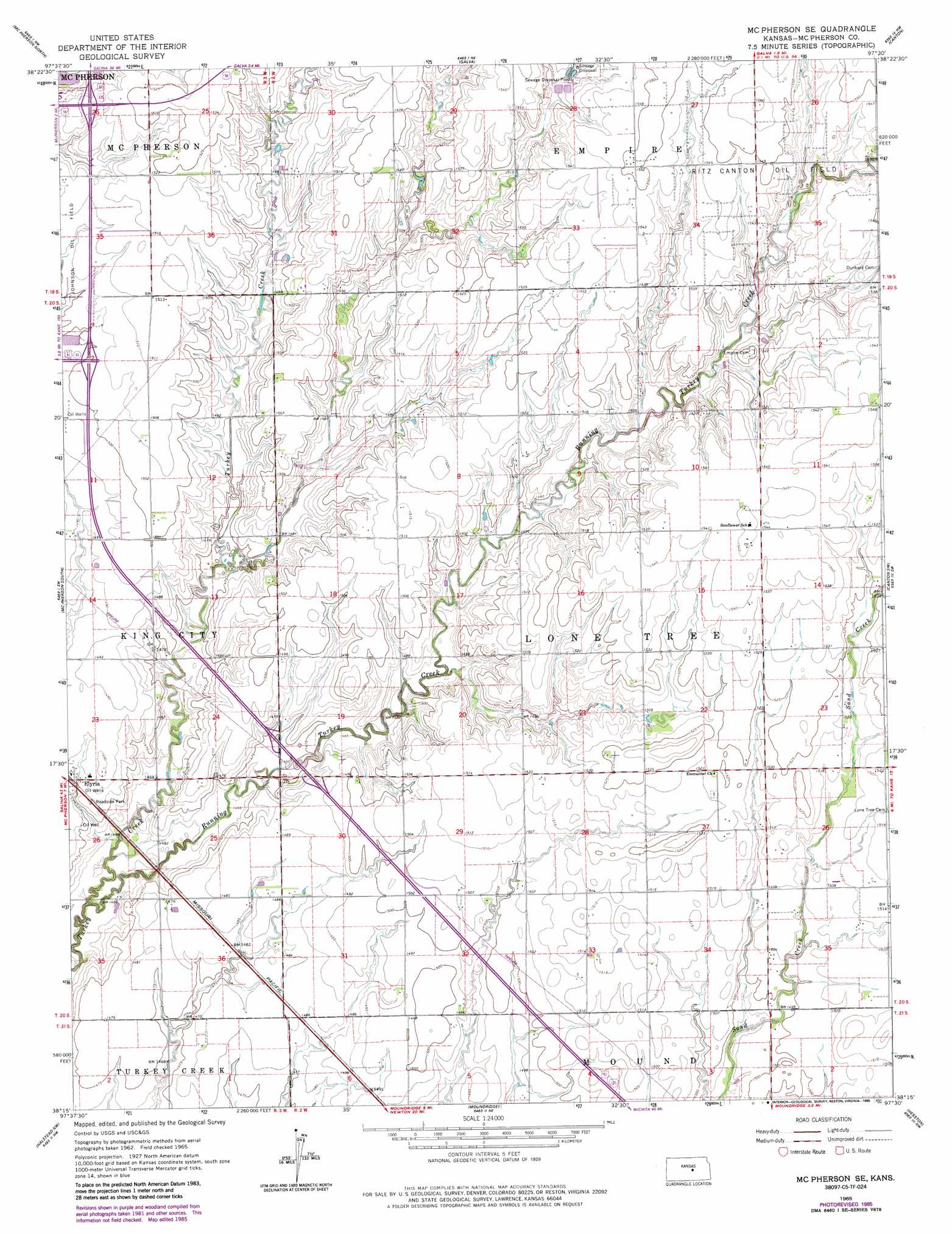
USGS Topo Quad 38097c5 - 1:24,000 scale
| Topo Map Name: | Mcpherson Se |
| USGS Topo Quad ID: | 38097c5 |
| Print Size: | ca. 21 1/4" wide x 27" high |
| Southeast Coordinates: | 38.25° N latitude / 97.5° W longitude |
| Map Center Coordinates: | 38.3125° N latitude / 97.5625° W longitude |
| U.S. State: | KS |
| Filename: | o38097c5.jpg |
| Download Map JPG Image: | Mcpherson Se topo map 1:24,000 scale |
| Map Type: | Topographic |
| Topo Series: | 7.5´ |
| Map Scale: | 1:24,000 |
| Source of Map Images: | United States Geological Survey (USGS) |
| Alternate Map Versions: |
Mc Pherson SE KS 1965, updated 1966 Download PDF Buy paper map Mc Pherson SE KS 1965, updated 1980 Download PDF Buy paper map Mc Pherson SE KS 1965, updated 1983 Download PDF Buy paper map Mc Pherson SE KS 1965, updated 1985 Download PDF Buy paper map McPherson SE KS 2009 Download PDF Buy paper map McPherson SE KS 2012 Download PDF Buy paper map McPherson SE KS 2015 Download PDF Buy paper map |
1:24,000 Topo Quads surrounding Mcpherson Se
Marquette |
Lindsborg |
Lindsborg Se |
Roxbury |
Gypsum Se |
Windom Ne |
Mcpherson North |
Galva |
Canton |
Waldeck |
Conway |
Mcpherson South |
Mcpherson Se |
Canton Sw |
Lehigh |
Buhler |
Halstead Nw |
Moundridge |
Hesston |
Goessel |
Hutchinson Se |
Burrton |
Halstead |
Zimmerdale |
Newton |
> Back to 38097a1 at 1:100,000 scale
> Back to 38096a1 at 1:250,000 scale
> Back to U.S. Topo Maps home
Mcpherson Se digital topo map on disk
Buy this Mcpherson Se topo map showing relief, roads, GPS coordinates and other geographical features, as a high-resolution digital map file on DVD: