Gypsum Se Topo Map Kansas
To zoom in, hover over the map of Gypsum Se
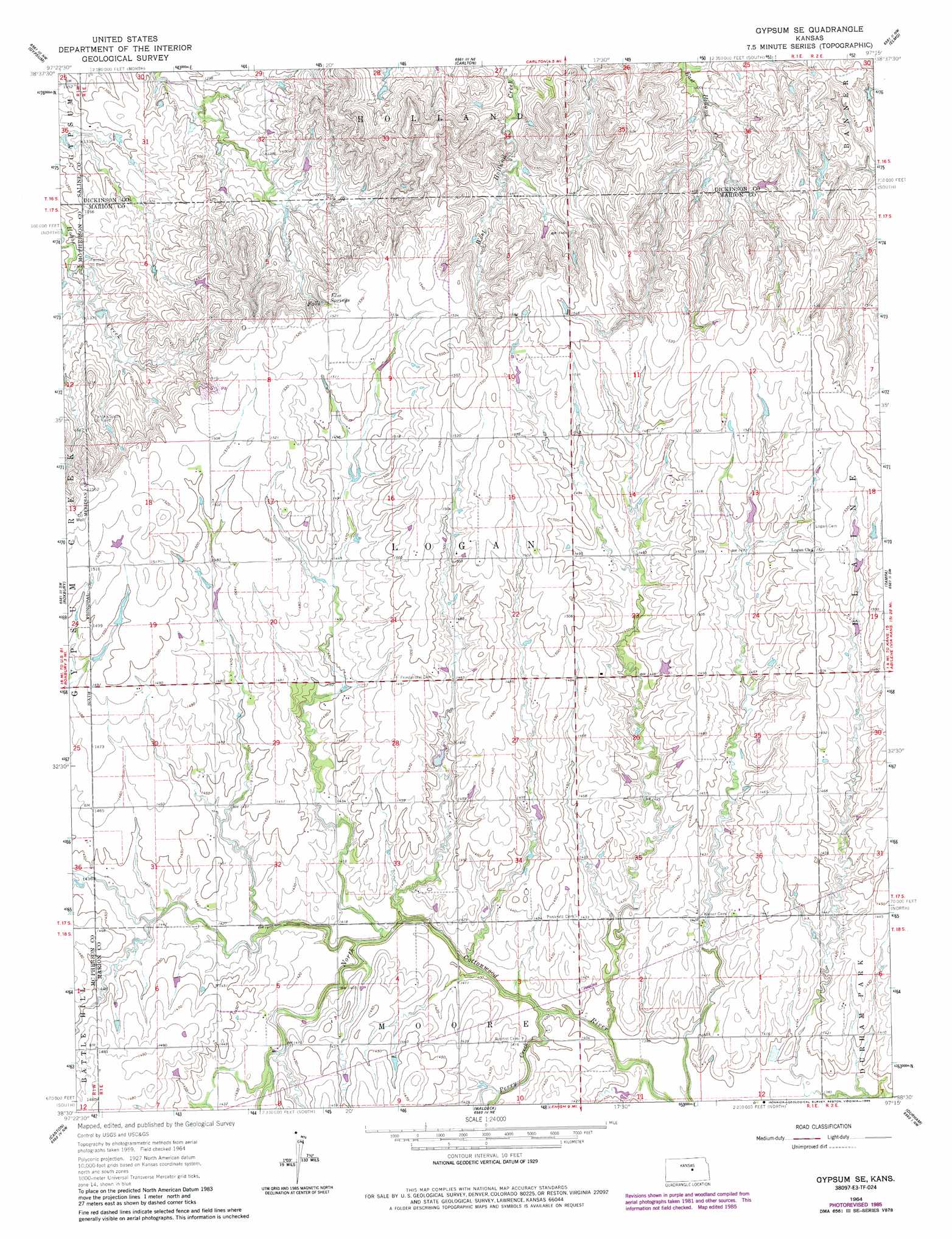
USGS Topo Quad 38097e3 - 1:24,000 scale
| Topo Map Name: | Gypsum Se |
| USGS Topo Quad ID: | 38097e3 |
| Print Size: | ca. 21 1/4" wide x 27" high |
| Southeast Coordinates: | 38.5° N latitude / 97.25° W longitude |
| Map Center Coordinates: | 38.5625° N latitude / 97.3125° W longitude |
| U.S. State: | KS |
| Filename: | o38097e3.jpg |
| Download Map JPG Image: | Gypsum Se topo map 1:24,000 scale |
| Map Type: | Topographic |
| Topo Series: | 7.5´ |
| Map Scale: | 1:24,000 |
| Source of Map Images: | United States Geological Survey (USGS) |
| Alternate Map Versions: |
Gypsum SE KS 1964, updated 1965 Download PDF Buy paper map Gypsum SE KS 1964, updated 1980 Download PDF Buy paper map Gypsum SE KS 1964, updated 1985 Download PDF Buy paper map Gypsum SE KS 2009 Download PDF Buy paper map Gypsum SE KS 2012 Download PDF Buy paper map Gypsum SE KS 2015 Download PDF Buy paper map |
1:24,000 Topo Quads surrounding Gypsum Se
Salina |
Kipp |
Holland |
Abilene Sw |
Navarre |
Assaria |
Gypsum |
Carlton |
Elmo |
Hope |
Lindsborg Se |
Roxbury |
Gypsum Se |
Tampa |
Ramona |
Galva |
Canton |
Waldeck |
Durham |
Pilsen |
Mcpherson Se |
Canton Sw |
Lehigh |
Hillsboro |
Marion |
> Back to 38097e1 at 1:100,000 scale
> Back to 38096a1 at 1:250,000 scale
> Back to U.S. Topo Maps home
Gypsum Se topo map: Gazetteer
Gypsum Se: Oilfields
Fanska Oil Field elevation 417m 1368′Fanska South Oil Field elevation 439m 1440′
Gypsum Se: Springs
Elm Springs elevation 460m 1509′Gypsum Se: Streams
Perry Creek elevation 423m 1387′Gypsum Se digital topo map on disk
Buy this Gypsum Se topo map showing relief, roads, GPS coordinates and other geographical features, as a high-resolution digital map file on DVD: