Falun Topo Map Kansas
To zoom in, hover over the map of Falun
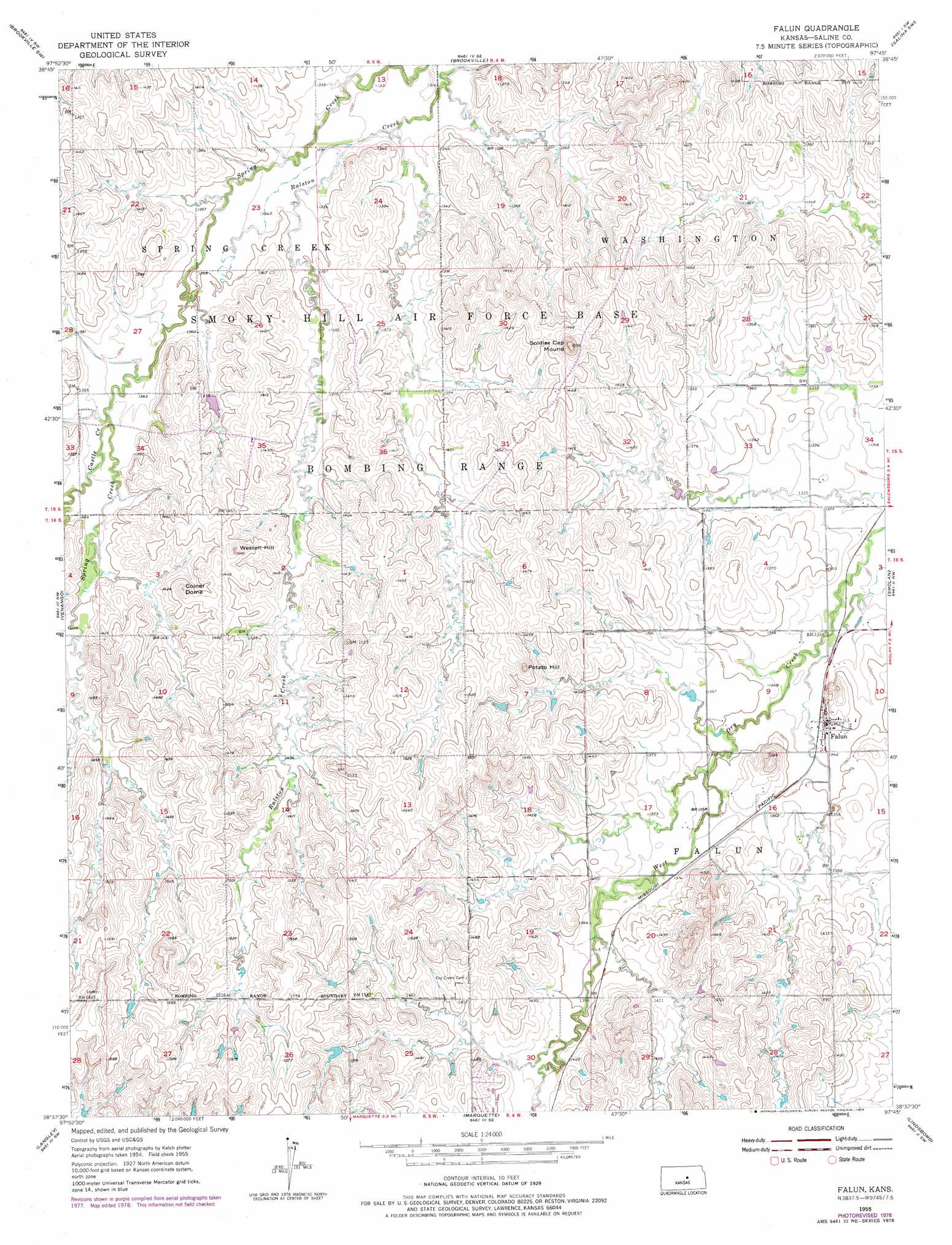
USGS Topo Quad 38097f7 - 1:24,000 scale
| Topo Map Name: | Falun |
| USGS Topo Quad ID: | 38097f7 |
| Print Size: | ca. 21 1/4" wide x 27" high |
| Southeast Coordinates: | 38.625° N latitude / 97.75° W longitude |
| Map Center Coordinates: | 38.6875° N latitude / 97.8125° W longitude |
| U.S. State: | KS |
| Filename: | o38097f7.jpg |
| Download Map JPG Image: | Falun topo map 1:24,000 scale |
| Map Type: | Topographic |
| Topo Series: | 7.5´ |
| Map Scale: | 1:24,000 |
| Source of Map Images: | United States Geological Survey (USGS) |
| Alternate Map Versions: |
Falun KS 1955, updated 1956 Download PDF Buy paper map Falun KS 1955, updated 1973 Download PDF Buy paper map Falun KS 1955, updated 1978 Download PDF Buy paper map Falun KS 2009 Download PDF Buy paper map Falun KS 2012 Download PDF Buy paper map Falun KS 2015 Download PDF Buy paper map |
1:24,000 Topo Quads surrounding Falun
Westfall |
Juniata |
Culver |
Trenton |
New Cambria |
Westfall Se |
Brookville Sw |
Brookville |
Salina Sw |
Salina |
Carneiro |
Venango |
Falun |
Smolan |
Assaria |
Crawford |
Langley |
Marquette |
Lindsborg |
Lindsborg Se |
Little River |
Windom |
Windom Ne |
Mcpherson North |
Galva |
> Back to 38097e1 at 1:100,000 scale
> Back to 38096a1 at 1:250,000 scale
> Back to U.S. Topo Maps home
Falun topo map: Gazetteer
Falun: Populated Places
Falun elevation 411m 1348′Falun: Streams
Castle Creek elevation 414m 1358′Falun: Summits
Coiner Dome elevation 458m 1502′Potato Hill elevation 464m 1522′
Soldier Cap Mound elevation 449m 1473′
Weston Hill elevation 458m 1502′
Falun digital topo map on disk
Buy this Falun topo map showing relief, roads, GPS coordinates and other geographical features, as a high-resolution digital map file on DVD: