Brookville Topo Map Kansas
To zoom in, hover over the map of Brookville
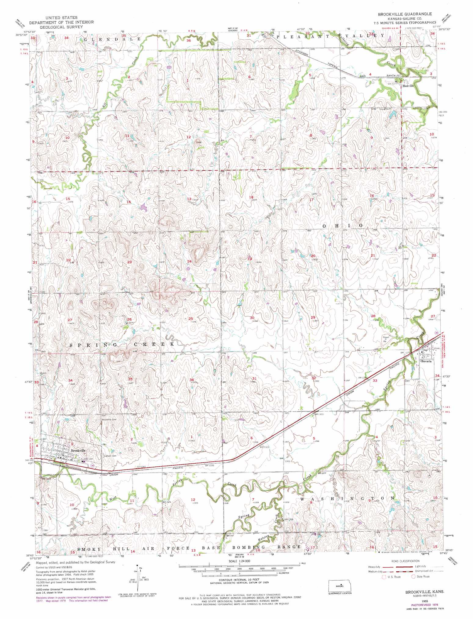
USGS Topo Quad 38097g7 - 1:24,000 scale
| Topo Map Name: | Brookville |
| USGS Topo Quad ID: | 38097g7 |
| Print Size: | ca. 21 1/4" wide x 27" high |
| Southeast Coordinates: | 38.75° N latitude / 97.75° W longitude |
| Map Center Coordinates: | 38.8125° N latitude / 97.8125° W longitude |
| U.S. State: | KS |
| Filename: | o38097g7.jpg |
| Download Map JPG Image: | Brookville topo map 1:24,000 scale |
| Map Type: | Topographic |
| Topo Series: | 7.5´ |
| Map Scale: | 1:24,000 |
| Source of Map Images: | United States Geological Survey (USGS) |
| Alternate Map Versions: |
Brookville KS 1955, updated 1956 Download PDF Buy paper map Brookville KS 1955, updated 1978 Download PDF Buy paper map Brookville KS 2009 Download PDF Buy paper map Brookville KS 2012 Download PDF Buy paper map Brookville KS 2015 Download PDF Buy paper map |
1:24,000 Topo Quads surrounding Brookville
Shady Bend |
Tescott |
Tescott Se |
Minneapolis South |
Bennington |
Westfall |
Juniata |
Culver |
Trenton |
New Cambria |
Westfall Se |
Brookville Sw |
Brookville |
Salina Sw |
Salina |
Carneiro |
Venango |
Falun |
Smolan |
Assaria |
Crawford |
Langley |
Marquette |
Lindsborg |
Lindsborg Se |
> Back to 38097e1 at 1:100,000 scale
> Back to 38096a1 at 1:250,000 scale
> Back to U.S. Topo Maps home
Brookville topo map: Gazetteer
Brookville: Populated Places
Bavaria elevation 388m 1272′Brookville elevation 414m 1358′
Hedville elevation 387m 1269′
Brookville: Streams
Ralston Creek elevation 389m 1276′West Spring Creek elevation 389m 1276′
Brookville digital topo map on disk
Buy this Brookville topo map showing relief, roads, GPS coordinates and other geographical features, as a high-resolution digital map file on DVD: