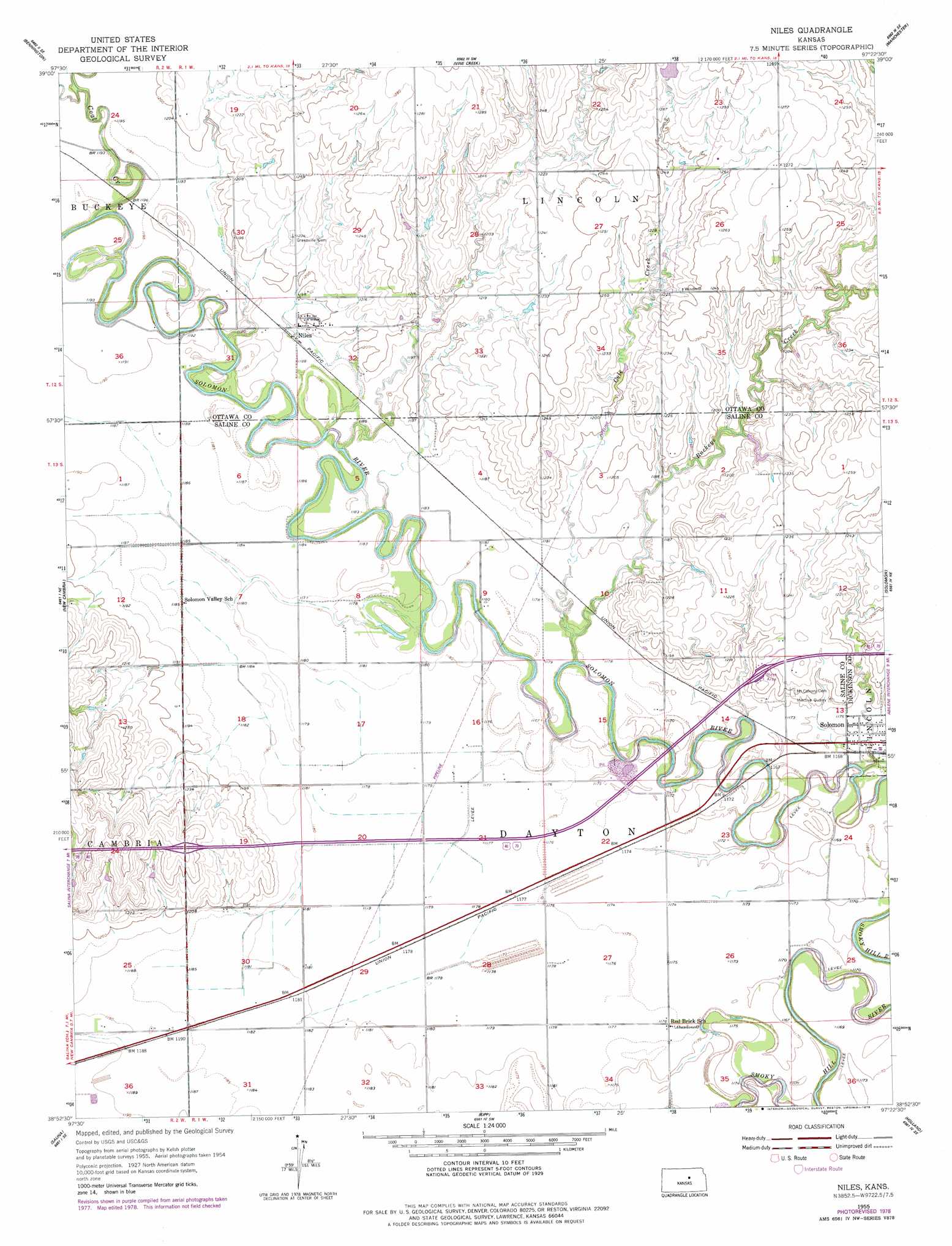
Niles Topo Map Kansas
To zoom in, hover over the map of Niles
USGS Topo Quad 38097h4 - 1:24,000 scale
| Topo Map Name: | Niles |
| USGS Topo Quad ID: | 38097h4 |
| Print Size: | ca. 21 1/4" wide x 27" high |
| Southeast Coordinates: | 38.875° N latitude / 97.375° W longitude |
| Map Center Coordinates: | 38.9375° N latitude / 97.4375° W longitude |
| U.S. State: | KS |
| Filename: | o38097h4.jpg |
| Download Map JPG Image: | Niles topo map 1:24,000 scale |
| Map Type: | Topographic |
| Topo Series: | 7.5´ |
| Map Scale: | 1:24,000 |
| Source of Map Images: | United States Geological Survey (USGS) |
| Alternate Map Versions: |
Niles KS 1955, updated 1956 Download PDF Buy paper map Niles KS 1955, updated 1978 Download PDF Buy paper map Niles KS 2009 Download PDF Buy paper map Niles KS 2012 Download PDF Buy paper map Niles KS 2015 Download PDF Buy paper map |
1:24,000 Topo Quads surrounding Niles
Minneapolis North |
Wells |
Manchester Nw |
Longford |
Industry |
Minneapolis South |
Bennington |
Vine Creek |
Manchester |
Buckeye |
Trenton |
New Cambria |
Niles |
Solomon |
Abilene |
Salina Sw |
Salina |
Kipp |
Holland |
Abilene Sw |
Smolan |
Assaria |
Gypsum |
Carlton |
Elmo |
> Back to 38097e1 at 1:100,000 scale
> Back to 38096a1 at 1:250,000 scale
> Back to U.S. Topo Maps home
Niles topo map: Gazetteer
Niles: Populated Places
Niles elevation 365m 1197′Niles: Streams
Buckeye Creek elevation 352m 1154′Coal Creek elevation 357m 1171′
Niles digital topo map on disk
Buy this Niles topo map showing relief, roads, GPS coordinates and other geographical features, as a high-resolution digital map file on DVD: