Juniata Topo Map Kansas
To zoom in, hover over the map of Juniata
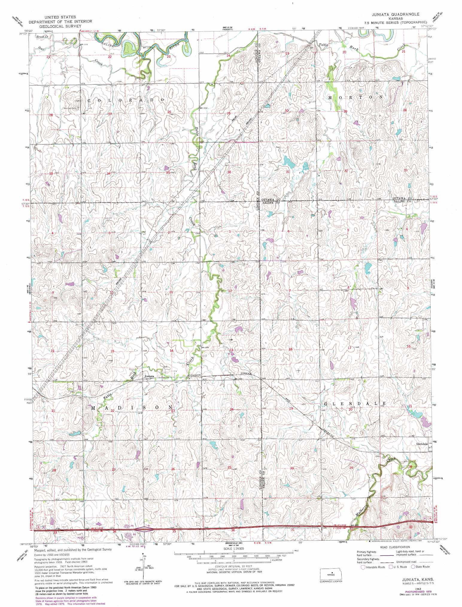
USGS Topo Quad 38097h8 - 1:24,000 scale
| Topo Map Name: | Juniata |
| USGS Topo Quad ID: | 38097h8 |
| Print Size: | ca. 21 1/4" wide x 27" high |
| Southeast Coordinates: | 38.875° N latitude / 97.875° W longitude |
| Map Center Coordinates: | 38.9375° N latitude / 97.9375° W longitude |
| U.S. State: | KS |
| Filename: | o38097h8.jpg |
| Download Map JPG Image: | Juniata topo map 1:24,000 scale |
| Map Type: | Topographic |
| Topo Series: | 7.5´ |
| Map Scale: | 1:24,000 |
| Source of Map Images: | United States Geological Survey (USGS) |
| Alternate Map Versions: |
Juniata KS 1963, updated 1964 Download PDF Buy paper map Juniata KS 1963, updated 1980 Download PDF Buy paper map Juniata KS 2009 Download PDF Buy paper map Juniata KS 2012 Download PDF Buy paper map Juniata KS 2015 Download PDF Buy paper map |
1:24,000 Topo Quads surrounding Juniata
Lincoln Nw |
Barnard |
Ada |
Tescott Ne |
Minneapolis North |
Lincoln |
Shady Bend |
Tescott |
Tescott Se |
Minneapolis South |
Westfall Nw |
Westfall |
Juniata |
Culver |
Trenton |
Westfall Sw |
Westfall Se |
Brookville Sw |
Brookville |
Salina Sw |
Ellsworth |
Carneiro |
Venango |
Falun |
Smolan |
> Back to 38097e1 at 1:100,000 scale
> Back to 38096a1 at 1:250,000 scale
> Back to U.S. Topo Maps home
Juniata topo map: Gazetteer
Juniata: Populated Places
Glendale elevation 422m 1384′Juniata elevation 429m 1407′
Juniata: Streams
Brush Creek elevation 402m 1318′Owl Creek elevation 397m 1302′
Juniata digital topo map on disk
Buy this Juniata topo map showing relief, roads, GPS coordinates and other geographical features, as a high-resolution digital map file on DVD: