Great Bend Topo Map Kansas
To zoom in, hover over the map of Great Bend
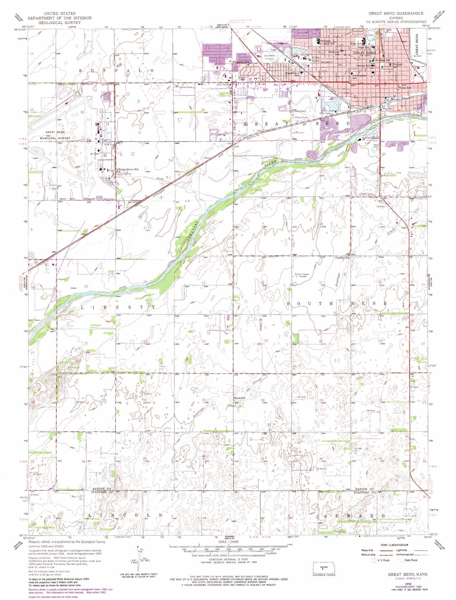
USGS Topo Quad 38098c7 - 1:24,000 scale
| Topo Map Name: | Great Bend |
| USGS Topo Quad ID: | 38098c7 |
| Print Size: | ca. 21 1/4" wide x 27" high |
| Southeast Coordinates: | 38.25° N latitude / 98.75° W longitude |
| Map Center Coordinates: | 38.3125° N latitude / 98.8125° W longitude |
| U.S. State: | KS |
| Filename: | o38098c7.jpg |
| Download Map JPG Image: | Great Bend topo map 1:24,000 scale |
| Map Type: | Topographic |
| Topo Series: | 7.5´ |
| Map Scale: | 1:24,000 |
| Source of Map Images: | United States Geological Survey (USGS) |
| Alternate Map Versions: |
Great Bend KS 1958, updated 1959 Download PDF Buy paper map Great Bend KS 1958, updated 1977 Download PDF Buy paper map Great Bend KS 1958, updated 1983 Download PDF Buy paper map Great Bend KS 2009 Download PDF Buy paper map Great Bend KS 2012 Download PDF Buy paper map Great Bend KS 2015 Download PDF Buy paper map |
1:24,000 Topo Quads surrounding Great Bend
Otis |
Olmitz |
Hoisington |
Redwing |
Claflin |
Albert |
Heizer |
Great Bend Ne |
Ellinwood Nw |
Ellinwood Ne |
Albert Se |
Pawnee Rock |
Great Bend |
Ellinwood Sw |
Ellinwood |
Larned |
Radium |
Seward |
Hudson Nw |
Big Salt Marsh |
Zook |
Saint John Sw |
Saint John North |
Hudson |
Hudson Se |
> Back to 38098a1 at 1:100,000 scale
> Back to 38098a1 at 1:250,000 scale
> Back to U.S. Topo Maps home
Great Bend topo map: Gazetteer
Great Bend: Parks
Brit Spaugh Park elevation 562m 1843′Heizer Park elevation 562m 1843′
Veterans Memorial Park elevation 567m 1860′
Great Bend: Plains
Great Bend Prairie elevation 578m 1896′Great Bend: Populated Places
Anchorway elevation 568m 1863′Great Bend elevation 564m 1850′
Great Bend: Streams
Antelope Creek elevation 564m 1850′Great Bend digital topo map on disk
Buy this Great Bend topo map showing relief, roads, GPS coordinates and other geographical features, as a high-resolution digital map file on DVD: