Westfall Topo Map Kansas
To zoom in, hover over the map of Westfall
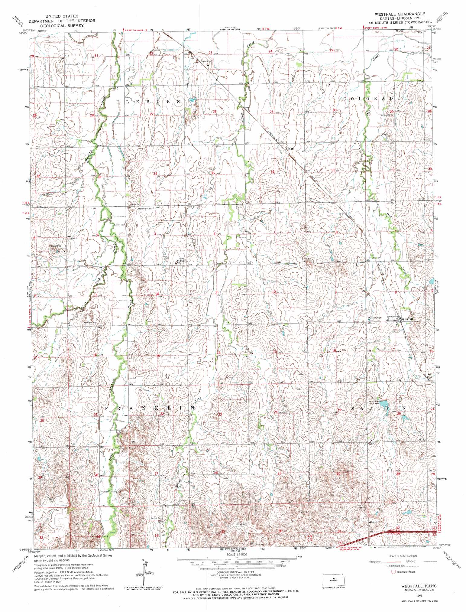
USGS Topo Quad 38098h1 - 1:24,000 scale
| Topo Map Name: | Westfall |
| USGS Topo Quad ID: | 38098h1 |
| Print Size: | ca. 21 1/4" wide x 27" high |
| Southeast Coordinates: | 38.875° N latitude / 98° W longitude |
| Map Center Coordinates: | 38.9375° N latitude / 98.0625° W longitude |
| U.S. State: | KS |
| Filename: | o38098h1.jpg |
| Download Map JPG Image: | Westfall topo map 1:24,000 scale |
| Map Type: | Topographic |
| Topo Series: | 7.5´ |
| Map Scale: | 1:24,000 |
| Source of Map Images: | United States Geological Survey (USGS) |
| Alternate Map Versions: |
Westfall KS 1963, updated 1964 Download PDF Buy paper map Westfall KS 2009 Download PDF Buy paper map Westfall KS 2012 Download PDF Buy paper map Westfall KS 2015 Download PDF Buy paper map |
1:24,000 Topo Quads surrounding Westfall
Ash Grove |
Lincoln Nw |
Barnard |
Ada |
Tescott Ne |
Vesper |
Lincoln |
Shady Bend |
Tescott |
Tescott Se |
Wilson Ne |
Westfall Nw |
Westfall |
Juniata |
Culver |
Black Wolf |
Westfall Sw |
Westfall Se |
Brookville Sw |
Brookville |
Holyrood Ne |
Ellsworth |
Carneiro |
Venango |
Falun |
> Back to 38098e1 at 1:100,000 scale
> Back to 38098a1 at 1:250,000 scale
> Back to U.S. Topo Maps home
Westfall topo map: Gazetteer
Westfall: Parks
Sylvan Public Use Area elevation 416m 1364′Westfall: Populated Places
Barton elevation 412m 1351′Edalgo elevation 424m 1391′
Westfall elevation 432m 1417′
Westfall: Streams
East Elkhorn Creek elevation 417m 1368′West Elkhorn Creek elevation 417m 1368′
Westfall digital topo map on disk
Buy this Westfall topo map showing relief, roads, GPS coordinates and other geographical features, as a high-resolution digital map file on DVD: