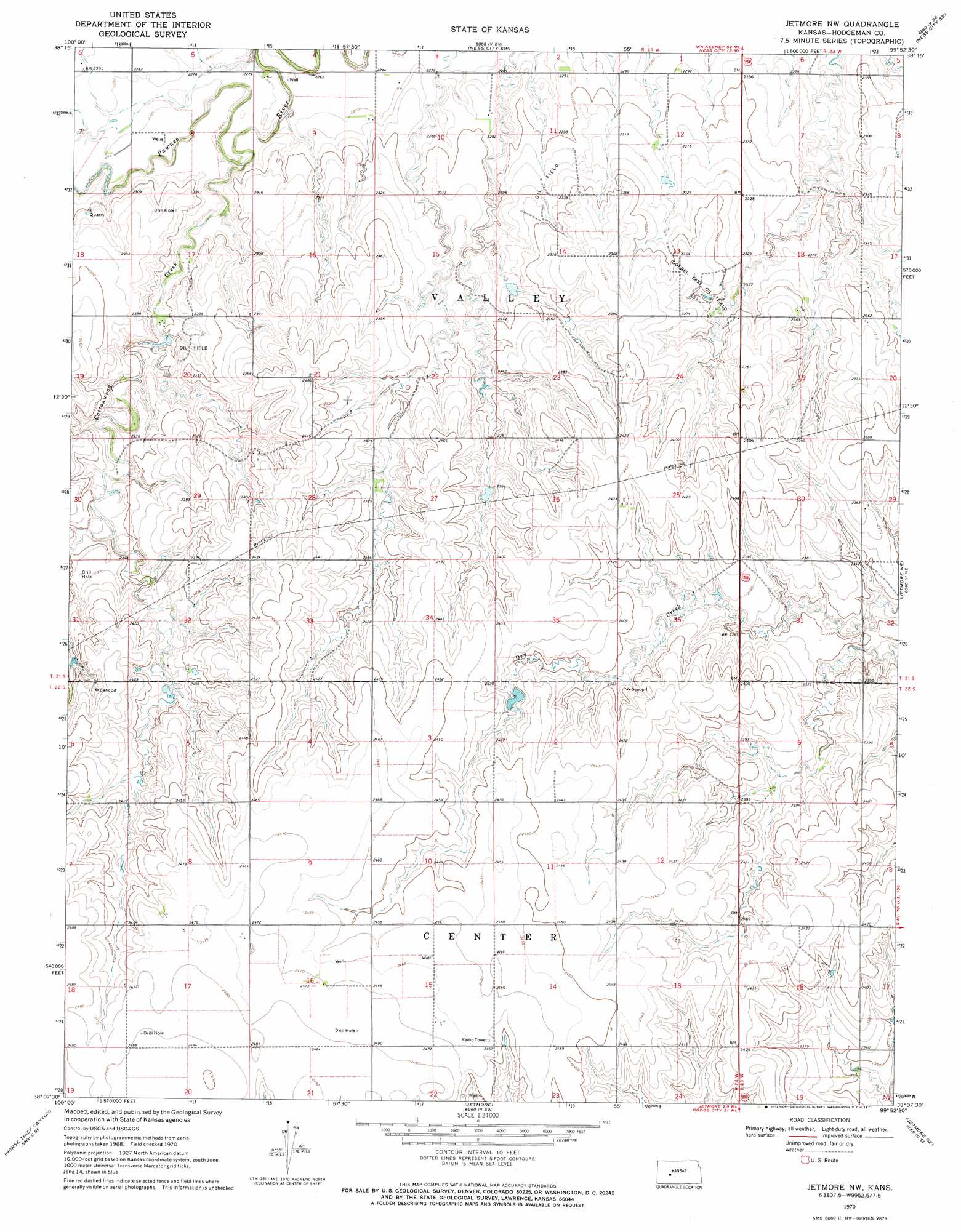
Jetmore Nw Topo Map Kansas
To zoom in, hover over the map of Jetmore Nw
USGS Topo Quad 38099b8 - 1:24,000 scale
| Topo Map Name: | Jetmore Nw |
| USGS Topo Quad ID: | 38099b8 |
| Print Size: | ca. 21 1/4" wide x 27" high |
| Southeast Coordinates: | 38.125° N latitude / 99.875° W longitude |
| Map Center Coordinates: | 38.1875° N latitude / 99.9375° W longitude |
| U.S. State: | KS |
| Filename: | o38099b8.jpg |
| Download Map JPG Image: | Jetmore Nw topo map 1:24,000 scale |
| Map Type: | Topographic |
| Topo Series: | 7.5´ |
| Map Scale: | 1:24,000 |
| Source of Map Images: | United States Geological Survey (USGS) |
| Alternate Map Versions: |
Jetmore NW KS 1970, updated 1971 Download PDF Buy paper map Jetmore NW KS 2009 Download PDF Buy paper map Jetmore NW KS 2012 Download PDF Buy paper map Jetmore NW KS 2015 Download PDF Buy paper map |
1:24,000 Topo Quads surrounding Jetmore Nw
Beeler |
Laird |
Ness City |
Ness City Ne |
Bazine |
Beeler Sw |
Beeler Se |
Ness City Sw |
Ness City Se |
Bazine Sw |
Horse Thief Canyon Nw |
Horse Thief Canyon Ne |
Jetmore Nw |
Jetmore Ne |
Hanston Nw |
Horse Thief Canyon Sw |
Horse Thief Canyon |
Jetmore |
Jetmore Se |
Hanston |
Dodge City Nw |
Dodge City Ne |
Spearville Nw |
Spearville Ne |
Offerle Nw |
> Back to 38099a1 at 1:100,000 scale
> Back to 38098a1 at 1:250,000 scale
> Back to U.S. Topo Maps home
Jetmore Nw topo map: Gazetteer
Jetmore Nw: Oilfields
Goebel East Oil Field elevation 719m 2358′Jetmore Nw: Streams
Cottonwood Creek elevation 689m 2260′Jetmore Nw digital topo map on disk
Buy this Jetmore Nw topo map showing relief, roads, GPS coordinates and other geographical features, as a high-resolution digital map file on DVD: