Ness City Topo Map Kansas
To zoom in, hover over the map of Ness City
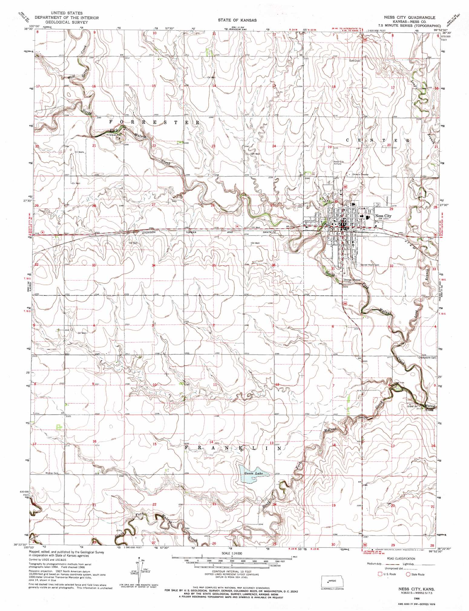
USGS Topo Quad 38099d8 - 1:24,000 scale
| Topo Map Name: | Ness City |
| USGS Topo Quad ID: | 38099d8 |
| Print Size: | ca. 21 1/4" wide x 27" high |
| Southeast Coordinates: | 38.375° N latitude / 99.875° W longitude |
| Map Center Coordinates: | 38.4375° N latitude / 99.9375° W longitude |
| U.S. State: | KS |
| Filename: | o38099d8.jpg |
| Download Map JPG Image: | Ness City topo map 1:24,000 scale |
| Map Type: | Topographic |
| Topo Series: | 7.5´ |
| Map Scale: | 1:24,000 |
| Source of Map Images: | United States Geological Survey (USGS) |
| Alternate Map Versions: |
Ness City KS 1966, updated 1967 Download PDF Buy paper map Ness City KS 2009 Download PDF Buy paper map Ness City KS 2012 Download PDF Buy paper map Ness City KS 2015 Download PDF Buy paper map |
1:24,000 Topo Quads surrounding Ness City
Utica |
Arnold |
Ransom |
Osgood |
Brownell |
Utica Sw |
Utica Se |
Ransom Sw |
Ransom Se |
Mccracken Sw |
Beeler |
Laird |
Ness City |
Ness City Ne |
Bazine |
Beeler Sw |
Beeler Se |
Ness City Sw |
Ness City Se |
Bazine Sw |
Horse Thief Canyon Nw |
Horse Thief Canyon Ne |
Jetmore Nw |
Jetmore Ne |
Hanston Nw |
> Back to 38099a1 at 1:100,000 scale
> Back to 38098a1 at 1:250,000 scale
> Back to U.S. Topo Maps home
Ness City topo map: Gazetteer
Ness City: Airports
Ness City Municipal Airport elevation 700m 2296′Ness City: Populated Places
Ness City elevation 687m 2253′Ness City: Reservoirs
Goose Lake elevation 683m 2240′Ness City: Streams
Long Branch elevation 666m 2185′North Fork Walnut Creek elevation 664m 2178′
South Fork Walnut Creek elevation 664m 2178′
Wild Horse Creek elevation 687m 2253′
Ness City digital topo map on disk
Buy this Ness City topo map showing relief, roads, GPS coordinates and other geographical features, as a high-resolution digital map file on DVD: