Brownell Topo Map Kansas
To zoom in, hover over the map of Brownell
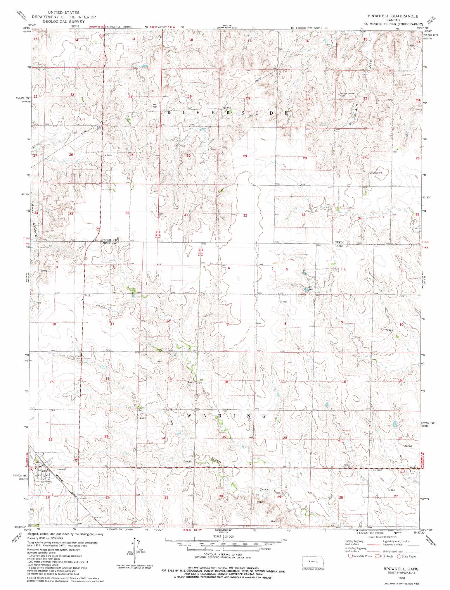
USGS Topo Quad 38099f6 - 1:24,000 scale
| Topo Map Name: | Brownell |
| USGS Topo Quad ID: | 38099f6 |
| Print Size: | ca. 21 1/4" wide x 27" high |
| Southeast Coordinates: | 38.625° N latitude / 99.625° W longitude |
| Map Center Coordinates: | 38.6875° N latitude / 99.6875° W longitude |
| U.S. State: | KS |
| Filename: | o38099f6.jpg |
| Download Map JPG Image: | Brownell topo map 1:24,000 scale |
| Map Type: | Topographic |
| Topo Series: | 7.5´ |
| Map Scale: | 1:24,000 |
| Source of Map Images: | United States Geological Survey (USGS) |
| Alternate Map Versions: |
Brownell KS 1980, updated 1981 Download PDF Buy paper map Brownell KS 2009 Download PDF Buy paper map Brownell KS 2012 Download PDF Buy paper map Brownell KS 2015 Download PDF Buy paper map |
1:24,000 Topo Quads surrounding Brownell
Trego Center |
Trego Center Ne |
Ogallah |
Ellis |
Yocemento |
Fort Downer |
Cedar Bluff |
Cedar Bluff Dam |
Ellis Se |
Antonino |
Ransom |
Osgood |
Brownell |
Mccracken Ne |
La Crosse Nw |
Ransom Sw |
Ransom Se |
Mccracken Sw |
Mccracken |
Hargrave |
Ness City |
Ness City Ne |
Bazine |
Alexander |
Nekoma |
> Back to 38099e1 at 1:100,000 scale
> Back to 38098a1 at 1:250,000 scale
> Back to U.S. Topo Maps home
Brownell topo map: Gazetteer
Brownell: Populated Places
Brownell elevation 736m 2414′Brownell: Summits
Round House Rock elevation 715m 2345′Brownell digital topo map on disk
Buy this Brownell topo map showing relief, roads, GPS coordinates and other geographical features, as a high-resolution digital map file on DVD: