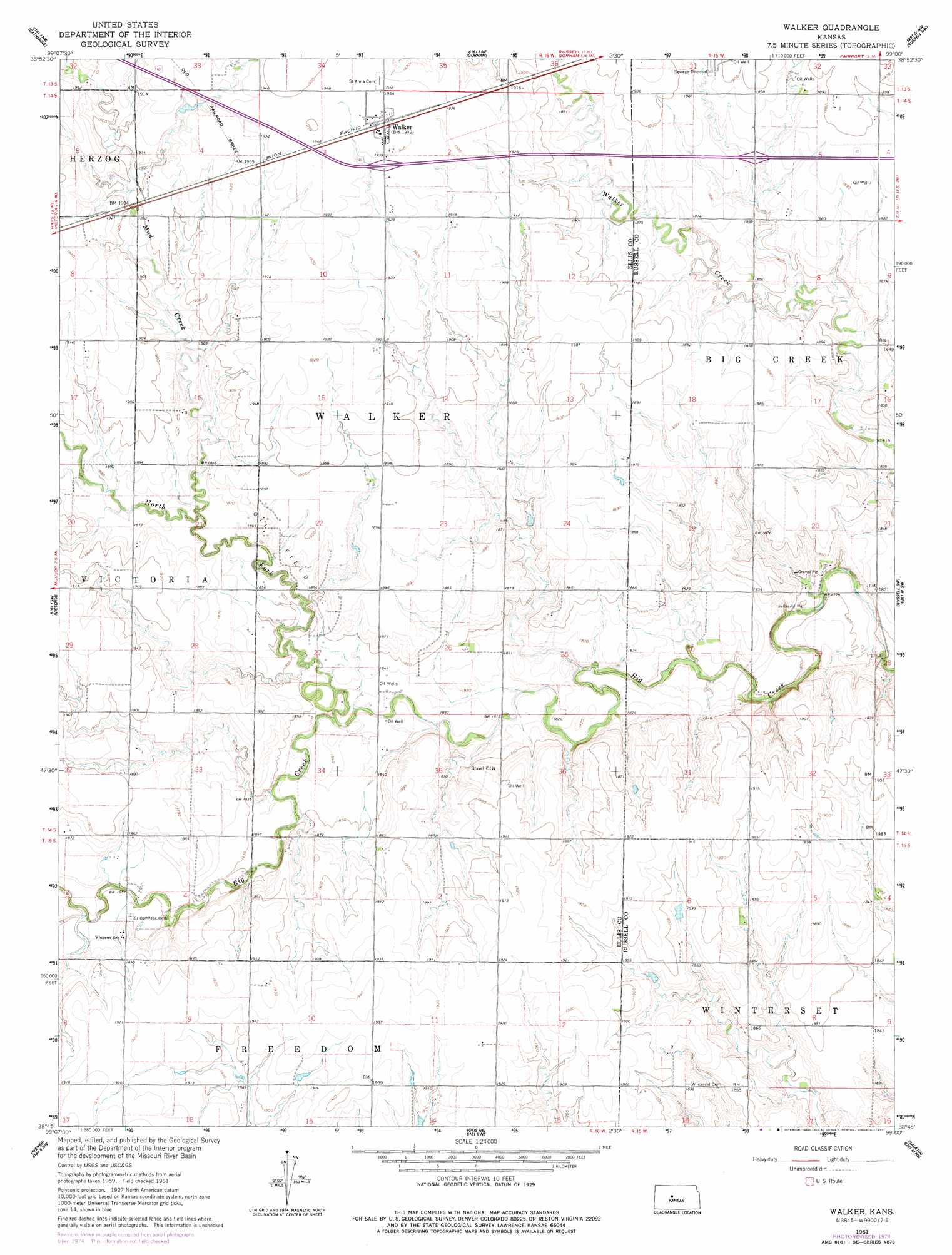
Walker Topo Map Kansas
To zoom in, hover over the map of Walker
USGS Topo Quad 38099g1 - 1:24,000 scale
| Topo Map Name: | Walker |
| USGS Topo Quad ID: | 38099g1 |
| Print Size: | ca. 21 1/4" wide x 27" high |
| Southeast Coordinates: | 38.75° N latitude / 99° W longitude |
| Map Center Coordinates: | 38.8125° N latitude / 99.0625° W longitude |
| U.S. State: | KS |
| Filename: | o38099g1.jpg |
| Download Map JPG Image: | Walker topo map 1:24,000 scale |
| Map Type: | Topographic |
| Topo Series: | 7.5´ |
| Map Scale: | 1:24,000 |
| Source of Map Images: | United States Geological Survey (USGS) |
| Alternate Map Versions: |
Walker KS 1961, updated 1962 Download PDF Buy paper map Walker KS 1961, updated 1977 Download PDF Buy paper map Walker KS 2010 Download PDF Buy paper map Walker KS 2012 Download PDF Buy paper map Walker KS 2015 Download PDF Buy paper map |
1:24,000 Topo Quads surrounding Walker
Plainville Se |
Turkville |
Fairport |
Paradise |
Waldo |
Hays North |
Catharine |
Gorham |
Russell Nw |
Russell |
Hays South |
Victoria |
Walker |
Russell Sw |
Homer |
Liebenthal |
Pfeifer |
Otis Ne |
Galatia |
Susank |
La Crosse |
Bison |
Otis |
Olmitz |
Hoisington |
> Back to 38099e1 at 1:100,000 scale
> Back to 38098a1 at 1:250,000 scale
> Back to U.S. Topo Maps home
Walker topo map: Gazetteer
Walker: Populated Places
Walker elevation 592m 1942′Walker: Streams
Mud Creek elevation 564m 1850′North Fork Big Creek elevation 555m 1820′
Walker digital topo map on disk
Buy this Walker topo map showing relief, roads, GPS coordinates and other geographical features, as a high-resolution digital map file on DVD: