Granada Topo Map Colorado
To zoom in, hover over the map of Granada
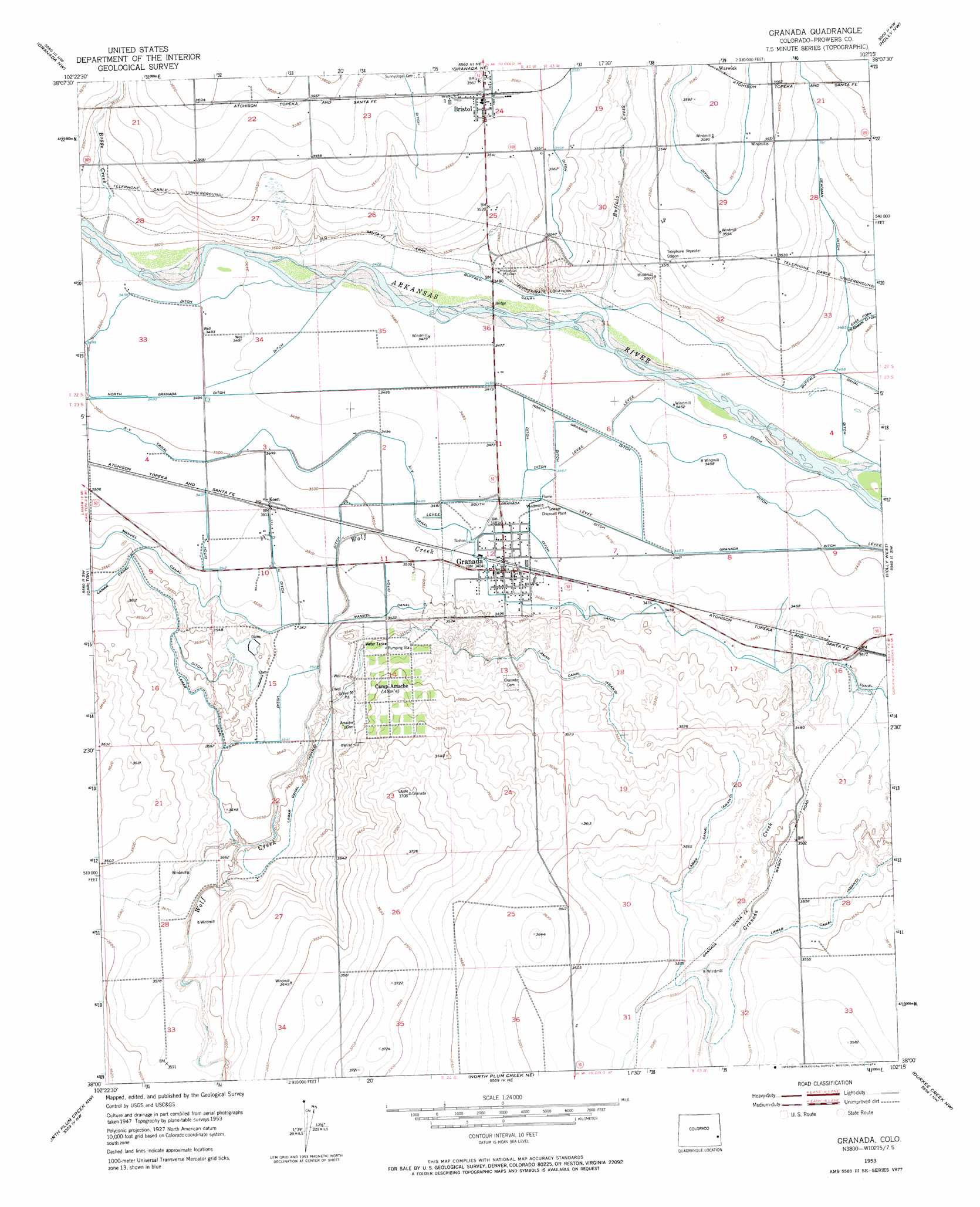
USGS Topo Quad 38102a3 - 1:24,000 scale
| Topo Map Name: | Granada |
| USGS Topo Quad ID: | 38102a3 |
| Print Size: | ca. 21 1/4" wide x 27" high |
| Southeast Coordinates: | 38° N latitude / 102.25° W longitude |
| Map Center Coordinates: | 38.0625° N latitude / 102.3125° W longitude |
| U.S. State: | CO |
| Filename: | o38102a3.jpg |
| Download Map JPG Image: | Granada topo map 1:24,000 scale |
| Map Type: | Topographic |
| Topo Series: | 7.5´ |
| Map Scale: | 1:24,000 |
| Source of Map Images: | United States Geological Survey (USGS) |
| Alternate Map Versions: |
Granada CO 1953, updated 1954 Download PDF Buy paper map Granada CO 1953, updated 1954 Download PDF Buy paper map Granada CO 1953, updated 1974 Download PDF Buy paper map Granada CO 2010 Download PDF Buy paper map Granada CO 2013 Download PDF Buy paper map Granada CO 2016 Download PDF Buy paper map |
1:24,000 Topo Quads surrounding Granada
Chivington Se |
Sheridan Lake Sw |
Sheridan Lake Se |
Lake Devore |
Towner Se |
May Valley |
Granada Nw |
Granada Ne |
Holly Nw |
Holly Ne |
Lamar East |
Carlton |
Granada |
Holly West |
Holly East |
Cat Creek Ne |
North Plum Creek Nw |
North Plum Creek Ne |
Durkee Creek Nw |
Durkee Creek Ne |
Gobblers Knob |
Barrel Spring |
North Plum Creek Se |
Two Butte Springs |
Durkee Creek Se |
> Back to 38102a1 at 1:100,000 scale
> Back to 38102a1 at 1:250,000 scale
> Back to U.S. Topo Maps home
Granada topo map: Gazetteer
Granada: Canals
Deadman Ditch elevation 1079m 3540′Granada Ditch elevation 1052m 3451′
North Granada Ditch elevation 1064m 3490′
South Granada Ditch elevation 1059m 3474′
X-Y Canal elevation 1065m 3494′
Granada: Dams
Floyd Verhoeff Dam elevation 1069m 3507′Granada: Populated Places
Bristol elevation 1085m 3559′Granada elevation 1062m 3484′
Koen elevation 1070m 3510′
Warwick elevation 1093m 3585′
Granada: Reservoirs
Floyd Verhoeff Reservoir elevation 1069m 3507′Granada: Streams
Boggs Creek elevation 1067m 3500′Buffalo Creek elevation 1055m 3461′
Granada Creek elevation 1061m 3480′
Wolf Creek elevation 1060m 3477′
Granada digital topo map on disk
Buy this Granada topo map showing relief, roads, GPS coordinates and other geographical features, as a high-resolution digital map file on DVD: