May Valley Topo Map Colorado
To zoom in, hover over the map of May Valley
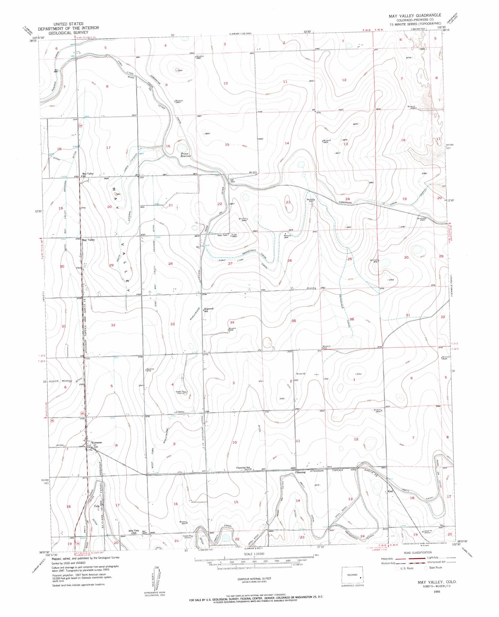
USGS Topo Quad 38102b5 - 1:24,000 scale
| Topo Map Name: | May Valley |
| USGS Topo Quad ID: | 38102b5 |
| Print Size: | ca. 21 1/4" wide x 27" high |
| Southeast Coordinates: | 38.125° N latitude / 102.5° W longitude |
| Map Center Coordinates: | 38.1875° N latitude / 102.5625° W longitude |
| U.S. State: | CO |
| Filename: | o38102b5.jpg |
| Download Map JPG Image: | May Valley topo map 1:24,000 scale |
| Map Type: | Topographic |
| Topo Series: | 7.5´ |
| Map Scale: | 1:24,000 |
| Source of Map Images: | United States Geological Survey (USGS) |
| Alternate Map Versions: |
May Valley CO 1955, updated 1956 Download PDF Buy paper map May Valley CO 2010 Download PDF Buy paper map May Valley CO 2013 Download PDF Buy paper map May Valley CO 2016 Download PDF Buy paper map |
1:24,000 Topo Quads surrounding May Valley
Eads |
Alkali Lake |
Chivington |
Brandon |
Sheridan Lake |
Swede Lake |
Neenoshe Reservoir |
Chivington Se |
Sheridan Lake Sw |
Sheridan Lake Se |
Mcclave |
Wiley |
May Valley |
Granada Nw |
Granada Ne |
Prowers |
Lamar West |
Lamar East |
Carlton |
Granada |
Denny Lake |
Cat Creek Nw |
Cat Creek Ne |
North Plum Creek Nw |
North Plum Creek Ne |
> Back to 38102a1 at 1:100,000 scale
> Back to 38102a1 at 1:250,000 scale
> Back to U.S. Topo Maps home
May Valley topo map: Gazetteer
May Valley: Canals
Comanche Canal elevation 1176m 3858′East Fork Wheatridge Lateral elevation 1138m 3733′
East May Valley Ditch elevation 1143m 3750′
James Lateral elevation 1171m 3841′
Smith Lateral elevation 1165m 3822′
West Fork Wheatridge Lateral elevation 1134m 3720′
West May Valley Drainage Ditch elevation 1140m 3740′
Wheatridge Lateral elevation 1153m 3782′
May Valley: Dams
Fort Lyons Dam elevation 1168m 3832′Sunny Brook Dam elevation 1116m 3661′
May Valley: Populated Places
Channing elevation 1116m 3661′Culp elevation 1114m 3654′
Karl elevation 1110m 3641′
Kornman elevation 1124m 3687′
May Valley elevation 1146m 3759′
May Valley: Reservoirs
Fort Lyons Reservoir elevation 1168m 3832′Prince Reservoir elevation 1171m 3841′
Sunny Brook Reservoir elevation 1116m 3661′
May Valley: Valleys
May Valley elevation 1169m 3835′May Valley digital topo map on disk
Buy this May Valley topo map showing relief, roads, GPS coordinates and other geographical features, as a high-resolution digital map file on DVD: