Mcclave Topo Map Colorado
To zoom in, hover over the map of Mcclave
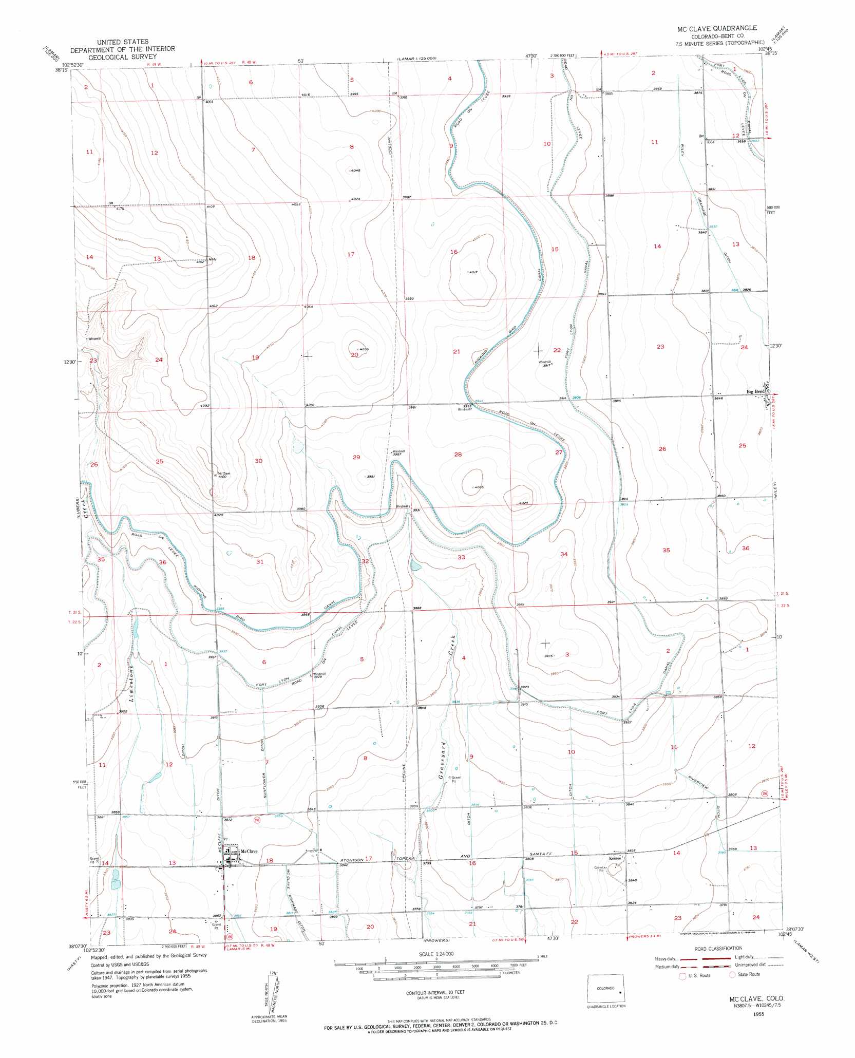
USGS Topo Quad 38102b7 - 1:24,000 scale
| Topo Map Name: | Mcclave |
| USGS Topo Quad ID: | 38102b7 |
| Print Size: | ca. 21 1/4" wide x 27" high |
| Southeast Coordinates: | 38.125° N latitude / 102.75° W longitude |
| Map Center Coordinates: | 38.1875° N latitude / 102.8125° W longitude |
| U.S. State: | CO |
| Filename: | o38102b7.jpg |
| Download Map JPG Image: | Mcclave topo map 1:24,000 scale |
| Map Type: | Topographic |
| Topo Series: | 7.5´ |
| Map Scale: | 1:24,000 |
| Source of Map Images: | United States Geological Survey (USGS) |
| Alternate Map Versions: |
McClave CO 1955, updated 1956 Download PDF Buy paper map McClave CO 2010 Download PDF Buy paper map McClave CO 2013 Download PDF Buy paper map McClave CO 2016 Download PDF Buy paper map |
1:24,000 Topo Quads surrounding Mcclave
Haswell Ne |
Hawkins |
Eads |
Alkali Lake |
Chivington |
Haswell Se |
Rose Ranch |
Swede Lake |
Neenoshe Reservoir |
Chivington Se |
Tree Top Ranch |
Lubers |
Mcclave |
Wiley |
May Valley |
Kreybill |
Hasty |
Prowers |
Lamar West |
Lamar East |
Toonerville Ne |
High Rock |
Denny Lake |
Cat Creek Nw |
Cat Creek Ne |
> Back to 38102a1 at 1:100,000 scale
> Back to 38102a1 at 1:250,000 scale
> Back to U.S. Topo Maps home
Mcclave topo map: Gazetteer
Mcclave: Canals
Sunflower Ditch elevation 1172m 3845′Mcclave: Populated Places
Big Bend elevation 1163m 3815′Keesee elevation 1170m 3838′
McClave elevation 1179m 3868′
Mcclave digital topo map on disk
Buy this Mcclave topo map showing relief, roads, GPS coordinates and other geographical features, as a high-resolution digital map file on DVD: