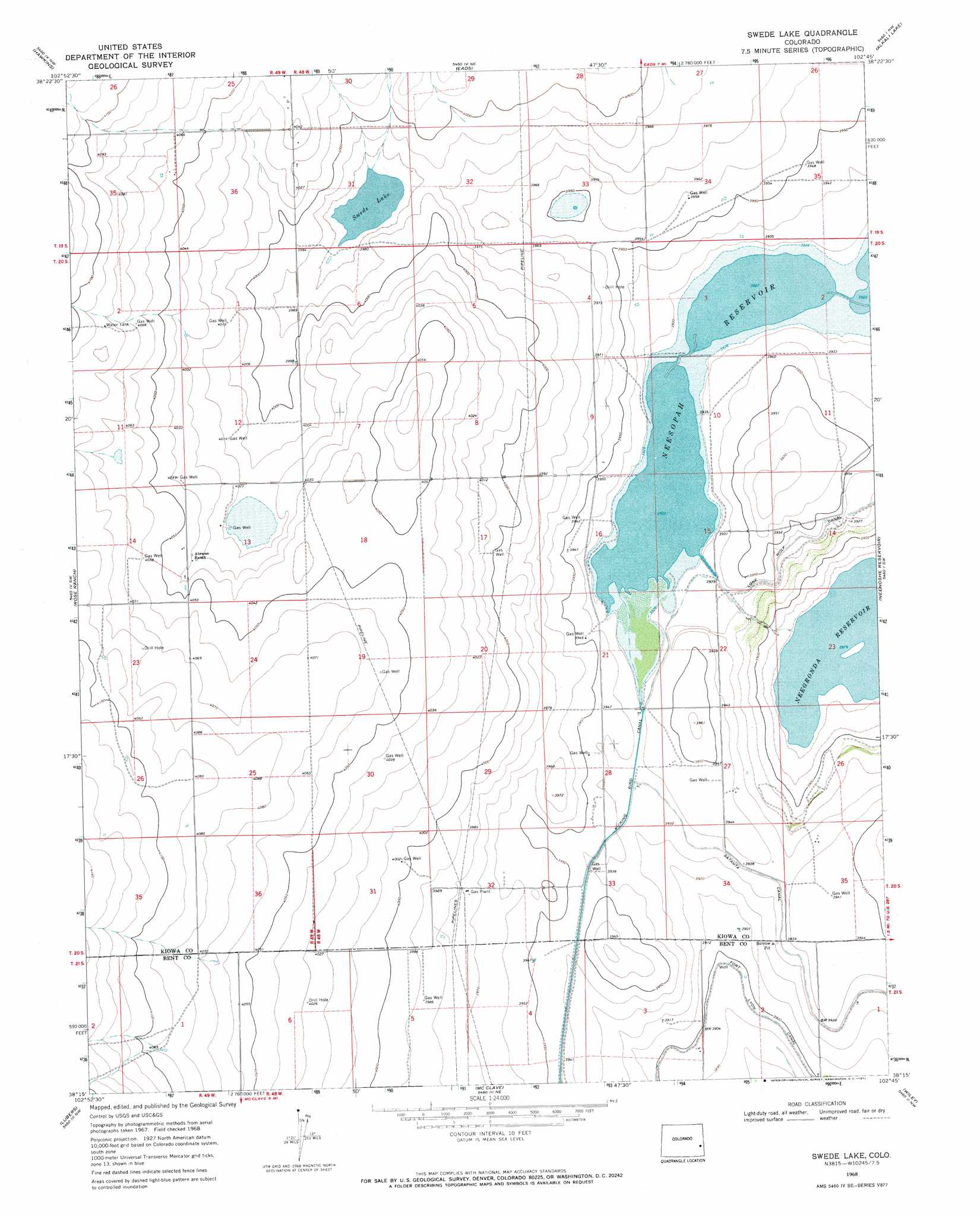
Swede Lake Topo Map Colorado
To zoom in, hover over the map of Swede Lake
USGS Topo Quad 38102c7 - 1:24,000 scale
| Topo Map Name: | Swede Lake |
| USGS Topo Quad ID: | 38102c7 |
| Print Size: | ca. 21 1/4" wide x 27" high |
| Southeast Coordinates: | 38.25° N latitude / 102.75° W longitude |
| Map Center Coordinates: | 38.3125° N latitude / 102.8125° W longitude |
| U.S. State: | CO |
| Filename: | o38102c7.jpg |
| Download Map JPG Image: | Swede Lake topo map 1:24,000 scale |
| Map Type: | Topographic |
| Topo Series: | 7.5´ |
| Map Scale: | 1:24,000 |
| Source of Map Images: | United States Geological Survey (USGS) |
| Alternate Map Versions: |
Swede Lake CO 1968, updated 1971 Download PDF Buy paper map Swede Lake CO 2011 Download PDF Buy paper map Swede Lake CO 2013 Download PDF Buy paper map Swede Lake CO 2016 Download PDF Buy paper map |
1:24,000 Topo Quads surrounding Swede Lake
Galatea |
Arsenic Lake Sw |
Dunlap Ranch |
Oswald Ranch |
Kit Carson 4 Se |
Haswell Ne |
Hawkins |
Eads |
Alkali Lake |
Chivington |
Haswell Se |
Rose Ranch |
Swede Lake |
Neenoshe Reservoir |
Chivington Se |
Tree Top Ranch |
Lubers |
Mcclave |
Wiley |
May Valley |
Kreybill |
Hasty |
Prowers |
Lamar West |
Lamar East |
> Back to 38102a1 at 1:100,000 scale
> Back to 38102a1 at 1:250,000 scale
> Back to U.S. Topo Maps home
Swede Lake topo map: Gazetteer
Swede Lake: Canals
Lone Wolf Canal elevation 1200m 3937′Swede Lake: Lakes
Swede Lake elevation 1211m 3973′Swede Lake digital topo map on disk
Buy this Swede Lake topo map showing relief, roads, GPS coordinates and other geographical features, as a high-resolution digital map file on DVD: