Arapahoe Topo Map Colorado
To zoom in, hover over the map of Arapahoe
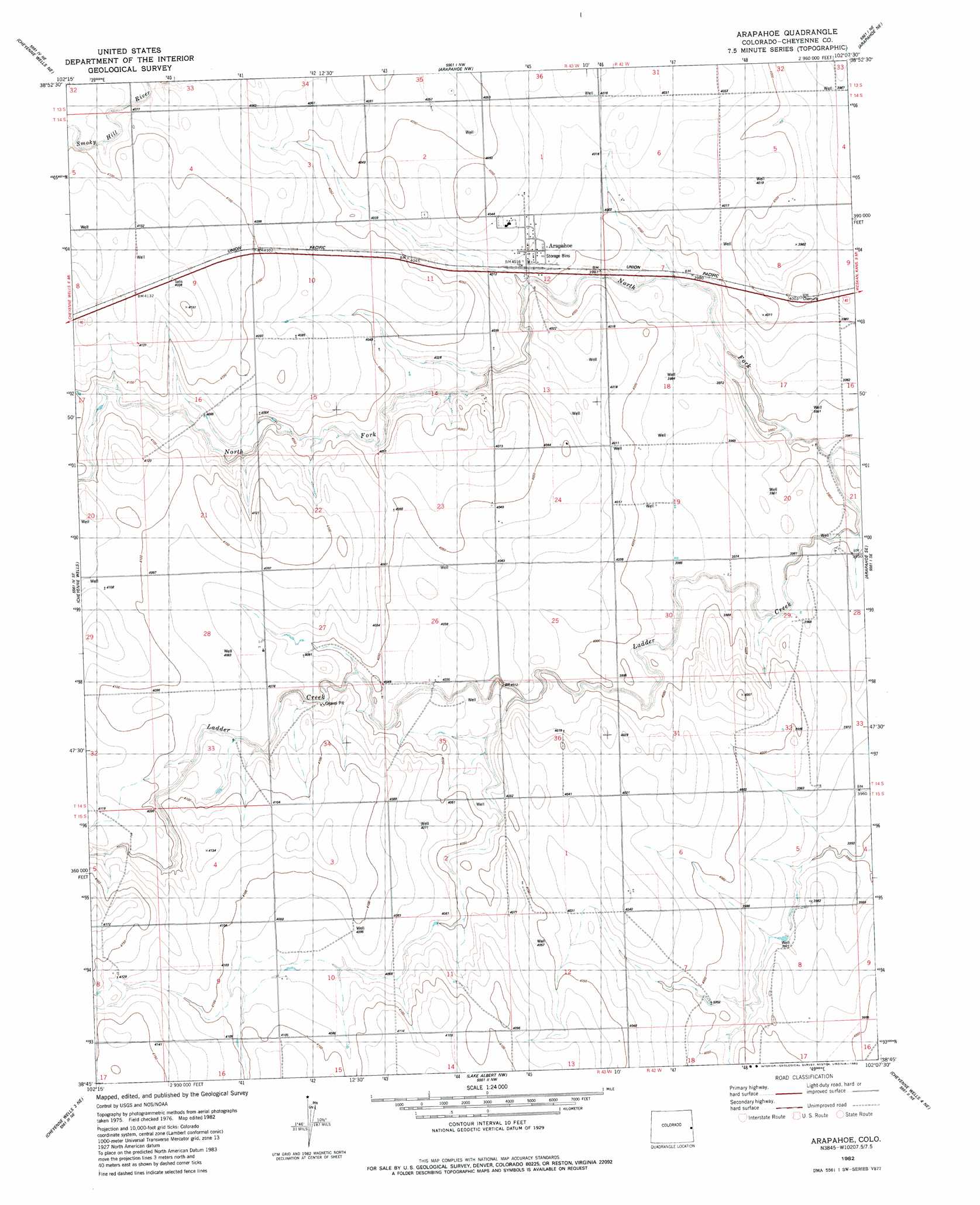
USGS Topo Quad 38102g2 - 1:24,000 scale
| Topo Map Name: | Arapahoe |
| USGS Topo Quad ID: | 38102g2 |
| Print Size: | ca. 21 1/4" wide x 27" high |
| Southeast Coordinates: | 38.75° N latitude / 102.125° W longitude |
| Map Center Coordinates: | 38.8125° N latitude / 102.1875° W longitude |
| U.S. State: | CO |
| Filename: | o38102g2.jpg |
| Download Map JPG Image: | Arapahoe topo map 1:24,000 scale |
| Map Type: | Topographic |
| Topo Series: | 7.5´ |
| Map Scale: | 1:24,000 |
| Source of Map Images: | United States Geological Survey (USGS) |
| Alternate Map Versions: |
Arapahoe CO 1982, updated 1982 Download PDF Buy paper map Arapahoe CO 2010 Download PDF Buy paper map Arapahoe CO 2013 Download PDF Buy paper map Arapahoe CO 2016 Download PDF Buy paper map |
1:24,000 Topo Quads surrounding Arapahoe
Burlington 3 Sw |
Burlington 3 Se |
Mount Sunflower Sw |
Mount Sunflower |
Horsethief Draw |
Cheyenne Wells Nw |
Cheyenne Wells Ne |
Arapahoe Nw |
Arapahoe Ne |
Weskan Nw |
Cheyenne Wells Sw |
Cheyenne Wells |
Arapahoe |
Arapahoe Se |
Weskan |
Cheyenne Wells 3 Nw |
Cheyenne Wells 3 Ne |
Lake Albert Nw |
Cheyenne Wells 4 Ne |
Sharon Springs 3 Nw |
Cheyenne Wells 3 Sw |
Cheyenne Wells 3 Se |
Lake Albert |
Cheyenne Wells 4 Se |
Sharon Springs 3 Sw |
> Back to 38102e1 at 1:100,000 scale
> Back to 38102a1 at 1:250,000 scale
> Back to U.S. Topo Maps home
Arapahoe topo map: Gazetteer
Arapahoe: Populated Places
Arapahoe elevation 1221m 4005′Arapahoe: Streams
North Fork Ladder Creek elevation 1199m 3933′Arapahoe digital topo map on disk
Buy this Arapahoe topo map showing relief, roads, GPS coordinates and other geographical features, as a high-resolution digital map file on DVD: