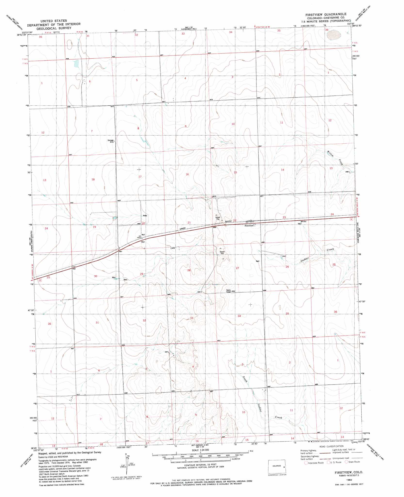
Firstview Topo Map Colorado
To zoom in, hover over the map of Firstview
USGS Topo Quad 38102g5 - 1:24,000 scale
| Topo Map Name: | Firstview |
| USGS Topo Quad ID: | 38102g5 |
| Print Size: | ca. 21 1/4" wide x 27" high |
| Southeast Coordinates: | 38.75° N latitude / 102.5° W longitude |
| Map Center Coordinates: | 38.8125° N latitude / 102.5625° W longitude |
| U.S. State: | CO |
| Filename: | o38102g5.jpg |
| Download Map JPG Image: | Firstview topo map 1:24,000 scale |
| Map Type: | Topographic |
| Topo Series: | 7.5´ |
| Map Scale: | 1:24,000 |
| Source of Map Images: | United States Geological Survey (USGS) |
| Alternate Map Versions: |
Firstview CO 1982, updated 1982 Download PDF Buy paper map Firstview CO 2010 Download PDF Buy paper map Firstview CO 2013 Download PDF Buy paper map Firstview CO 2016 Download PDF Buy paper map |
1:24,000 Topo Quads surrounding Firstview
Stratton 3 Se |
Alpine Ranch Sw |
Alpine Ranch |
Burlington 3 Sw |
Burlington 3 Se |
Big Spring |
Eureka Creek North |
Landsman Hill |
Cheyenne Wells Nw |
Cheyenne Wells Ne |
Kit Carson |
Eureka Creek South |
Firstview |
Cheyenne Wells Sw |
Cheyenne Wells |
Lewis Lake |
Kit Carson 4 Nw |
Kit Carson 4 Ne |
Cheyenne Wells 3 Nw |
Cheyenne Wells 3 Ne |
Dunlap Ranch |
Oswald Ranch |
Kit Carson 4 Se |
Cheyenne Wells 3 Sw |
Cheyenne Wells 3 Se |
> Back to 38102e1 at 1:100,000 scale
> Back to 38102a1 at 1:250,000 scale
> Back to U.S. Topo Maps home
Firstview digital topo map on disk
Buy this Firstview topo map showing relief, roads, GPS coordinates and other geographical features, as a high-resolution digital map file on DVD: