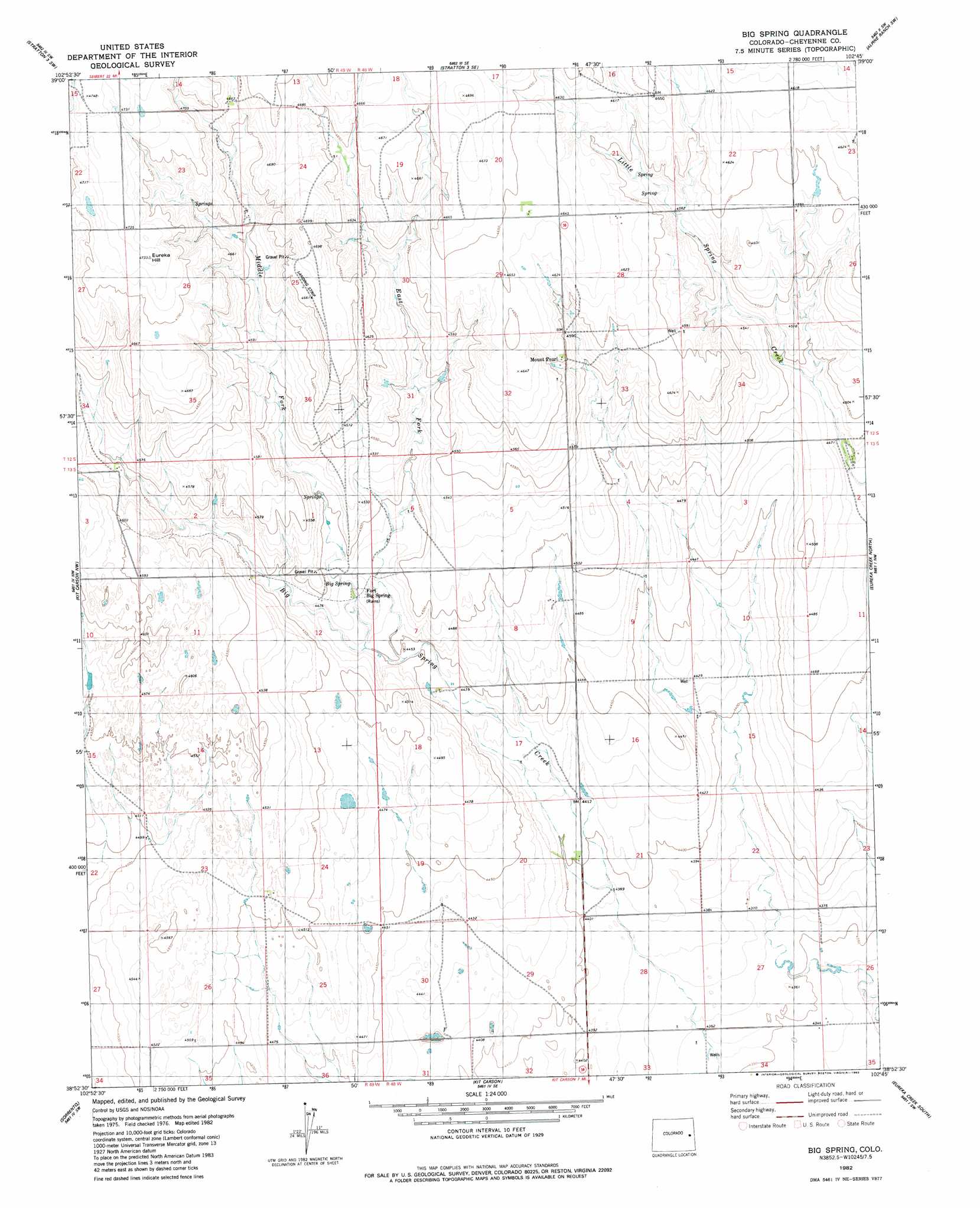
Big Spring Topo Map Colorado
To zoom in, hover over the map of Big Spring
USGS Topo Quad 38102h7 - 1:24,000 scale
| Topo Map Name: | Big Spring |
| USGS Topo Quad ID: | 38102h7 |
| Print Size: | ca. 21 1/4" wide x 27" high |
| Southeast Coordinates: | 38.875° N latitude / 102.75° W longitude |
| Map Center Coordinates: | 38.9375° N latitude / 102.8125° W longitude |
| U.S. State: | CO |
| Filename: | o38102h7.jpg |
| Download Map JPG Image: | Big Spring topo map 1:24,000 scale |
| Map Type: | Topographic |
| Topo Series: | 7.5´ |
| Map Scale: | 1:24,000 |
| Source of Map Images: | United States Geological Survey (USGS) |
| Alternate Map Versions: |
Big Spring CO 1982, updated 1982 Download PDF Buy paper map Big Spring CO 2010 Download PDF Buy paper map Big Spring CO 2013 Download PDF Buy paper map Big Spring CO 2016 Download PDF Buy paper map |
1:24,000 Topo Quads surrounding Big Spring
Hugo 4 Ne |
Stratton 3 Nw |
Stratton 3 Ne |
Alpine Ranch Nw |
Alpine Ranch Ne |
Hugo 4 Se |
Stratton 3 Sw |
Stratton 3 Se |
Alpine Ranch Sw |
Alpine Ranch |
Sanders Ranch |
Kit Carson Nw |
Big Spring |
Eureka Creek North |
Landsman Hill |
Wild Horse |
Sorrento |
Kit Carson |
Eureka Creek South |
Firstview |
Galatea Ne |
Arsenic Lake |
Lewis Lake |
Kit Carson 4 Nw |
Kit Carson 4 Ne |
> Back to 38102e1 at 1:100,000 scale
> Back to 38102a1 at 1:250,000 scale
> Back to U.S. Topo Maps home
Big Spring topo map: Gazetteer
Big Spring: Populated Places
Fort Big Spring elevation 1367m 4484′Mount Pearl elevation 1389m 4557′
Big Spring: Springs
Big Spring elevation 1367m 4484′Big Spring: Streams
East Fork Big Spring Creek elevation 1362m 4468′Middle Fork Big Spring Creek elevation 1365m 4478′
Big Spring: Summits
Eureka Hill elevation 1443m 4734′Big Spring digital topo map on disk
Buy this Big Spring topo map showing relief, roads, GPS coordinates and other geographical features, as a high-resolution digital map file on DVD: