Peace Valley Topo Map Colorado
To zoom in, hover over the map of Peace Valley
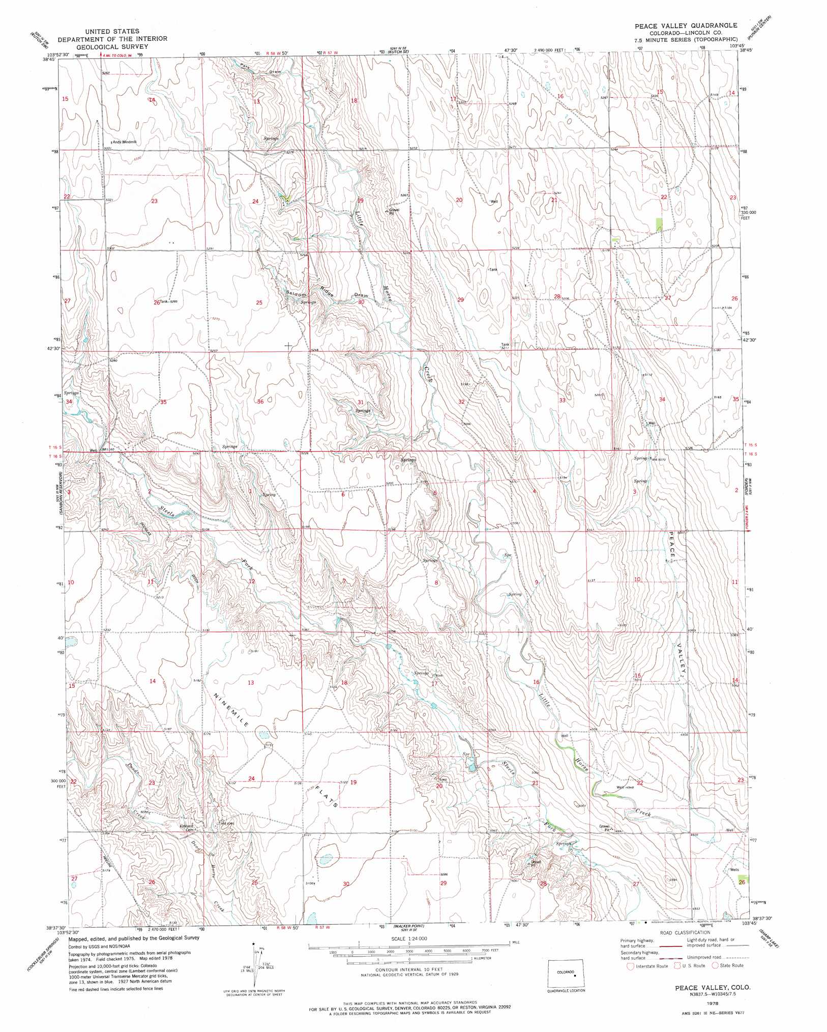
USGS Topo Quad 38103f7 - 1:24,000 scale
| Topo Map Name: | Peace Valley |
| USGS Topo Quad ID: | 38103f7 |
| Print Size: | ca. 21 1/4" wide x 27" high |
| Southeast Coordinates: | 38.625° N latitude / 103.75° W longitude |
| Map Center Coordinates: | 38.6875° N latitude / 103.8125° W longitude |
| U.S. State: | CO |
| Filename: | o38103f7.jpg |
| Download Map JPG Image: | Peace Valley topo map 1:24,000 scale |
| Map Type: | Topographic |
| Topo Series: | 7.5´ |
| Map Scale: | 1:24,000 |
| Source of Map Images: | United States Geological Survey (USGS) |
| Alternate Map Versions: |
Peace Valley CO 1978, updated 1978 Download PDF Buy paper map Peace Valley CO 2010 Download PDF Buy paper map Peace Valley CO 2013 Download PDF Buy paper map Peace Valley CO 2016 Download PDF Buy paper map |
1:24,000 Topo Quads surrounding Peace Valley
Holtwold Store |
Kutch Nw |
Kutch |
Punkin Center Nw |
Beckman Lake |
Rush |
Kutch Sw |
Kutch Se |
Punkin Center |
Stanley Gulch |
Truckton Ne |
Sanborn Reservoir |
Peace Valley |
Forder |
Karval |
Truckton Se |
Cockleburr Springs |
Walker Point |
Sharp Lake |
Metz Springs |
Grandview School |
Ninemile Spring |
Windmill Lake |
Box Springs |
The Pinnacles |
> Back to 38103e1 at 1:100,000 scale
> Back to 38102a1 at 1:250,000 scale
> Back to U.S. Topo Maps home
Peace Valley topo map: Gazetteer
Peace Valley: Canals
Douglas Ditch elevation 1584m 5196′Peace Valley: Dams
Kuester Dam elevation 1501m 4924′Peace Valley: Reservoirs
Kuester Reservoir elevation 1501m 4924′Peace Valley: Streams
Pond Creek elevation 1544m 5065′Peace Valley: Valleys
Pats Draw elevation 1589m 5213′Peace Valley elevation 1501m 4924′
Seldom Ridge Draw elevation 1564m 5131′
Peace Valley digital topo map on disk
Buy this Peace Valley topo map showing relief, roads, GPS coordinates and other geographical features, as a high-resolution digital map file on DVD: