Sanborn Reservoir Topo Map Colorado
To zoom in, hover over the map of Sanborn Reservoir
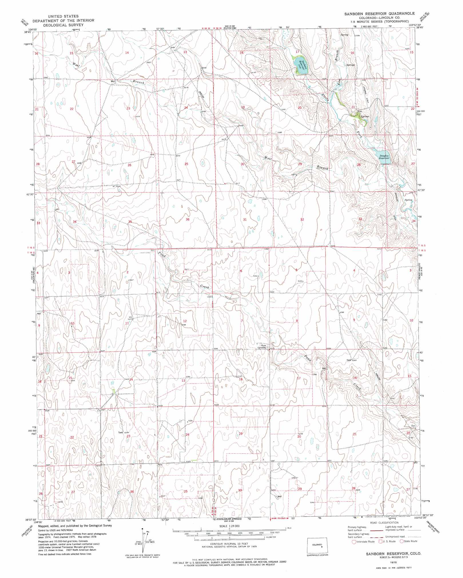
USGS Topo Quad 38103f8 - 1:24,000 scale
| Topo Map Name: | Sanborn Reservoir |
| USGS Topo Quad ID: | 38103f8 |
| Print Size: | ca. 21 1/4" wide x 27" high |
| Southeast Coordinates: | 38.625° N latitude / 103.875° W longitude |
| Map Center Coordinates: | 38.6875° N latitude / 103.9375° W longitude |
| U.S. State: | CO |
| Filename: | o38103f8.jpg |
| Download Map JPG Image: | Sanborn Reservoir topo map 1:24,000 scale |
| Map Type: | Topographic |
| Topo Series: | 7.5´ |
| Map Scale: | 1:24,000 |
| Source of Map Images: | United States Geological Survey (USGS) |
| Alternate Map Versions: |
Sanborn Reservoir CO 1978, updated 1978 Download PDF Buy paper map Sanborn Reservoir CO 2010 Download PDF Buy paper map Sanborn Reservoir CO 2013 Download PDF Buy paper map Sanborn Reservoir CO 2016 Download PDF Buy paper map |
1:24,000 Topo Quads surrounding Sanborn Reservoir
Rush Nw |
Holtwold Store |
Kutch Nw |
Kutch |
Punkin Center Nw |
Yoder |
Rush |
Kutch Sw |
Kutch Se |
Punkin Center |
Truckton |
Truckton Ne |
Sanborn Reservoir |
Peace Valley |
Forder |
Edison School |
Truckton Se |
Cockleburr Springs |
Walker Point |
Sharp Lake |
Highlands Church |
Grandview School |
Ninemile Spring |
Windmill Lake |
Box Springs |
> Back to 38103e1 at 1:100,000 scale
> Back to 38102a1 at 1:250,000 scale
> Back to U.S. Topo Maps home
Sanborn Reservoir topo map: Gazetteer
Sanborn Reservoir: Dams
Brett Gray Dam elevation 1619m 5311′Sanborn Reservoir: Reservoirs
Brett Gray Reservoir elevation 1619m 5311′Douglas Reservoir elevation 1599m 5246′
Sanborn Reservoir elevation 1624m 5328′
Sanborn Reservoir: Streams
East Branch Steels Fork elevation 1608m 5275′West Branch Steels Fork Horse Creek elevation 1592m 5223′
Sanborn Reservoir digital topo map on disk
Buy this Sanborn Reservoir topo map showing relief, roads, GPS coordinates and other geographical features, as a high-resolution digital map file on DVD: