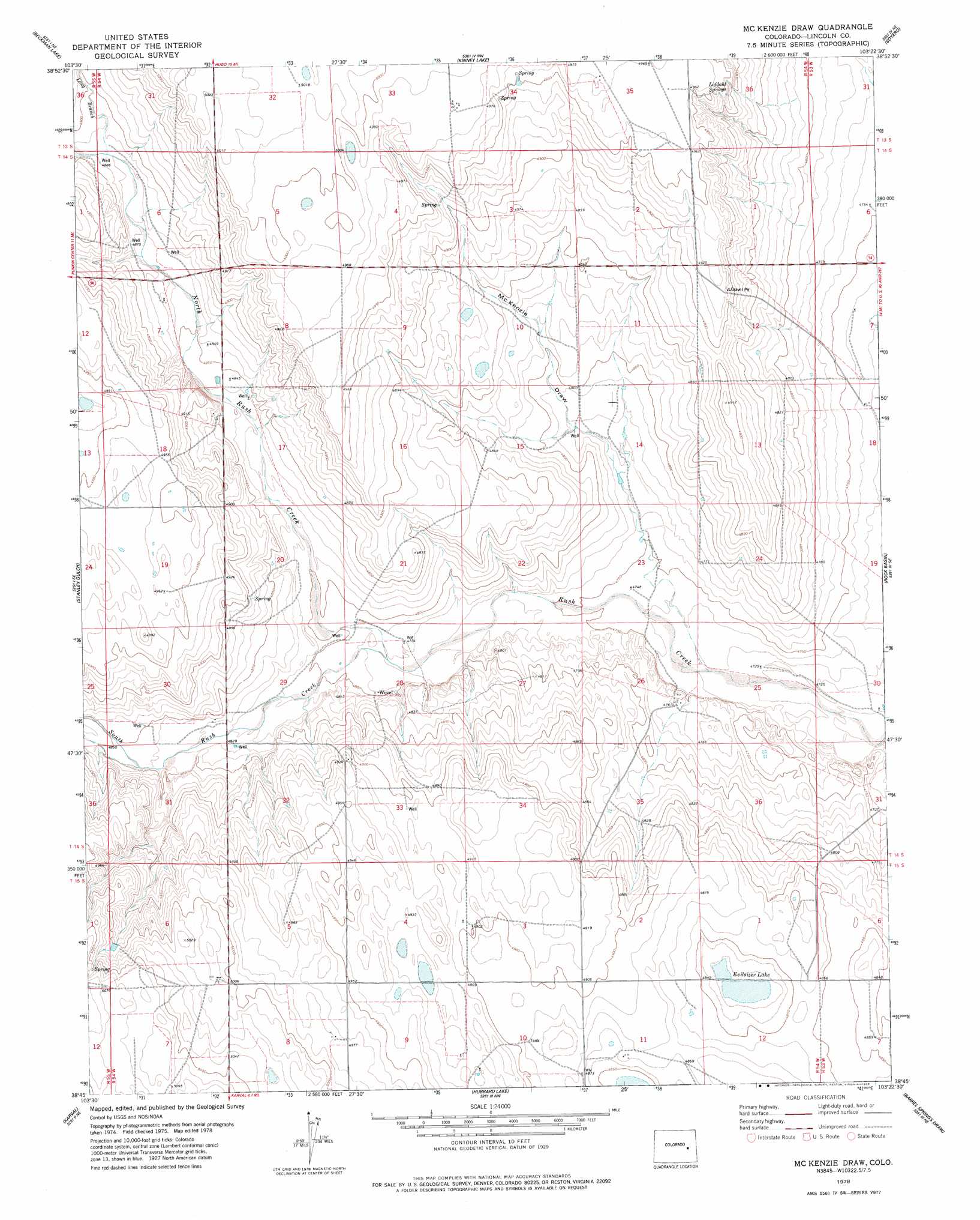
Mckenzie Draw Topo Map Colorado
To zoom in, hover over the map of Mckenzie Draw
USGS Topo Quad 38103g4 - 1:24,000 scale
| Topo Map Name: | Mckenzie Draw |
| USGS Topo Quad ID: | 38103g4 |
| Print Size: | ca. 21 1/4" wide x 27" high |
| Southeast Coordinates: | 38.75° N latitude / 103.375° W longitude |
| Map Center Coordinates: | 38.8125° N latitude / 103.4375° W longitude |
| U.S. State: | CO |
| Filename: | o38103g4.jpg |
| Download Map JPG Image: | Mckenzie Draw topo map 1:24,000 scale |
| Map Type: | Topographic |
| Topo Series: | 7.5´ |
| Map Scale: | 1:24,000 |
| Source of Map Images: | United States Geological Survey (USGS) |
| Alternate Map Versions: |
Mc Kenzie Draw CO 1978, updated 1978 Download PDF Buy paper map McKenzie Draw CO 2010 Download PDF Buy paper map McKenzie Draw CO 2013 Download PDF Buy paper map McKenzie Draw CO 2016 Download PDF Buy paper map |
1:24,000 Topo Quads surrounding Mckenzie Draw
Long Creek |
Lake Se |
Hugo Sw |
Clifford |
Bledsoe Ranch |
Punkin Center Nw |
Beckman Lake |
Kinney Lake |
Boyero |
Schafer Reservoir |
Punkin Center |
Stanley Gulch |
Mckenzie Draw |
Rock Basin |
Aroya |
Forder |
Karval |
Hubbard Lake |
Barrel Springs Draw |
Stacy Lakes Draw |
Sharp Lake |
Metz Springs |
Scott Draw |
Bluff Spring |
Galatea Sw |
> Back to 38103e1 at 1:100,000 scale
> Back to 38102a1 at 1:250,000 scale
> Back to U.S. Topo Maps home
Mckenzie Draw topo map: Gazetteer
Mckenzie Draw: Populated Places
Wezel (historical) elevation 1462m 4796′Mckenzie Draw: Reservoirs
Evilsizer Lake elevation 1472m 4829′Mckenzie Draw: Streams
Long Branch elevation 1490m 4888′North Rush Creek elevation 1458m 4783′
South Rush Creek elevation 1458m 4783′
Mckenzie Draw: Valleys
McKenzie Draw elevation 1441m 4727′Mckenzie Draw digital topo map on disk
Buy this Mckenzie Draw topo map showing relief, roads, GPS coordinates and other geographical features, as a high-resolution digital map file on DVD: