Flying A Ranch Topo Map Colorado
To zoom in, hover over the map of Flying A Ranch
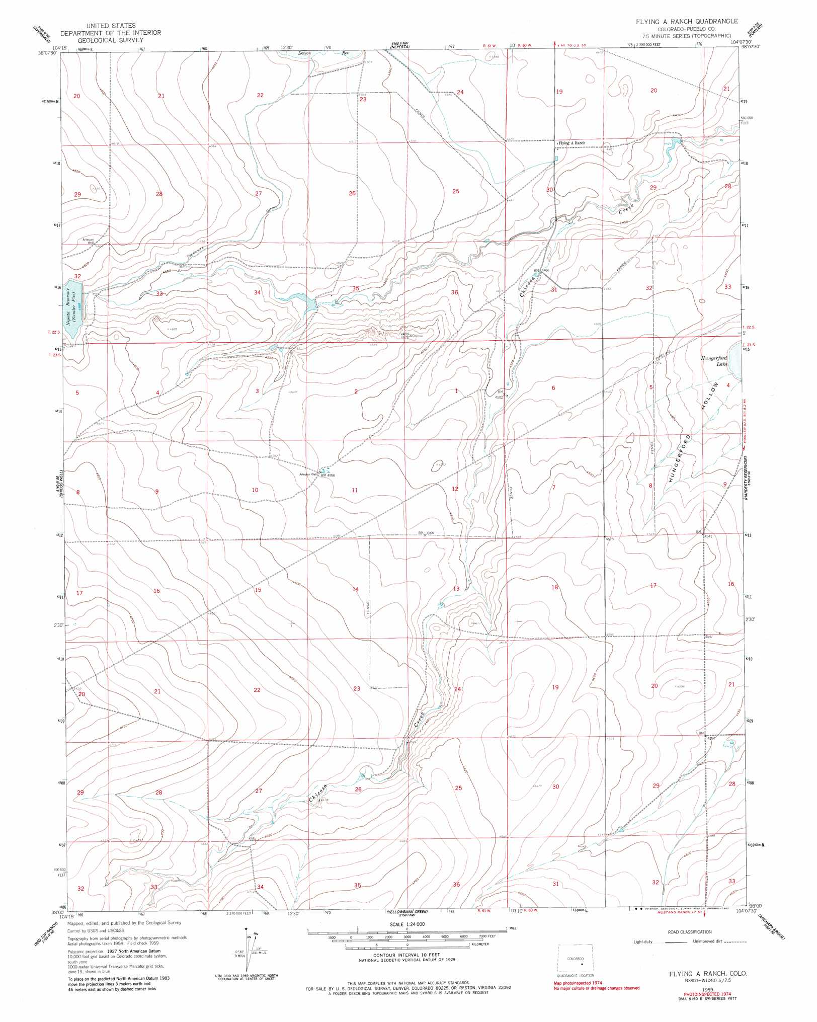
USGS Topo Quad 38104a2 - 1:24,000 scale
| Topo Map Name: | Flying A Ranch |
| USGS Topo Quad ID: | 38104a2 |
| Print Size: | ca. 21 1/4" wide x 27" high |
| Southeast Coordinates: | 38° N latitude / 104.125° W longitude |
| Map Center Coordinates: | 38.0625° N latitude / 104.1875° W longitude |
| U.S. State: | CO |
| Filename: | o38104a2.jpg |
| Download Map JPG Image: | Flying A Ranch topo map 1:24,000 scale |
| Map Type: | Topographic |
| Topo Series: | 7.5´ |
| Map Scale: | 1:24,000 |
| Source of Map Images: | United States Geological Survey (USGS) |
| Alternate Map Versions: |
Flying A Ranch CO 1959, updated 1960 Download PDF Buy paper map Flying A Ranch CO 1959, updated 1983 Download PDF Buy paper map Flying A Ranch CO 2010 Download PDF Buy paper map Flying A Ranch CO 2013 Download PDF Buy paper map Flying A Ranch CO 2016 Download PDF Buy paper map |
1:24,000 Topo Quads surrounding Flying A Ranch
Devine |
North Avondale |
Boone Hill |
Grandview School Se |
Antelope Mesa |
Vineland |
Avondale |
Nepesta |
Fowler |
Olney Springs |
Doyle Bridge |
Chicos Well |
Flying A Ranch |
Hardesty Reservoir |
Elder |
Hog Ranch Canyon |
Red Top Ranch |
Yellowbank Creek |
Apishapa Bridge |
Timpas Nw |
North Rattlesnake Butte |
Myers Canyon |
Sanford Hills |
Snowden Lake |
Timpas Sw |
> Back to 38104a1 at 1:100,000 scale
> Back to 38104a1 at 1:250,000 scale
> Back to U.S. Topo Maps home
Flying A Ranch topo map: Gazetteer
Flying A Ranch: Canals
Nepesta Ditch elevation 1382m 4534′Flying A Ranch: Reservoirs
Nepesta Reservoir Number 5 elevation 1398m 4586′Flying A Ranch: Streams
North Chicosa Creek elevation 1354m 4442′South Chicosa Creek elevation 1421m 4662′
Flying A Ranch: Valleys
Hardesty Draw elevation 1388m 4553′Flying A Ranch digital topo map on disk
Buy this Flying A Ranch topo map showing relief, roads, GPS coordinates and other geographical features, as a high-resolution digital map file on DVD: