Verde School Topo Map Colorado
To zoom in, hover over the map of Verde School
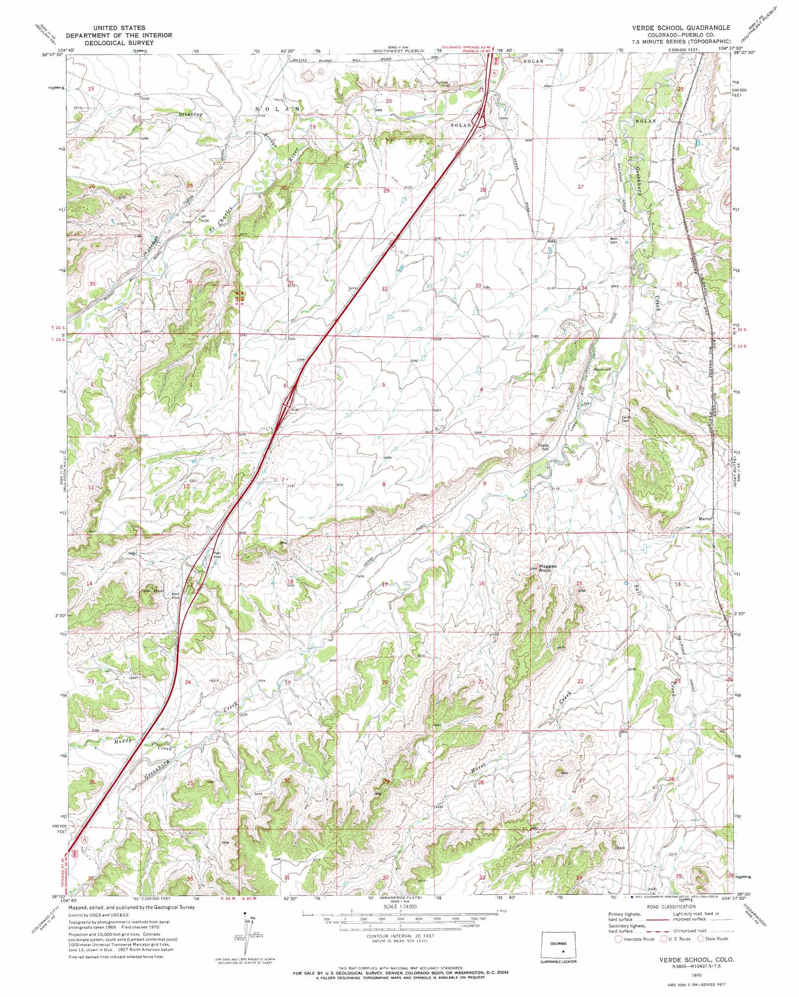
USGS Topo Quad 38104a6 - 1:24,000 scale
| Topo Map Name: | Verde School |
| USGS Topo Quad ID: | 38104a6 |
| Print Size: | ca. 21 1/4" wide x 27" high |
| Southeast Coordinates: | 38° N latitude / 104.625° W longitude |
| Map Center Coordinates: | 38.0625° N latitude / 104.6875° W longitude |
| U.S. State: | CO |
| Filename: | o38104a6.jpg |
| Download Map JPG Image: | Verde School topo map 1:24,000 scale |
| Map Type: | Topographic |
| Topo Series: | 7.5´ |
| Map Scale: | 1:24,000 |
| Source of Map Images: | United States Geological Survey (USGS) |
| Alternate Map Versions: |
Verde School CO 1970, updated 1973 Download PDF Buy paper map Verde School CO 2010 Download PDF Buy paper map Verde School CO 2013 Download PDF Buy paper map Verde School CO 2016 Download PDF Buy paper map |
1:24,000 Topo Quads surrounding Verde School
Hobson |
Swallows |
Northwest Pueblo |
Northeast Pueblo |
Devine |
Owl Canyon |
Beulah Ne |
Southwest Pueblo |
Southeast Pueblo |
Vineland |
Beulah |
Muldoon Hill |
Verde School |
Goat Butte |
Doyle Bridge |
Rye |
Colorado City |
Graneros Flats |
Cedarwood |
Hog Ranch Canyon |
Hayden Butte |
Huerfano Butte |
Lascar |
Capps Springs |
North Rattlesnake Butte |
> Back to 38104a1 at 1:100,000 scale
> Back to 38104a1 at 1:250,000 scale
> Back to U.S. Topo Maps home
Verde School topo map: Gazetteer
Verde School: Canals
Lamb and Smith Ditch elevation 1548m 5078′Saint Charles Flood Ditch elevation 1580m 5183′
Verde School: Streams
Horse Creek elevation 1573m 5160′Muddy Creek elevation 1610m 5282′
Verde School: Summits
Maggies Knob elevation 1634m 5360′Verde School digital topo map on disk
Buy this Verde School topo map showing relief, roads, GPS coordinates and other geographical features, as a high-resolution digital map file on DVD: