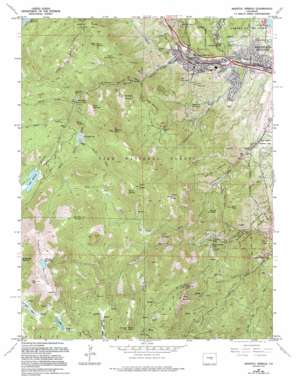
Manitou Springs Topo Map Colorado
To zoom in, hover over the map of Manitou Springs
USGS Topo Quad 38104g8 - 1:24,000 scale
| Topo Map Name: | Manitou Springs |
| USGS Topo Quad ID: | 38104g8 |
| Print Size: | ca. 21 1/4" wide x 27" high |
| Southeast Coordinates: | 38.75° N latitude / 104.875° W longitude |
| Map Center Coordinates: | 38.8125° N latitude / 104.9375° W longitude |
| U.S. State: | CO |
| Filename: | o38104g8.jpg |
| Download Map JPG Image: | Manitou Springs topo map 1:24,000 scale |
| Map Type: | Topographic |
| Topo Series: | 7.5´ |
| Map Scale: | 1:24,000 |
| Source of Map Images: | United States Geological Survey (USGS) |
| Alternate Map Versions: |
Manitou Springs CO 1948, updated 1956 Download PDF Buy paper map Manitou Springs CO 1948, updated 1956 Download PDF Buy paper map Manitou CO 1950 Download PDF Buy paper map Manitou Springs CO 1961, updated 1963 Download PDF Buy paper map Manitou Springs CO 1961, updated 1966 Download PDF Buy paper map Manitou Springs CO 1961, updated 1966 Download PDF Buy paper map Manitou Springs CO 1961, updated 1970 Download PDF Buy paper map Manitou Springs CO 1961, updated 1970 Download PDF Buy paper map Manitou Springs CO 1961, updated 1974 Download PDF Buy paper map Manitou Springs CO 1961, updated 1977 Download PDF Buy paper map Manitou Springs CO 1961, updated 1977 Download PDF Buy paper map Manitou Springs CO 1961, updated 1994 Download PDF Buy paper map Manitou Springs CO 1961, updated 1994 Download PDF Buy paper map Manitou Springs CO 1961, updated 1994 Download PDF Buy paper map Manitou Springs CO 1994, updated 2001 Download PDF Buy paper map Manitou Springs CO 2011 Download PDF Buy paper map Manitou Springs CO 2013 Download PDF Buy paper map Manitou Springs CO 2016 Download PDF Buy paper map |
| FStopo: | US Forest Service topo Manitou Springs is available: Download FStopo PDF Download FStopo TIF |
1:24,000 Topo Quads surrounding Manitou Springs
> Back to 38104e1 at 1:100,000 scale
> Back to 38104a1 at 1:250,000 scale
> Back to U.S. Topo Maps home
Manitou Springs topo map: Gazetteer
Manitou Springs: Arches
Pigs Eye elevation 1963m 6440′Siamese Twins elevation 1964m 6443′
Manitou Springs: Cliffs
Point Sublime elevation 2140m 7020′Manitou Springs: Dams
Big Tooth Reservoir Dam elevation 2913m 9557′Lake Moraine Dam elevation 3113m 10213′
Mount Baldy Dam elevation 3614m 11856′
Manitou Springs: Falls
Helen Hunt Falls elevation 2206m 7237′Rainbow Falls elevation 2019m 6624′
Saint Marys Falls elevation 2723m 8933′
Seven Falls elevation 2101m 6893′
Silver Cascade Falls elevation 2313m 7588′
Manitou Springs: Flats
Butterworth Flat elevation 2388m 7834′Crystal Park elevation 2553m 8375′
Deer Park elevation 3387m 11112′
Frosty Park elevation 3111m 10206′
Jones Park elevation 2782m 9127′
Manitou Springs: Mines
Bock Pit elevation 1873m 6145′Dorothy O Claim elevation 2542m 8339′
Duffields Mine elevation 2601m 8533′
Eureka Tunnel Mine elevation 2545m 8349′
Saint Peters Dome Pegmatite Prospect elevation 2683m 8802′
Stove Mountain Claims elevation 2759m 9051′
Wheeler Pit elevation 2036m 6679′
Manitou Springs: Parks
Garden of the Gods elevation 1914m 6279′High Park elevation 3476m 11404′
North Cheyenne Park elevation 2279m 7477′
Ruxton Park elevation 2767m 9078′
Manitou Springs: Pillars
Balanced Rock elevation 1934m 6345′Gog Rock elevation 2674m 8772′
Grandview Rock elevation 2857m 9373′
Magog Rock elevation 2663m 8736′
Ship Rock elevation 1940m 6364′
Tenney Crags elevation 3076m 10091′
Manitou Springs: Populated Places
Green Settlement elevation 2178m 7145′Manitou Springs elevation 1938m 6358′
Midway elevation 2743m 8999′
Minnehaha elevation 2544m 8346′
Old Mountain View (historical) elevation 2937m 9635′
Manitou Springs: Post Offices
Manitou Springs Post Office elevation 1939m 6361′Manitou Springs: Reservoirs
Big Tooth Reservoir elevation 2860m 9383′Lake Moraine elevation 3113m 10213′
Mount Baldy Reservoir elevation 3614m 11856′
Stratton Reservoir elevation 3614m 11856′
Manitou Springs: Streams
Cabin Creek elevation 2654m 8707′Hunters Run elevation 2045m 6709′
Lion Creek elevation 2819m 9248′
North Fork French Creek elevation 2588m 8490′
Ruxton Creek elevation 1932m 6338′
Seep Creek elevation 2883m 9458′
Sheep Creek elevation 2739m 8986′
South Fork French Creek elevation 2591m 8500′
South Ruxton Creek elevation 2707m 8881′
Sutherland Creek elevation 1891m 6204′
Sweetwater Creek elevation 2153m 7063′
Willow Creek elevation 2863m 9393′
Manitou Springs: Summits
Almagre Mountain elevation 3768m 12362′Cameron Cone elevation 3263m 10705′
Eagle Mountain elevation 2750m 9022′
Iron Mountain elevation 2175m 7135′
Kineo Mountain elevation 2882m 9455′
Marys Mountain elevation 3004m 9855′
Mays Peak elevation 2525m 8284′
Mount Arthur elevation 3293m 10803′
Mount Buckhorn elevation 2548m 8359′
Mount Cutler elevation 2200m 7217′
Mount Garfield elevation 3327m 10915′
Mount Manitou elevation 2877m 9438′
Mount Rosa elevation 3507m 11505′
Red Mountain elevation 2248m 7375′
Rocky Mountain elevation 2816m 9238′
Sheep Mountain elevation 2988m 9803′
Stove Mountain elevation 2984m 9790′
Sugarloaf Mountain elevation 2315m 7595′
Manitou Springs: Trails
Indian Trail elevation 2157m 7076′Palmer Trail elevation 2378m 7801′
Penrose Trail elevation 2310m 7578′
Manitou Springs: Valleys
Artists Glen elevation 2441m 8008′Bear Canyon elevation 2011m 6597′
Black Canyon elevation 1900m 6233′
Buffalo Canyon elevation 2209m 7247′
Cavern Gulch elevation 2031m 6663′
Dark Canyon elevation 2712m 8897′
Englemann Canyon elevation 1973m 6473′
Gardiner Gulch elevation 2085m 6840′
Williams Canyon elevation 1943m 6374′
Manitou Springs digital topo map on disk
Buy this Manitou Springs topo map showing relief, roads, GPS coordinates and other geographical features, as a high-resolution digital map file on DVD:


