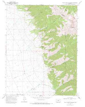
Valley View Hot Springs Topo Map Colorado
To zoom in, hover over the map of Valley View Hot Springs
USGS Topo Quad 38105b7 - 1:24,000 scale
| Topo Map Name: | Valley View Hot Springs |
| USGS Topo Quad ID: | 38105b7 |
| Print Size: | ca. 21 1/4" wide x 27" high |
| Southeast Coordinates: | 38.125° N latitude / 105.75° W longitude |
| Map Center Coordinates: | 38.1875° N latitude / 105.8125° W longitude |
| U.S. State: | CO |
| Filename: | o38105b7.jpg |
| Download Map JPG Image: | Valley View Hot Springs topo map 1:24,000 scale |
| Map Type: | Topographic |
| Topo Series: | 7.5´ |
| Map Scale: | 1:24,000 |
| Source of Map Images: | United States Geological Survey (USGS) |
| Alternate Map Versions: |
Valley View Hot Springs CO 1950, updated 1970 Download PDF Buy paper map Valley View Hot Springs CO 1967, updated 1971 Download PDF Buy paper map Valley View Hot Springs CO 1967, updated 1971 Download PDF Buy paper map Valley View Hot Springs CO 2001, updated 2005 Download PDF Buy paper map Valley View Hot Springs CO 2011 Download PDF Buy paper map Valley View Hot Springs CO 2013 Download PDF Buy paper map Valley View Hot Springs CO 2016 Download PDF Buy paper map |
| FStopo: | US Forest Service topo Valley View Hot Springs is available: Download FStopo PDF Download FStopo TIF |
1:24,000 Topo Quads surrounding Valley View Hot Springs
> Back to 38105a1 at 1:100,000 scale
> Back to 38104a1 at 1:250,000 scale
> Back to U.S. Topo Maps home
Valley View Hot Springs topo map: Gazetteer
Valley View Hot Springs: Canals
Cotton Creek Ditch elevation 2469m 8100′Valley View Hot Springs: Mines
Anna Lee Mine elevation 3875m 12713′Faith Mine elevation 2995m 9826′
Millie Luna Mine elevation 2995m 9826′
Old Bennet Mine elevation 2939m 9642′
Orient Mine elevation 2951m 9681′
Sylvia Mine elevation 2995m 9826′
Valley View Hot Springs: Streams
Cotton Creek elevation 2396m 7860′Garner Creek elevation 2364m 7755′
Major Creek elevation 2504m 8215′
Valley View Hot Springs: Summits
Cottonwood Peak elevation 4144m 13595′Valley View Hot Springs: Valleys
Aspen Gulch elevation 3007m 9865′Black Canyon elevation 2678m 8786′
Hot Springs Canyon elevation 2632m 8635′
Lime Canyon elevation 2742m 8996′
Orient Canyon elevation 2720m 8923′
Steel Canyon elevation 2686m 8812′
Valley View Hot Springs digital topo map on disk
Buy this Valley View Hot Springs topo map showing relief, roads, GPS coordinates and other geographical features, as a high-resolution digital map file on DVD:


