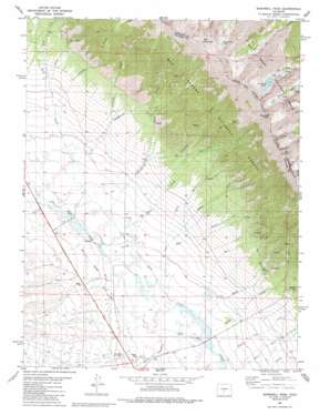
Bushnell Peak Topo Map Colorado
To zoom in, hover over the map of Bushnell Peak
USGS Topo Quad 38105c8 - 1:24,000 scale
| Topo Map Name: | Bushnell Peak |
| USGS Topo Quad ID: | 38105c8 |
| Print Size: | ca. 21 1/4" wide x 27" high |
| Southeast Coordinates: | 38.25° N latitude / 105.875° W longitude |
| Map Center Coordinates: | 38.3125° N latitude / 105.9375° W longitude |
| U.S. State: | CO |
| Filename: | o38105c8.jpg |
| Download Map JPG Image: | Bushnell Peak topo map 1:24,000 scale |
| Map Type: | Topographic |
| Topo Series: | 7.5´ |
| Map Scale: | 1:24,000 |
| Source of Map Images: | United States Geological Survey (USGS) |
| Alternate Map Versions: |
Bushnell Peak CO 1981, updated 1981 Download PDF Buy paper map Bushnell Peak CO 1981, updated 1986 Download PDF Buy paper map Bushnell Peak CO 2001, updated 2005 Download PDF Buy paper map Bushnell Peak CO 2011 Download PDF Buy paper map Bushnell Peak CO 2013 Download PDF Buy paper map Bushnell Peak CO 2016 Download PDF Buy paper map |
| FStopo: | US Forest Service topo Bushnell Peak is available: Download FStopo PDF Download FStopo TIF |
1:24,000 Topo Quads surrounding Bushnell Peak
> Back to 38105a1 at 1:100,000 scale
> Back to 38104a1 at 1:250,000 scale
> Back to U.S. Topo Maps home
Bushnell Peak topo map: Gazetteer
Bushnell Peak: Lakes
Bushnell Lakes elevation 3519m 11545′West Creek Lake elevation 3557m 11669′
Bushnell Peak: Springs
Hayden Spring elevation 2680m 8792′Oak Springs elevation 2640m 8661′
Bushnell Peak: Streams
Bolton Creek elevation 2598m 8523′Brook Creek elevation 2429m 7969′
Butterfly Creek elevation 2543m 8343′
Cook Creek elevation 2418m 7933′
Ferguson Creek elevation 2568m 8425′
Hayden Pass Creek elevation 2400m 7874′
Kerber Creek elevation 2410m 7906′
Little Red Creek elevation 3125m 10252′
Miller Creek elevation 2450m 8038′
Nieland Creek elevation 2523m 8277′
North Rock Creek elevation 2724m 8937′
Peterson Creek elevation 2457m 8061′
Raspberry Creek elevation 2439m 8001′
Red Creek elevation 2949m 9675′
Rock Creek elevation 2401m 7877′
South Rock Creek elevation 2724m 8937′
Yankee Creek elevation 2592m 8503′
Bushnell Peak: Summits
Bushnell Peak elevation 3993m 13100′Mount Otto elevation 3888m 12755′
Red Mountain elevation 3956m 12979′
Twin Sisters elevation 3867m 12687′
Bushnell Peak: Valleys
Carr Gulch elevation 2449m 8034′Eaglebrook Gulch elevation 2487m 8159′
Euclid Gulch elevation 2413m 7916′
Jack Gulch elevation 2467m 8093′
Richie Gulch elevation 2736m 8976′
Bushnell Peak digital topo map on disk
Buy this Bushnell Peak topo map showing relief, roads, GPS coordinates and other geographical features, as a high-resolution digital map file on DVD:


