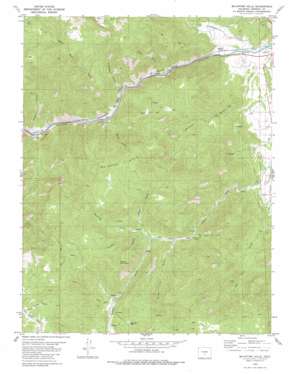
Mcintyre Hills Topo Map Colorado
To zoom in, hover over the map of Mcintyre Hills
USGS Topo Quad 38105d4 - 1:24,000 scale
| Topo Map Name: | Mcintyre Hills |
| USGS Topo Quad ID: | 38105d4 |
| Print Size: | ca. 21 1/4" wide x 27" high |
| Southeast Coordinates: | 38.375° N latitude / 105.375° W longitude |
| Map Center Coordinates: | 38.4375° N latitude / 105.4375° W longitude |
| U.S. State: | CO |
| Filename: | o38105d4.jpg |
| Download Map JPG Image: | Mcintyre Hills topo map 1:24,000 scale |
| Map Type: | Topographic |
| Topo Series: | 7.5´ |
| Map Scale: | 1:24,000 |
| Source of Map Images: | United States Geological Survey (USGS) |
| Alternate Map Versions: |
Mc Intyre Hills CO 1980, updated 1981 Download PDF Buy paper map Mc Intyre Hills CO 1980, updated 1981 Download PDF Buy paper map McIntyre Hills CO 2010 Download PDF Buy paper map McIntyre Hills CO 2013 Download PDF Buy paper map McIntyre Hills CO 2016 Download PDF Buy paper map |
1:24,000 Topo Quads surrounding Mcintyre Hills
> Back to 38105a1 at 1:100,000 scale
> Back to 38104a1 at 1:250,000 scale
> Back to U.S. Topo Maps home
Mcintyre Hills topo map: Gazetteer
Mcintyre Hills: Basins
Little Hole elevation 2148m 7047′Sheep Basin elevation 1867m 6125′
Mcintyre Hills: Dams
Harvey-Murry Dam elevation 1861m 6105′Mcintyre Hills: Flats
Goat Park elevation 2456m 8057′Mcintyre Hills: Mines
McIntyre Mine elevation 1855m 6085′Spikebuck Mine elevation 2070m 6791′
Sunset Mine elevation 2127m 6978′
Mcintyre Hills: Populated Places
Fink elevation 1757m 5764′Sunset City elevation 2059m 6755′
Mcintyre Hills: Reservoirs
Harvey-Murry Reservoir elevation 1861m 6105′Mcintyre Hills: Streams
Currant Creek elevation 1777m 5830′Tallahassee Creek elevation 1755m 5757′
Mcintyre Hills: Summits
McIntyre Hills elevation 2458m 8064′Poverty Mountain elevation 2518m 8261′
Mcintyre Hills: Valleys
Arkansas River Canyon elevation 1762m 5780′Baker Gulch elevation 1803m 5915′
Bootlegger Gulch elevation 1792m 5879′
Cedar Gulch elevation 1772m 5813′
Copper Gulch elevation 1906m 6253′
East Sunset City Gulch elevation 2041m 6696′
Poverty Gulch elevation 2138m 7014′
Smith Gulch elevation 2138m 7014′
Spike Buck Gulch elevation 1815m 5954′
Sulphur Gulch elevation 1836m 6023′
Sunset City Gulch elevation 2081m 6827′
Surrey Gulch elevation 2204m 7230′
Washtub Gulch elevation 2108m 6916′
Mcintyre Hills digital topo map on disk
Buy this Mcintyre Hills topo map showing relief, roads, GPS coordinates and other geographical features, as a high-resolution digital map file on DVD:


