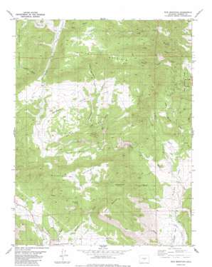
Rice Mountain Topo Map Colorado
To zoom in, hover over the map of Rice Mountain
USGS Topo Quad 38105e3 - 1:24,000 scale
| Topo Map Name: | Rice Mountain |
| USGS Topo Quad ID: | 38105e3 |
| Print Size: | ca. 21 1/4" wide x 27" high |
| Southeast Coordinates: | 38.5° N latitude / 105.25° W longitude |
| Map Center Coordinates: | 38.5625° N latitude / 105.3125° W longitude |
| U.S. State: | CO |
| Filename: | o38105e3.jpg |
| Download Map JPG Image: | Rice Mountain topo map 1:24,000 scale |
| Map Type: | Topographic |
| Topo Series: | 7.5´ |
| Map Scale: | 1:24,000 |
| Source of Map Images: | United States Geological Survey (USGS) |
| Alternate Map Versions: |
Rice Mountain CO 1983, updated 1983 Download PDF Buy paper map Rice Mountain CO 1983, updated 1991 Download PDF Buy paper map Rice Mountain CO 2010 Download PDF Buy paper map Rice Mountain CO 2013 Download PDF Buy paper map Rice Mountain CO 2016 Download PDF Buy paper map |
1:24,000 Topo Quads surrounding Rice Mountain
> Back to 38105e1 at 1:100,000 scale
> Back to 38104a1 at 1:250,000 scale
> Back to U.S. Topo Maps home
Rice Mountain topo map: Gazetteer
Rice Mountain: Dams
Little Johnny Dam elevation 1936m 6351′Rice Mountain: Flats
Red Rock Park elevation 1986m 6515′Shaws Park elevation 1873m 6145′
Webster Park elevation 2220m 7283′
Rice Mountain: Mines
Chicken Claim elevation 2152m 7060′Hoppy Claim elevation 2152m 7060′
Red Cliff Thirty Mine elevation 2002m 6568′
Rice Mountain: Reservoirs
Little Johnny Reservoir elevation 1936m 6351′Rice Mountain: Ridges
Blue Ridge elevation 2223m 7293′Rice Mountain: Springs
Bumback Spring elevation 1899m 6230′Red Rocks Spring elevation 2207m 7240′
Rice Mountain: Summits
Rice Mountain elevation 2612m 8569′Twin Mountain elevation 2395m 7857′
Rice Mountain: Valleys
Bear Gulch elevation 2364m 7755′Big Spoon Gulch elevation 2050m 6725′
Cedar Gulch elevation 2014m 6607′
Gooseberry Gulch elevation 2088m 6850′
Middle Gooseberry Gulch elevation 2213m 7260′
Mikesell Gulch elevation 1908m 6259′
Rice Gulch elevation 2342m 7683′
Seep Springs Draw elevation 1876m 6154′
Thompson Gulch elevation 2266m 7434′
Twin Gulch elevation 1802m 5912′
Washington Gulch elevation 1827m 5994′
Rice Mountain digital topo map on disk
Buy this Rice Mountain topo map showing relief, roads, GPS coordinates and other geographical features, as a high-resolution digital map file on DVD:


