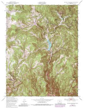
Big Bull Mountain Topo Map Colorado
To zoom in, hover over the map of Big Bull Mountain
USGS Topo Quad 38105f1 - 1:24,000 scale
| Topo Map Name: | Big Bull Mountain |
| USGS Topo Quad ID: | 38105f1 |
| Print Size: | ca. 21 1/4" wide x 27" high |
| Southeast Coordinates: | 38.625° N latitude / 105° W longitude |
| Map Center Coordinates: | 38.6875° N latitude / 105.0625° W longitude |
| U.S. State: | CO |
| Filename: | o38105f1.jpg |
| Download Map JPG Image: | Big Bull Mountain topo map 1:24,000 scale |
| Map Type: | Topographic |
| Topo Series: | 7.5´ |
| Map Scale: | 1:24,000 |
| Source of Map Images: | United States Geological Survey (USGS) |
| Alternate Map Versions: |
Big Bull Mountain CO 1951, updated 1954 Download PDF Buy paper map Big Bull Mountain CO 1951, updated 1954 Download PDF Buy paper map Big Bull Mountain CO 1951, updated 1970 Download PDF Buy paper map Big Bull Mountain CO 1951, updated 1970 Download PDF Buy paper map Big Bull Mountain CO 1951, updated 1978 Download PDF Buy paper map Big Bull Mountain CO 1951, updated 1978 Download PDF Buy paper map Big Bull Mountain CO 1951, updated 1985 Download PDF Buy paper map Big Bull Mountain CO 1951, updated 1988 Download PDF Buy paper map Big Bull Mountain CO 1994, updated 1998 Download PDF Buy paper map Big Bull Mountain CO 2011 Download PDF Buy paper map Big Bull Mountain CO 2013 Download PDF Buy paper map Big Bull Mountain CO 2016 Download PDF Buy paper map |
| FStopo: | US Forest Service topo Big Bull Mountain is available: Download FStopo PDF Download FStopo TIF |
1:24,000 Topo Quads surrounding Big Bull Mountain
> Back to 38105e1 at 1:100,000 scale
> Back to 38104a1 at 1:250,000 scale
> Back to U.S. Topo Maps home
Big Bull Mountain topo map: Gazetteer
Big Bull Mountain: Dams
Pringtime Dam elevation 2806m 9206′Skaguay Dam elevation 2715m 8907′
Big Bull Mountain: Mines
Brown Mine elevation 3054m 10019′Gold Knob Mine elevation 3038m 9967′
Homestake Mine elevation 3113m 10213′
Little May Mine elevation 3231m 10600′
North Cascade Mine elevation 3131m 10272′
Triumph Mine elevation 3224m 10577′
Victor Mine elevation 3222m 10570′
Big Bull Mountain: Parks
Beaver Creek State Wildlife Area elevation 2660m 8727′Cathedral Park elevation 2978m 9770′
Lower Beaver Park elevation 2727m 8946′
Big Bull Mountain: Reservoirs
Pringtime Reservoir elevation 2806m 9206′Skaguay Reservoir elevation 2715m 8907′
Skagway Reservoir elevation 2709m 8887′
Big Bull Mountain: Streams
Bison Creek elevation 2830m 9284′Grassy Creek elevation 2918m 9573′
Middle Beaver Creek elevation 2738m 8982′
Middle Cottonwood Creek elevation 2944m 9658′
Willow Creek elevation 2807m 9209′
Big Bull Mountain: Summits
Big Bull Mountain elevation 3303m 10836′Brind Mountain elevation 3196m 10485′
Crown Point elevation 3023m 9917′
Nipple Mountain elevation 3022m 9914′
Big Bull Mountain: Valleys
Douglas Gulch elevation 2678m 8786′Big Bull Mountain digital topo map on disk
Buy this Big Bull Mountain topo map showing relief, roads, GPS coordinates and other geographical features, as a high-resolution digital map file on DVD:


