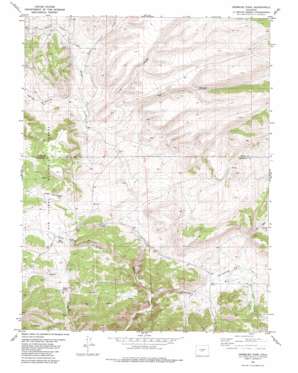
Gribbles Park Topo Map Colorado
To zoom in, hover over the map of Gribbles Park
USGS Topo Quad 38105f7 - 1:24,000 scale
| Topo Map Name: | Gribbles Park |
| USGS Topo Quad ID: | 38105f7 |
| Print Size: | ca. 21 1/4" wide x 27" high |
| Southeast Coordinates: | 38.625° N latitude / 105.75° W longitude |
| Map Center Coordinates: | 38.6875° N latitude / 105.8125° W longitude |
| U.S. State: | CO |
| Filename: | o38105f7.jpg |
| Download Map JPG Image: | Gribbles Park topo map 1:24,000 scale |
| Map Type: | Topographic |
| Topo Series: | 7.5´ |
| Map Scale: | 1:24,000 |
| Source of Map Images: | United States Geological Survey (USGS) |
| Alternate Map Versions: |
Gribbles Park CO 1983, updated 1983 Download PDF Buy paper map Gribbles Park CO 1983, updated 1983 Download PDF Buy paper map Gribbles Park CO 1994, updated 1998 Download PDF Buy paper map Gribbles Park CO 2011 Download PDF Buy paper map Gribbles Park CO 2013 Download PDF Buy paper map Gribbles Park CO 2016 Download PDF Buy paper map |
| FStopo: | US Forest Service topo Gribbles Park is available: Download FStopo PDF Download FStopo TIF |
1:24,000 Topo Quads surrounding Gribbles Park
> Back to 38105e1 at 1:100,000 scale
> Back to 38104a1 at 1:250,000 scale
> Back to U.S. Topo Maps home
Gribbles Park topo map: Gazetteer
Gribbles Park: Flats
Gribbles Park elevation 2713m 8900′Gribbles Park: Springs
Mud Spring elevation 2797m 9176′Suckerville Spring elevation 2774m 9101′
Gribbles Park: Streams
Gribbles Run elevation 2614m 8576′Herring Creek elevation 2738m 8982′
Rock Creek elevation 2732m 8963′
Running Creek elevation 2720m 8923′
Rye Slough elevation 2722m 8930′
Steer Creek elevation 2636m 8648′
Wagon Tongue Creek elevation 2756m 9041′
Gribbles Park: Trails
Ute Trail elevation 2816m 9238′Gribbles Park: Valleys
Antelope Gulch elevation 2696m 8845′Bull Gulch elevation 2739m 8986′
Cals Fork Gulch elevation 2768m 9081′
Long Gulch elevation 2743m 8999′
Gribbles Park digital topo map on disk
Buy this Gribbles Park topo map showing relief, roads, GPS coordinates and other geographical features, as a high-resolution digital map file on DVD:


