Saguache Park Topo Map Colorado
To zoom in, hover over the map of Saguache Park
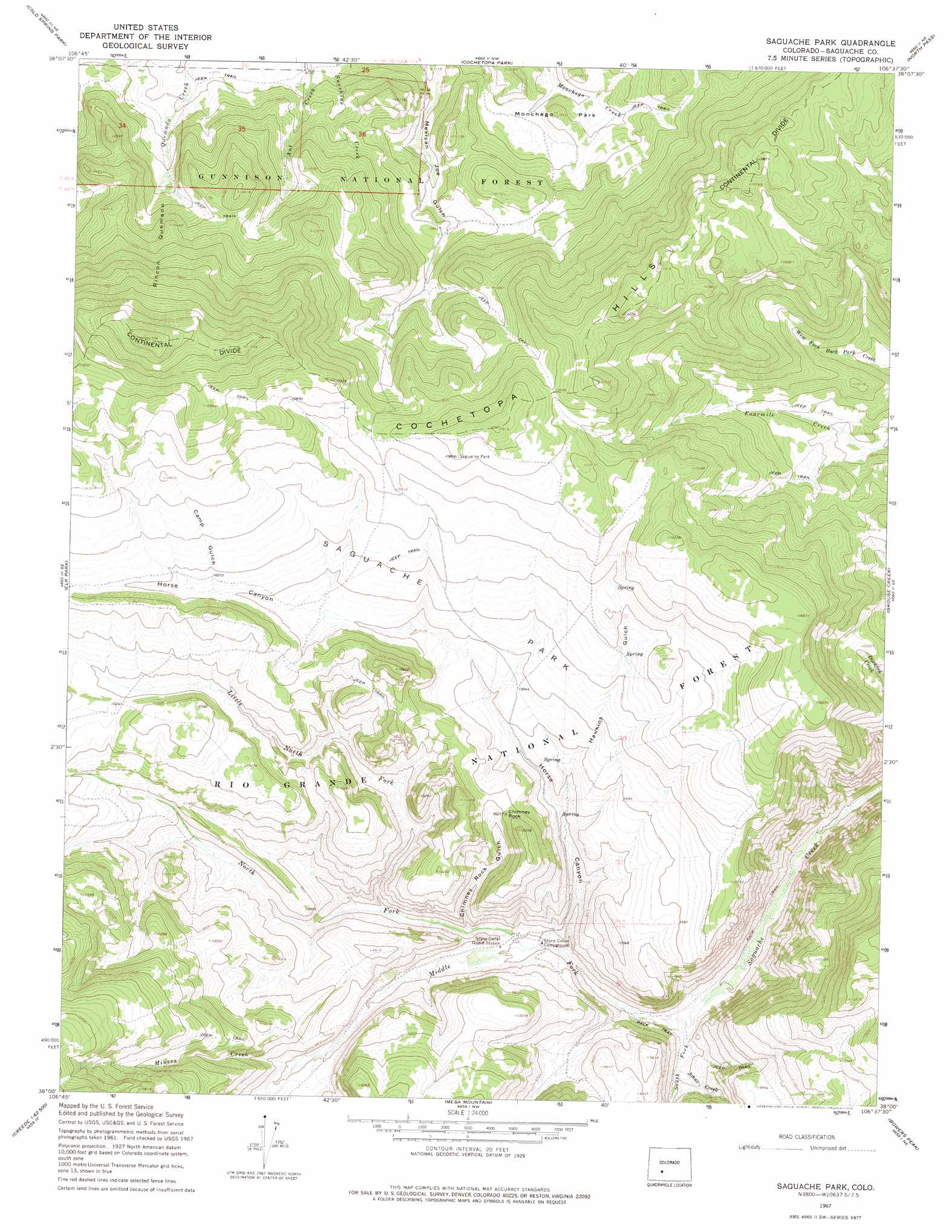
USGS Topo Quad 38106a6 - 1:24,000 scale
| Topo Map Name: | Saguache Park |
| USGS Topo Quad ID: | 38106a6 |
| Print Size: | ca. 21 1/4" wide x 27" high |
| Southeast Coordinates: | 38° N latitude / 106.625° W longitude |
| Map Center Coordinates: | 38.0625° N latitude / 106.6875° W longitude |
| U.S. State: | CO |
| Filename: | o38106a6.jpg |
| Download Map JPG Image: | Saguache Park topo map 1:24,000 scale |
| Map Type: | Topographic |
| Topo Series: | 7.5´ |
| Map Scale: | 1:24,000 |
| Source of Map Images: | United States Geological Survey (USGS) |
| Alternate Map Versions: |
Saguache Park CO 1967, updated 1969 Download PDF Buy paper map Saguache Park CO 1967, updated 1969 Download PDF Buy paper map Saguache Park CO 1967, updated 1975 Download PDF Buy paper map Saguache Park CO 2001, updated 2005 Download PDF Buy paper map Saguache Park CO 2011 Download PDF Buy paper map Saguache Park CO 2013 Download PDF Buy paper map Saguache Park CO 2016 Download PDF Buy paper map |
| FStopo: | US Forest Service topo Saguache Park is available: Download FStopo PDF Download FStopo TIF |
1:24,000 Topo Quads surrounding Saguache Park
Spring Hill Creek |
Sawtooth Mountain |
Razor Creek Dome |
West Baldy |
Sargents Mesa |
Rock Creek Park |
Cold Spring Park |
Cochetopa Park |
North Pass |
Trickle Mountain |
Stewart Peak |
Elk Park |
Saguache Park |
Grouse Creek |
Lake Mountain |
San Luis Peak |
Halfmoon Pass |
Mesa Mountain |
Bowers Peak |
Lookout Mountain |
Creede |
Wagon Wheel Gap |
Pool Table Mountain |
Pine Cone Knob |
Twin Mountains |
> Back to 38106a1 at 1:100,000 scale
> Back to 38106a1 at 1:250,000 scale
> Back to U.S. Topo Maps home
Saguache Park topo map: Gazetteer
Saguache Park: Flats
Monchego Park elevation 3019m 9904′Saguache Park elevation 3117m 10226′
Saguache Park: Pillars
Chimney Rock elevation 3105m 10187′Saguache Park: Streams
Johns Creek elevation 2854m 9363′Little North Fork elevation 2920m 9580′
Middle Fork Saguache Creek elevation 2892m 9488′
Miners Creek elevation 2947m 9668′
North Fork Saguache Creek elevation 2892m 9488′
South Fork Saguache Creek elevation 2844m 9330′
Saguache Park: Valleys
Camp Gulch elevation 3122m 10242′Chimney Rock Gulch elevation 2909m 9543′
Hawkins Gulch elevation 2997m 9832′
Horse Canyon elevation 2876m 9435′
Rincon Quemado elevation 3070m 10072′
Saguache Park digital topo map on disk
Buy this Saguache Park topo map showing relief, roads, GPS coordinates and other geographical features, as a high-resolution digital map file on DVD: