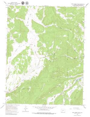
Rock Creek Park Topo Map Colorado
To zoom in, hover over the map of Rock Creek Park
USGS Topo Quad 38106b8 - 1:24,000 scale
| Topo Map Name: | Rock Creek Park |
| USGS Topo Quad ID: | 38106b8 |
| Print Size: | ca. 21 1/4" wide x 27" high |
| Southeast Coordinates: | 38.125° N latitude / 106.875° W longitude |
| Map Center Coordinates: | 38.1875° N latitude / 106.9375° W longitude |
| U.S. State: | CO |
| Filename: | o38106b8.jpg |
| Download Map JPG Image: | Rock Creek Park topo map 1:24,000 scale |
| Map Type: | Topographic |
| Topo Series: | 7.5´ |
| Map Scale: | 1:24,000 |
| Source of Map Images: | United States Geological Survey (USGS) |
| Alternate Map Versions: |
Rock Creek Park CO 1965, updated 1968 Download PDF Buy paper map Rock Creek Park CO 1965, updated 1968 Download PDF Buy paper map Rock Creek Park CO 1965, updated 1979 Download PDF Buy paper map Rock Creek Park CO 2001, updated 2004 Download PDF Buy paper map Rock Creek Park CO 2011 Download PDF Buy paper map Rock Creek Park CO 2013 Download PDF Buy paper map Rock Creek Park CO 2016 Download PDF Buy paper map |
| FStopo: | US Forest Service topo Rock Creek Park is available: Download FStopo PDF Download FStopo TIF |
1:24,000 Topo Quads surrounding Rock Creek Park
> Back to 38106a1 at 1:100,000 scale
> Back to 38106a1 at 1:250,000 scale
> Back to U.S. Topo Maps home
Rock Creek Park topo map: Gazetteer
Rock Creek Park: Basins
Pinto Basin elevation 2977m 9767′Rock Creek Park: Flats
McDonough Park elevation 2958m 9704′Porcupine Park elevation 2961m 9714′
Rock Creek Park elevation 3033m 9950′
Summit Park elevation 3044m 9986′
Rock Creek Park: Reservoirs
McDonough Reservoir elevation 2871m 9419′Rock Creek Park: Springs
East Spring elevation 3026m 9927′Rock Creek Park: Streams
Bull Creek elevation 2871m 9419′Elk Creek elevation 2908m 9540′
Killdeer Creek elevation 2918m 9573′
Monument Rock Creek elevation 2995m 9826′
Road Miller Creek elevation 2899m 9511′
Still Creek elevation 2918m 9573′
Still Creek elevation 9575m 31414′
Rock Creek Park: Trails
Winn Trail elevation 3043m 9983′Rock Creek Park digital topo map on disk
Buy this Rock Creek Park topo map showing relief, roads, GPS coordinates and other geographical features, as a high-resolution digital map file on DVD:


