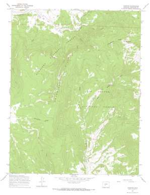
Chester Topo Map Colorado
To zoom in, hover over the map of Chester
USGS Topo Quad 38106c3 - 1:24,000 scale
| Topo Map Name: | Chester |
| USGS Topo Quad ID: | 38106c3 |
| Print Size: | ca. 21 1/4" wide x 27" high |
| Southeast Coordinates: | 38.25° N latitude / 106.25° W longitude |
| Map Center Coordinates: | 38.3125° N latitude / 106.3125° W longitude |
| U.S. State: | CO |
| Filename: | o38106c3.jpg |
| Download Map JPG Image: | Chester topo map 1:24,000 scale |
| Map Type: | Topographic |
| Topo Series: | 7.5´ |
| Map Scale: | 1:24,000 |
| Source of Map Images: | United States Geological Survey (USGS) |
| Alternate Map Versions: |
Chester CO 1967, updated 1969 Download PDF Buy paper map Chester CO 1967, updated 1969 Download PDF Buy paper map Chester CO 2001, updated 2005 Download PDF Buy paper map Chester CO 2011 Download PDF Buy paper map Chester CO 2013 Download PDF Buy paper map Chester CO 2016 Download PDF Buy paper map |
| FStopo: | US Forest Service topo Chester is available: Download FStopo PDF Download FStopo TIF |
1:24,000 Topo Quads surrounding Chester
> Back to 38106a1 at 1:100,000 scale
> Back to 38106a1 at 1:250,000 scale
> Back to U.S. Topo Maps home
Chester topo map: Gazetteer
Chester: Flats
Cameron Park elevation 3272m 10734′Sawmill Park elevation 3257m 10685′
Chester: Populated Places
Chester elevation 2865m 9399′Chester: Ridges
Monarch Ridge elevation 2886m 9468′Chester: Streams
Duncan Creek elevation 2790m 9153′East Middle Creek elevation 2733m 8966′
Indian Creek elevation 2666m 8746′
Indian Creek elevation 2683m 8802′
Jay Creek elevation 2814m 9232′
Milk Creek elevation 2697m 8848′
Tank Seven Creek elevation 2750m 9022′
Chester: Summits
Headwaters Hill elevation 3616m 11863′Windy Peak elevation 3623m 11886′
Chester: Valleys
East Pierce Gulch elevation 3357m 11013′Horse Canyon elevation 2638m 8654′
Spring Gulch elevation 2646m 8681′
Chester digital topo map on disk
Buy this Chester topo map showing relief, roads, GPS coordinates and other geographical features, as a high-resolution digital map file on DVD:


