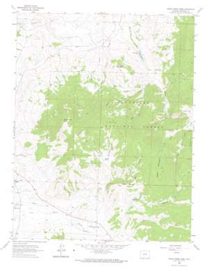
Razor Creek Dome Topo Map Colorado
To zoom in, hover over the map of Razor Creek Dome
USGS Topo Quad 38106c6 - 1:24,000 scale
| Topo Map Name: | Razor Creek Dome |
| USGS Topo Quad ID: | 38106c6 |
| Print Size: | ca. 21 1/4" wide x 27" high |
| Southeast Coordinates: | 38.25° N latitude / 106.625° W longitude |
| Map Center Coordinates: | 38.3125° N latitude / 106.6875° W longitude |
| U.S. State: | CO |
| Filename: | o38106c6.jpg |
| Download Map JPG Image: | Razor Creek Dome topo map 1:24,000 scale |
| Map Type: | Topographic |
| Topo Series: | 7.5´ |
| Map Scale: | 1:24,000 |
| Source of Map Images: | United States Geological Survey (USGS) |
| Alternate Map Versions: |
Razor Creek Dome CO 1962, updated 1964 Download PDF Buy paper map Razor Creek Dome CO 1962, updated 1974 Download PDF Buy paper map Razor Creek Dome CO 2001, updated 2004 Download PDF Buy paper map Razor Creek Dome CO 2011 Download PDF Buy paper map Razor Creek Dome CO 2013 Download PDF Buy paper map Razor Creek Dome CO 2016 Download PDF Buy paper map |
| FStopo: | US Forest Service topo Razor Creek Dome is available: Download FStopo PDF Download FStopo TIF |
1:24,000 Topo Quads surrounding Razor Creek Dome
> Back to 38106a1 at 1:100,000 scale
> Back to 38106a1 at 1:250,000 scale
> Back to U.S. Topo Maps home
Razor Creek Dome topo map: Gazetteer
Razor Creek Dome: Cliffs
V Rock elevation 3187m 10456′Razor Creek Dome: Dams
Vouga Dam elevation 2618m 8589′Razor Creek Dome: Flats
Mill Park elevation 3087m 10127′Sage Park elevation 3002m 9849′
Razor Creek Dome: Mines
Indian Creek Bog Iron Mine elevation 2893m 9491′Irishmans Dream Mine elevation 2674m 8772′
Kathy Jo Mine elevation 2674m 8772′
Lost Nueve Mine elevation 2654m 8707′
Lost Ocho Mine elevation 2673m 8769′
Razor Creek Dome: Reservoirs
Moss Lake elevation 2700m 8858′Vouga Reservoir elevation 2618m 8589′
Razor Creek Dome: Streams
Gismo Creek elevation 2809m 9215′Mill Creek elevation 2641m 8664′
Prosser Creek elevation 2567m 8421′
West Gismo Creek elevation 2767m 9078′
West Pass Creek elevation 2695m 8841′
Razor Creek Dome: Summits
Deer Hill elevation 3051m 10009′Green Mountain elevation 3329m 10921′
Prosser Rock elevation 2976m 9763′
Razor Creek Dome elevation 3514m 11528′
Razor Creek Dome: Valleys
Dean Jones Gulch elevation 2698m 8851′Home Gulch elevation 2777m 9110′
Lightening Gulch elevation 2891m 9484′
Lion Gulch elevation 2723m 8933′
Myers Gulch elevation 2807m 9209′
North Gulch elevation 2756m 9041′
Pole Gulch elevation 2667m 8750′
Rocky Gulch elevation 2859m 9379′
South Gulch elevation 2759m 9051′
Spruce Gulch elevation 2612m 8569′
Wolverine Gulch elevation 2760m 9055′
Razor Creek Dome digital topo map on disk
Buy this Razor Creek Dome topo map showing relief, roads, GPS coordinates and other geographical features, as a high-resolution digital map file on DVD:


