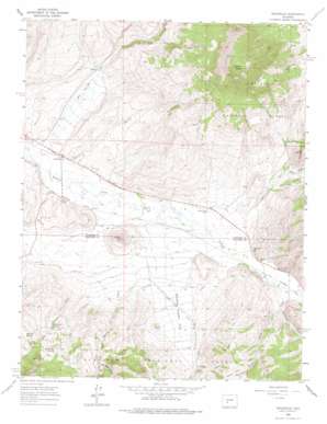
Doyleville Topo Map Colorado
To zoom in, hover over the map of Doyleville
USGS Topo Quad 38106d5 - 1:24,000 scale
| Topo Map Name: | Doyleville |
| USGS Topo Quad ID: | 38106d5 |
| Print Size: | ca. 21 1/4" wide x 27" high |
| Southeast Coordinates: | 38.375° N latitude / 106.5° W longitude |
| Map Center Coordinates: | 38.4375° N latitude / 106.5625° W longitude |
| U.S. State: | CO |
| Filename: | o38106d5.jpg |
| Download Map JPG Image: | Doyleville topo map 1:24,000 scale |
| Map Type: | Topographic |
| Topo Series: | 7.5´ |
| Map Scale: | 1:24,000 |
| Source of Map Images: | United States Geological Survey (USGS) |
| Alternate Map Versions: |
Doyleville CO 1962, updated 1964 Download PDF Buy paper map Doyleville CO 1962, updated 1964 Download PDF Buy paper map Doyleville CO 1962, updated 1974 Download PDF Buy paper map Doyleville CO 2001, updated 2004 Download PDF Buy paper map Doyleville CO 2011 Download PDF Buy paper map Doyleville CO 2013 Download PDF Buy paper map Doyleville CO 2016 Download PDF Buy paper map |
| FStopo: | US Forest Service topo Doyleville is available: Download FStopo PDF Download FStopo TIF |
1:24,000 Topo Quads surrounding Doyleville
> Back to 38106a1 at 1:100,000 scale
> Back to 38106a1 at 1:250,000 scale
> Back to U.S. Topo Maps home
Doyleville topo map: Gazetteer
Doyleville: Canals
Arch Irrigation Ditch elevation 2491m 8172′Needle Creek Ditch elevation 2528m 8293′
Doyleville: Flats
Needle Creek Flat elevation 2532m 8307′Doyleville: Mines
Moore Property Mine elevation 2498m 8195′Doyleville: Pillars
Cat Rocks elevation 2812m 9225′Doyleville: Populated Places
Doyleville elevation 2455m 8054′Doyleville: Springs
Beer Keg Spring elevation 2776m 9107′Big Draw Spring elevation 2655m 8710′
Rock Spring elevation 2751m 9025′
Willow Bog Spring elevation 2756m 9041′
Doyleville: Streams
Barret Creek elevation 2494m 8182′Cole Creek elevation 2525m 8284′
Dutchman Creek elevation 2536m 8320′
Hot Springs Creek elevation 2449m 8034′
Left Hand Barret Creek elevation 2695m 8841′
Needle Creek elevation 2492m 8175′
Owens Creek elevation 2501m 8205′
Right Hand Barret Creek elevation 2695m 8841′
Doyleville: Summits
Coyote Hill elevation 2616m 8582′Mill Hill elevation 2723m 8933′
Tomichi Dome elevation 3498m 11476′
Doyleville: Valleys
Bear Gulch elevation 2529m 8297′Berry Gulch elevation 2560m 8398′
Big Draw elevation 2534m 8313′
Deacon Jones Gulch elevation 2616m 8582′
Horn Gulch elevation 2489m 8166′
Long Draw elevation 2495m 8185′
Monson Gulch elevation 2458m 8064′
Peterman Gulch elevation 2640m 8661′
Peterson Gulch elevation 2578m 8458′
Doyleville digital topo map on disk
Buy this Doyleville topo map showing relief, roads, GPS coordinates and other geographical features, as a high-resolution digital map file on DVD:


