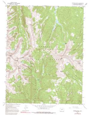
Fairview Peak Topo Map Colorado
To zoom in, hover over the map of Fairview Peak
USGS Topo Quad 38106f5 - 1:24,000 scale
| Topo Map Name: | Fairview Peak |
| USGS Topo Quad ID: | 38106f5 |
| Print Size: | ca. 21 1/4" wide x 27" high |
| Southeast Coordinates: | 38.625° N latitude / 106.5° W longitude |
| Map Center Coordinates: | 38.6875° N latitude / 106.5625° W longitude |
| U.S. State: | CO |
| Filename: | o38106f5.jpg |
| Download Map JPG Image: | Fairview Peak topo map 1:24,000 scale |
| Map Type: | Topographic |
| Topo Series: | 7.5´ |
| Map Scale: | 1:24,000 |
| Source of Map Images: | United States Geological Survey (USGS) |
| Alternate Map Versions: |
Fairview Peak CO 1967, updated 1973 Download PDF Buy paper map Fairview Peak CO 1967, updated 1973 Download PDF Buy paper map Fairview Peak CO 1967, updated 1991 Download PDF Buy paper map Fairview Peak CO 1967, updated 1991 Download PDF Buy paper map Fairview Peak CO 2001, updated 2004 Download PDF Buy paper map Fairview Peak CO 2011 Download PDF Buy paper map Fairview Peak CO 2013 Download PDF Buy paper map Fairview Peak CO 2016 Download PDF Buy paper map |
| FStopo: | US Forest Service topo Fairview Peak is available: Download FStopo PDF Download FStopo TIF |
1:24,000 Topo Quads surrounding Fairview Peak
> Back to 38106e1 at 1:100,000 scale
> Back to 38106a1 at 1:250,000 scale
> Back to U.S. Topo Maps home
Fairview Peak topo map: Gazetteer
Fairview Peak: Flats
Chicago Park elevation 3124m 10249′Fairview Peak: Gaps
Gunsight Pass elevation 3714m 12185′Fairview Peak: Lakes
Annie Lake elevation 3546m 11633′Boulder Lake elevation 3502m 11489′
Fairview Lake elevation 3444m 11299′
Henry Lake elevation 3568m 11706′
Jackson Lake elevation 3656m 11994′
Lamphier Lake elevation 3566m 11699′
Lower Lamphier Lake elevation 3422m 11227′
Mill Lake elevation 3496m 11469′
Fairview Peak: Mines
Fairview Mine elevation 3647m 11965′Gold Link Mine elevation 2929m 9609′
Hotrocks Mine elevation 3514m 11528′
Pitkin Mine elevation 3476m 11404′
Sandy Hook Mine elevation 3013m 9885′
Fairview Peak: Ridges
Fossil Ridge elevation 3821m 12536′Shaw Ridge elevation 3575m 11729′
Fairview Peak: Streams
Brush Creek elevation 3182m 10439′Cameron Creek elevation 3046m 9993′
Lamphier Creek elevation 3042m 9980′
Fairview Peak: Summits
Broncho Mountain elevation 3904m 12808′Cameron Mountain elevation 3597m 11801′
Cross Mountain elevation 3798m 12460′
Fairview Peak elevation 4029m 13218′
Fossil Mountain elevation 3885m 12746′
Green Mountain elevation 3873m 12706′
Henry Mountain elevation 4042m 13261′
Sheep Mountain elevation 3739m 12267′
Square Top Mountain elevation 3954m 12972′
Terrible Mountain elevation 3594m 11791′
Fairview Peak: Trails
Gold Creek Union Park Trail elevation 3153m 10344′Gunsight Trail elevation 3297m 10816′
Onemile Trail elevation 3724m 12217′
Fairview Peak: Valleys
Annie Gulch elevation 3235m 10613′Boulder Gulch elevation 2883m 9458′
Browns Gulch elevation 3018m 9901′
Burro Gulch elevation 3175m 10416′
Hills Gulch elevation 2940m 9645′
Jackson Gulch elevation 3232m 10603′
Mill Gulch elevation 3186m 10452′
New Dollar Gulch elevation 3110m 10203′
Porcupine Gulch elevation 3283m 10770′
Snowslide Gulch elevation 3027m 9931′
Fairview Peak digital topo map on disk
Buy this Fairview Peak topo map showing relief, roads, GPS coordinates and other geographical features, as a high-resolution digital map file on DVD:


