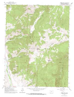
Cement Mountain Topo Map Colorado
To zoom in, hover over the map of Cement Mountain
USGS Topo Quad 38106g7 - 1:24,000 scale
| Topo Map Name: | Cement Mountain |
| USGS Topo Quad ID: | 38106g7 |
| Print Size: | ca. 21 1/4" wide x 27" high |
| Southeast Coordinates: | 38.75° N latitude / 106.75° W longitude |
| Map Center Coordinates: | 38.8125° N latitude / 106.8125° W longitude |
| U.S. State: | CO |
| Filename: | o38106g7.jpg |
| Download Map JPG Image: | Cement Mountain topo map 1:24,000 scale |
| Map Type: | Topographic |
| Topo Series: | 7.5´ |
| Map Scale: | 1:24,000 |
| Source of Map Images: | United States Geological Survey (USGS) |
| Alternate Map Versions: |
Cement Mountain CO 1961, updated 1964 Download PDF Buy paper map Cement Mountain CO 1961, updated 1964 Download PDF Buy paper map Cement Mountain CO 1961, updated 1970 Download PDF Buy paper map Cement Mountain CO 1961, updated 1970 Download PDF Buy paper map Cement Mountain CO 2001, updated 2004 Download PDF Buy paper map Cement Mountain CO 2011 Download PDF Buy paper map Cement Mountain CO 2013 Download PDF Buy paper map Cement Mountain CO 2016 Download PDF Buy paper map |
| FStopo: | US Forest Service topo Cement Mountain is available: Download FStopo PDF Download FStopo TIF |
1:24,000 Topo Quads surrounding Cement Mountain
> Back to 38106e1 at 1:100,000 scale
> Back to 38106a1 at 1:250,000 scale
> Back to U.S. Topo Maps home
Cement Mountain topo map: Gazetteer
Cement Mountain: Basins
Granite Basin elevation 3042m 9980′Horse Basin elevation 3174m 10413′
Cement Mountain: Canals
East River Number 1 Ditch elevation 2563m 8408′Cement Mountain: Mines
Cement Creek Quarry elevation 2725m 8940′Maggie Mine elevation 3393m 11131′
Rosebud Group Mine elevation 3385m 11105′
Cement Mountain: Springs
Cement Creek Hot Spring elevation 2810m 9219′Ranger Hot Spring elevation 2658m 8720′
Cement Mountain: Streams
Granite Creek elevation 2585m 8480′Horse Basin Creek elevation 2759m 9051′
Waterfall Creek elevation 2942m 9652′
Cement Mountain: Summits
Cement Mountain elevation 3721m 12208′East Cement Mountain elevation 3664m 12020′
Point Lookout elevation 3422m 11227′
Round Mountain elevation 3317m 10882′
Cement Mountain: Trails
Granite Basin Trail elevation 3039m 9970′Cement Mountain: Valleys
Eccher Gulch elevation 2612m 8569′Rosebud Gulch elevation 2939m 9642′
Walrod Gulch elevation 2724m 8937′
Cement Mountain digital topo map on disk
Buy this Cement Mountain topo map showing relief, roads, GPS coordinates and other geographical features, as a high-resolution digital map file on DVD:


