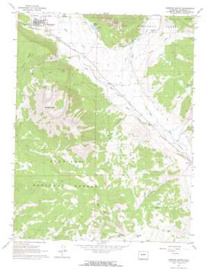
Crested Butte Topo Map Colorado
To zoom in, hover over the map of Crested Butte
USGS Topo Quad 38106g8 - 1:24,000 scale
| Topo Map Name: | Crested Butte |
| USGS Topo Quad ID: | 38106g8 |
| Print Size: | ca. 21 1/4" wide x 27" high |
| Southeast Coordinates: | 38.75° N latitude / 106.875° W longitude |
| Map Center Coordinates: | 38.8125° N latitude / 106.9375° W longitude |
| U.S. State: | CO |
| Filename: | o38106g8.jpg |
| Download Map JPG Image: | Crested Butte topo map 1:24,000 scale |
| Map Type: | Topographic |
| Topo Series: | 7.5´ |
| Map Scale: | 1:24,000 |
| Source of Map Images: | United States Geological Survey (USGS) |
| Alternate Map Versions: |
Crested Butte CO 1961, updated 1964 Download PDF Buy paper map Crested Butte CO 1961, updated 1969 Download PDF Buy paper map Crested Butte CO 1961, updated 1969 Download PDF Buy paper map Crested Butte CO 2001, updated 2004 Download PDF Buy paper map Crested Butte CO 2011 Download PDF Buy paper map Crested Butte CO 2013 Download PDF Buy paper map Crested Butte CO 2016 Download PDF Buy paper map |
| FStopo: | US Forest Service topo Crested Butte is available: Download FStopo PDF Download FStopo TIF |
1:24,000 Topo Quads surrounding Crested Butte
> Back to 38106e1 at 1:100,000 scale
> Back to 38106a1 at 1:250,000 scale
> Back to U.S. Topo Maps home
Crested Butte topo map: Gazetteer
Crested Butte: Airports
Avion Club at Crested Butte Airport elevation 2714m 8904′Crested Butte: Canals
Dillsworth Ditch elevation 2666m 8746′East River Number 2 Ditch elevation 2647m 8684′
Halazon Ditch elevation 2713m 8900′
Imobersteg Ditch elevation 2602m 8536′
Verzuh Ditch elevation 2711m 8894′
Verzuh Young Bafand Ditch elevation 2723m 8933′
Crested Butte: Lakes
Red Mountain Lake elevation 3158m 10360′Crested Butte: Mines
Buckley Mine elevation 2964m 9724′Bulkley Mine elevation 2964m 9724′
K D Mine elevation 2868m 9409′
Crested Butte: Parks
Crested Butte Town Park elevation 2717m 8914′Totem Pole Park elevation 2716m 8910′
Crested Butte: Populated Places
Crested Butte elevation 2720m 8923′Crested Butte: Post Offices
Crested Butte Post Office elevation 2719m 8920′Crested Butte: Reservoirs
Big Alkali Lake elevation 3158m 10360′Lake Grant elevation 2749m 9019′
Crested Butte: Springs
Cement Creek Spring elevation 2636m 8648′Crested Butte: Streams
Cement Creek elevation 2594m 8510′Farris Creek elevation 2683m 8802′
Crested Butte: Summits
Red Mountain elevation 3544m 11627′Strand Hill elevation 3123m 10246′
Whetstone Mountain elevation 3807m 12490′
Crested Butte: Valleys
Baxter Gulch elevation 2709m 8887′Oversteeg Gulch elevation 2599m 8526′
Squaw Gulch elevation 2672m 8766′
Crested Butte digital topo map on disk
Buy this Crested Butte topo map showing relief, roads, GPS coordinates and other geographical features, as a high-resolution digital map file on DVD:


