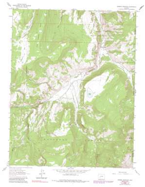
Mineral Mountain Topo Map Colorado
To zoom in, hover over the map of Mineral Mountain
USGS Topo Quad 38107a1 - 1:24,000 scale
| Topo Map Name: | Mineral Mountain |
| USGS Topo Quad ID: | 38107a1 |
| Print Size: | ca. 21 1/4" wide x 27" high |
| Southeast Coordinates: | 38° N latitude / 107° W longitude |
| Map Center Coordinates: | 38.0625° N latitude / 107.0625° W longitude |
| U.S. State: | CO |
| Filename: | o38107a1.jpg |
| Download Map JPG Image: | Mineral Mountain topo map 1:24,000 scale |
| Map Type: | Topographic |
| Topo Series: | 7.5´ |
| Map Scale: | 1:24,000 |
| Source of Map Images: | United States Geological Survey (USGS) |
| Alternate Map Versions: |
Mineral Mountain CO 1963, updated 1966 Download PDF Buy paper map Mineral Mountain CO 1963, updated 1966 Download PDF Buy paper map Mineral Mountain CO 1963, updated 1973 Download PDF Buy paper map Mineral Mountain CO 1963, updated 1984 Download PDF Buy paper map Mineral Mountain CO 1963, updated 1991 Download PDF Buy paper map Mineral Mountain CO 1963, updated 1991 Download PDF Buy paper map Mineral Mountain CO 2001, updated 2004 Download PDF Buy paper map Mineral Mountain CO 2011 Download PDF Buy paper map Mineral Mountain CO 2013 Download PDF Buy paper map Mineral Mountain CO 2016 Download PDF Buy paper map |
| FStopo: | US Forest Service topo Mineral Mountain is available: Download FStopo PDF Download FStopo TIF |
1:24,000 Topo Quads surrounding Mineral Mountain
> Back to 38107a1 at 1:100,000 scale
> Back to 38106a1 at 1:250,000 scale
> Back to U.S. Topo Maps home
Mineral Mountain topo map: Gazetteer
Mineral Mountain: Flats
Mineral Park elevation 3483m 11427′Monument Park elevation 3343m 10967′
Powderhorn Park elevation 3279m 10757′
Robbers Roost elevation 3243m 10639′
Mineral Mountain: Lakes
Dry Lake elevation 2984m 9790′Mineral Mountain: Parks
Cebolla Game Management Area elevation 2690m 8825′Mineral Mountain: Populated Places
Cathedral elevation 2717m 8914′Mineral Mountain: Ridges
Fish Canyon Ridge elevation 3395m 11138′Mineral Mountain: Streams
Calf Creek elevation 2837m 9307′Cathedral Creek elevation 2800m 9186′
Martinez Creek elevation 2956m 9698′
Mineral Creek elevation 2757m 9045′
Pasture Creek elevation 2794m 9166′
Rock Creek elevation 2661m 8730′
Rough Creek elevation 2824m 9265′
Spring Creek elevation 2707m 8881′
Mineral Mountain: Summits
Mineral Mountain elevation 3687m 12096′Mineral Mountain: Trails
Cebolla Trail elevation 3452m 11325′Devils Hole Trail elevation 2997m 9832′
Rough Creek Trail elevation 2990m 9809′
Mineral Mountain: Valleys
Sanders Draw elevation 2694m 8838′Wood Gulch elevation 2785m 9137′
Mineral Mountain digital topo map on disk
Buy this Mineral Mountain topo map showing relief, roads, GPS coordinates and other geographical features, as a high-resolution digital map file on DVD:


