Powderhorn Lakes Topo Map Colorado
To zoom in, hover over the map of Powderhorn Lakes
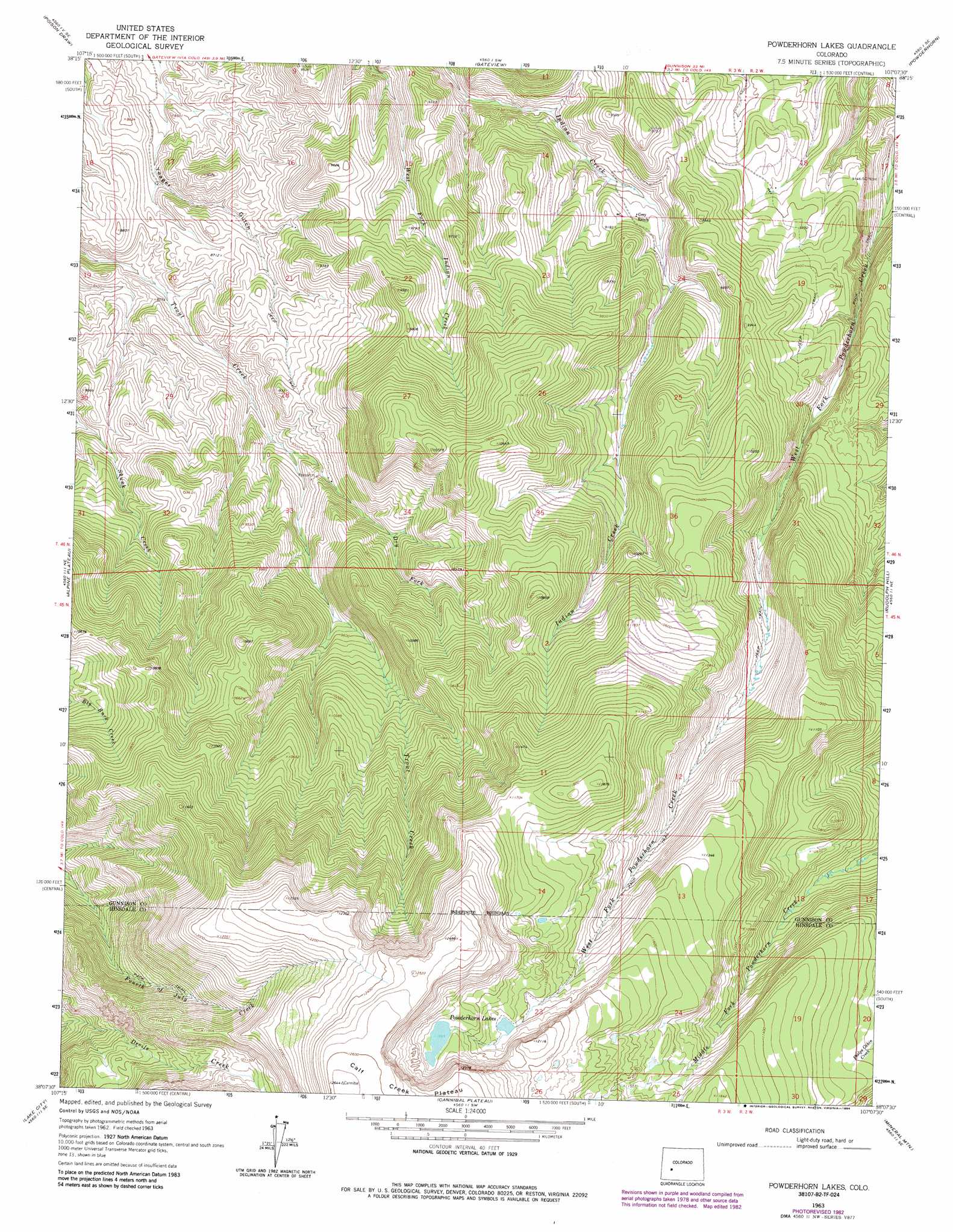
USGS Topo Quad 38107b2 - 1:24,000 scale
| Topo Map Name: | Powderhorn Lakes |
| USGS Topo Quad ID: | 38107b2 |
| Print Size: | ca. 21 1/4" wide x 27" high |
| Southeast Coordinates: | 38.125° N latitude / 107.125° W longitude |
| Map Center Coordinates: | 38.1875° N latitude / 107.1875° W longitude |
| U.S. State: | CO |
| Filename: | o38107b2.jpg |
| Download Map JPG Image: | Powderhorn Lakes topo map 1:24,000 scale |
| Map Type: | Topographic |
| Topo Series: | 7.5´ |
| Map Scale: | 1:24,000 |
| Source of Map Images: | United States Geological Survey (USGS) |
| Alternate Map Versions: |
Powderhorn Lakes CO 1963, updated 1966 Download PDF Buy paper map Powderhorn Lakes CO 1963, updated 1971 Download PDF Buy paper map Powderhorn Lakes CO 1963, updated 1984 Download PDF Buy paper map Powderhorn Lakes CO 2010 Download PDF Buy paper map Powderhorn Lakes CO 2013 Download PDF Buy paper map Powderhorn Lakes CO 2016 Download PDF Buy paper map |
1:24,000 Topo Quads surrounding Powderhorn Lakes
Curecanti Needle |
Sapinero |
Carpenter Ridge |
Big Mesa |
Iris Nw |
Lost Lake |
Poison Draw |
Gateview |
Powderhorn |
Spring Hill Creek |
Sheep Mountain |
Alpine Plateau |
Powderhorn Lakes |
Rudolph Hill |
Rock Creek Park |
Uncompahgre Peak |
Lake City |
Cannibal Plateau |
Mineral Mountain |
Stewart Peak |
Redcloud Peak |
Lake San Cristobal |
Slumgullion Pass |
Baldy Cinco |
San Luis Peak |
> Back to 38107a1 at 1:100,000 scale
> Back to 38106a1 at 1:250,000 scale
> Back to U.S. Topo Maps home
Powderhorn Lakes topo map: Gazetteer
Powderhorn Lakes: Lakes
Powderhorn Lakes elevation 3594m 11791′Powderhorn Lakes: Parks
Powderhorn Primitive Area elevation 3441m 11289′Powderhorn Lakes: Streams
Dry Fork Trout Creek elevation 2713m 8900′Powderhorn Lakes: Summits
Calf Creek Plateau elevation 3859m 12660′Powderhorn Lakes digital topo map on disk
Buy this Powderhorn Lakes topo map showing relief, roads, GPS coordinates and other geographical features, as a high-resolution digital map file on DVD: