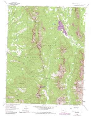
Courthouse Mountain Topo Map Colorado
To zoom in, hover over the map of Courthouse Mountain
USGS Topo Quad 38107b5 - 1:24,000 scale
| Topo Map Name: | Courthouse Mountain |
| USGS Topo Quad ID: | 38107b5 |
| Print Size: | ca. 21 1/4" wide x 27" high |
| Southeast Coordinates: | 38.125° N latitude / 107.5° W longitude |
| Map Center Coordinates: | 38.1875° N latitude / 107.5625° W longitude |
| U.S. State: | CO |
| Filename: | o38107b5.jpg |
| Download Map JPG Image: | Courthouse Mountain topo map 1:24,000 scale |
| Map Type: | Topographic |
| Topo Series: | 7.5´ |
| Map Scale: | 1:24,000 |
| Source of Map Images: | United States Geological Survey (USGS) |
| Alternate Map Versions: |
Courthouse Mountain CO 1963, updated 1966 Download PDF Buy paper map Courthouse Mountain CO 1963, updated 1966 Download PDF Buy paper map Courthouse Mountain CO 1963, updated 1970 Download PDF Buy paper map Courthouse Mountain CO 1963, updated 1970 Download PDF Buy paper map Courthouse Mountain CO 1963, updated 1984 Download PDF Buy paper map Courthouse Mountain CO 2011 Download PDF Buy paper map Courthouse Mountain CO 2013 Download PDF Buy paper map Courthouse Mountain CO 2016 Download PDF Buy paper map |
| FStopo: | US Forest Service topo Courthouse Mountain is available: Download FStopo PDF Download FStopo TIF |
1:24,000 Topo Quads surrounding Courthouse Mountain
> Back to 38107a1 at 1:100,000 scale
> Back to 38106a1 at 1:250,000 scale
> Back to U.S. Topo Maps home
Courthouse Mountain topo map: Gazetteer
Courthouse Mountain: Canals
Cimarron Feeder Garnet Ditch elevation 3030m 9940′Courthouse Mountain: Dams
Silver Jack Dam elevation 2671m 8763′Courthouse Mountain: Flats
Cabbage Patch elevation 2855m 9366′The Hole elevation 3360m 11023′
Courthouse Mountain: Gaps
Lou Creek Pass elevation 3316m 10879′Owl Creek Pass elevation 3082m 10111′
Courthouse Mountain: Lakes
Bates Lakes elevation 3052m 10013′Clear Lake elevation 2825m 9268′
Cowboy Lake elevation 2833m 9294′
Hanging Lake elevation 2741m 8992′
Courthouse Mountain: Mines
Kennedy Mine elevation 2899m 9511′Lou Creek Coal Mine elevation 2722m 8930′
Courthouse Mountain: Pillars
Chimney Rock elevation 3340m 10958′Courthouse Mountain: Reservoirs
Silver Jack Reservoir elevation 2671m 8763′Courthouse Mountain: Ridges
Cimarron Ridge elevation 3258m 10688′Pinnacle Ridge elevation 3702m 12145′
Spruce Ridge elevation 2881m 9452′
Turret Ridge elevation 3233m 10606′
Courthouse Mountain: Streams
East Fork Cimarron River elevation 2750m 9022′Fox Creek elevation 2656m 8713′
Middle Fork Cimarron River elevation 2750m 9022′
West Fork Cimarron River elevation 2722m 8930′
Courthouse Mountain: Summits
Courthouse Mountain elevation 3695m 12122′Dunsinane elevation 3867m 12687′
Sneva Mountain elevation 2762m 9061′
Stealey Mountain elevation 3119m 10232′
Courthouse Mountain: Trails
Courthouse Trail elevation 2941m 9648′Deer Creek Trail elevation 3047m 9996′
Lou Creek Trail elevation 2824m 9265′
Courthouse Mountain: Valleys
Devils Canyon elevation 2648m 8687′Courthouse Mountain digital topo map on disk
Buy this Courthouse Mountain topo map showing relief, roads, GPS coordinates and other geographical features, as a high-resolution digital map file on DVD:


