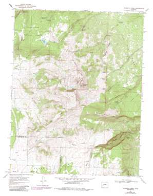
Horsefly Peak Topo Map Colorado
To zoom in, hover over the map of Horsefly Peak
USGS Topo Quad 38107b8 - 1:24,000 scale
| Topo Map Name: | Horsefly Peak |
| USGS Topo Quad ID: | 38107b8 |
| Print Size: | ca. 21 1/4" wide x 27" high |
| Southeast Coordinates: | 38.125° N latitude / 107.875° W longitude |
| Map Center Coordinates: | 38.1875° N latitude / 107.9375° W longitude |
| U.S. State: | CO |
| Filename: | o38107b8.jpg |
| Download Map JPG Image: | Horsefly Peak topo map 1:24,000 scale |
| Map Type: | Topographic |
| Topo Series: | 7.5´ |
| Map Scale: | 1:24,000 |
| Source of Map Images: | United States Geological Survey (USGS) |
| Alternate Map Versions: |
Horsefly Peak CO 1967, updated 1971 Download PDF Buy paper map Horsefly Peak CO 1967, updated 1971 Download PDF Buy paper map Horsefly Peak CO 1967, updated 1975 Download PDF Buy paper map Horsefly Peak CO 1967, updated 1984 Download PDF Buy paper map Horsefly Peak CO 2011 Download PDF Buy paper map Horsefly Peak CO 2013 Download PDF Buy paper map Horsefly Peak CO 2016 Download PDF Buy paper map |
| FStopo: | US Forest Service topo Horsefly Peak is available: Download FStopo PDF Download FStopo TIF |
1:24,000 Topo Quads surrounding Horsefly Peak
> Back to 38107a1 at 1:100,000 scale
> Back to 38106a1 at 1:250,000 scale
> Back to U.S. Topo Maps home
Horsefly Peak topo map: Gazetteer
Horsefly Peak: Basins
Bears Den elevation 2559m 8395′Horsefly Peak: Dams
Paxton Dam elevation 2819m 9248′Horsefly Peak: Lakes
Natural Pond elevation 2616m 8582′Horsefly Peak: Mines
Liberty Bell Mines elevation 2736m 8976′Horsefly Peak: Reservoirs
Big Pond elevation 2723m 8933′Cottonwood Reservoir elevation 2537m 8323′
Hally Tank elevation 2723m 8933′
Hofmann Reservoir elevation 2971m 9747′
Horse Pasture Reservoir elevation 2786m 9140′
Paxton Reservoir elevation 2819m 9248′
Spring Pond elevation 2699m 8854′
West Pond elevation 2765m 9071′
Horsefly Peak: Ridges
Horsefly Ridge elevation 3052m 10013′Hull Ridge elevation 2946m 9665′
Sagehen Ridge elevation 2811m 9222′
Horsefly Peak: Springs
Johnson Spring elevation 2766m 9074′Mexican Cabin Spring elevation 2659m 8723′
Palmer Spring elevation 2835m 9301′
Powerline Spring elevation 2695m 8841′
Schmidt Spring elevation 2821m 9255′
Smith Spring elevation 2742m 8996′
Steel Tank Spring elevation 2763m 9064′
Horsefly Peak: Streams
Johnson Creek elevation 2617m 8585′Horsefly Peak: Summits
Flat Top elevation 3096m 10157′Horsefly Peak elevation 3144m 10314′
Log Hill Mesa elevation 2735m 8973′
Spruce Mountain elevation 3009m 9872′
Horsefly Peak: Valleys
Beach Canyon elevation 2646m 8681′Horsefly Peak digital topo map on disk
Buy this Horsefly Peak topo map showing relief, roads, GPS coordinates and other geographical features, as a high-resolution digital map file on DVD:


