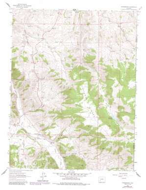
Powderhorn Topo Map Colorado
To zoom in, hover over the map of Powderhorn
USGS Topo Quad 38107c1 - 1:24,000 scale
| Topo Map Name: | Powderhorn |
| USGS Topo Quad ID: | 38107c1 |
| Print Size: | ca. 21 1/4" wide x 27" high |
| Southeast Coordinates: | 38.25° N latitude / 107° W longitude |
| Map Center Coordinates: | 38.3125° N latitude / 107.0625° W longitude |
| U.S. State: | CO |
| Filename: | o38107c1.jpg |
| Download Map JPG Image: | Powderhorn topo map 1:24,000 scale |
| Map Type: | Topographic |
| Topo Series: | 7.5´ |
| Map Scale: | 1:24,000 |
| Source of Map Images: | United States Geological Survey (USGS) |
| Alternate Map Versions: |
Powderhorn CO 1962, updated 1964 Download PDF Buy paper map Powderhorn CO 1962, updated 1972 Download PDF Buy paper map Powderhorn CO 1962, updated 1984 Download PDF Buy paper map Powderhorn CO 2010 Download PDF Buy paper map Powderhorn CO 2013 Download PDF Buy paper map Powderhorn CO 2016 Download PDF Buy paper map |
1:24,000 Topo Quads surrounding Powderhorn
> Back to 38107a1 at 1:100,000 scale
> Back to 38106a1 at 1:250,000 scale
> Back to U.S. Topo Maps home
Powderhorn topo map: Gazetteer
Powderhorn: Dams
Soderquist Dam elevation 2834m 9297′Powderhorn: Mines
Aaberlite Mines elevation 2626m 8615′Beaver Creek Mine elevation 2673m 8769′
Cebolla Creek Titaneferous Iron Deposit elevation 2510m 8234′
Chimney Mine elevation 2771m 9091′
Good Hope Mine elevation 2771m 9091′
Iron Hill Area Mine elevation 2675m 8776′
Iron Hill Columbium Deposit elevation 2597m 8520′
Iron Hills Manganese District Mine elevation 2586m 8484′
Ironcap Mine elevation 2737m 8979′
Mammoth Mine elevation 2771m 9091′
Old Lot Mine elevation 2679m 8789′
Powderhorn Mine elevation 2841m 9320′
Rare Earth Mining Company Mine elevation 2803m 9196′
Seventy-six Shaft Mine elevation 2686m 8812′
Sunset Mine elevation 2719m 8920′
Vulcan Mine elevation 2771m 9091′
Powderhorn: Populated Places
Midway (historical) elevation 2608m 8556′Powderhorn elevation 2468m 8097′
Vulcan (historical) elevation 2720m 8923′
Powderhorn: Post Offices
Powderhorn Post Office elevation 2459m 8067′Powderhorn: Reservoirs
Soderquist Reservoir elevation 2834m 9297′Powderhorn: Springs
Cebolla Hot Springs elevation 2466m 8090′Powderhorn: Streams
Deldorado Creek elevation 2490m 8169′Dry Powderhorn Creek elevation 2472m 8110′
Little Camp Creek elevation 2597m 8520′
Little Willow Creek elevation 2536m 8320′
Powderhorn Creek elevation 2444m 8018′
Powderhorn: Summits
Huntsman Mesa elevation 3078m 10098′Iron Hill elevation 2820m 9251′
Ninemile Hill elevation 2746m 9009′
Powderhorn: Valleys
Huntsman Gulch elevation 2501m 8205′Milkranch Gulch elevation 2444m 8018′
Smith Gulch elevation 2496m 8188′
Stone Gulch elevation 2471m 8106′
Watts Draw elevation 2817m 9242′
Powderhorn digital topo map on disk
Buy this Powderhorn topo map showing relief, roads, GPS coordinates and other geographical features, as a high-resolution digital map file on DVD:


